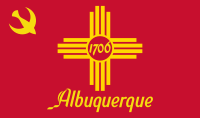
Albuquerque, New Mexico
| V・T・E |
| latitude: 35.084, longitude: -106.651 |
| Browse map of Albuquerque 35°05′02.40″ N, 106°39′03.60″ W |
| Edit map |

|
|
External links:
|
| Use this template for your locality |
Albuquerque is a city in New Mexico at latitude 35°05′02.40″ North, longitude 106°39′03.60″ West.
Not to be confused with the city in Spain where the duke whom the New Mexican city is named after originated.
imports
in progress
(or wrapping up even) /Microsoft Buildings Import
potential
The City publishes a large amount of public domain GIS data as part of its Open Data Initiative, including:
- Transit data (bus stops, routes, real-time data)
- Bike paths
- Public art, registered historic places
There is also older data available at https://cabq.gov/gis/geographic-information-systems-data / https://cabq.gov/gis/geographic-information-systems-metadata, including:
- Latitude/longitude of all street addresses
- Latitude/longitude of all schools, arroyos (flood control ditches), bus stops, libraries, swimming pools, bike trails, and more.
- Addresses of all business registrations in the city (public records), which can be use in conjunction with the latitude/longitude of street addresses to map businesses.
Using this data, Albuquerque can become the "model" OSM city for municipalities that release GIS data to the public domain.
Street names
In Albuquerque, street names typically consist of a name, a suffix, and an ordinal (Northeast, Northwest, Southeast, or Southwest) relative to the city’s “middle point” at Central Avenue and the railroad tracks. For example,
- Montgomery (name)
- Boulevard (suffix)
- Northeast (ordinal)
Some street names are in Spanish, so they consist of a prefix, then a name, then an ordinal in English.
- Avenida (prefix)
- César Chávez (name)
- Southeast (ordinal)
When naming streets or adding addresses, don’t leave off the suffix or ordinal! Don’t abbreviate names either—it’s Doctor Martin Luther King Junior Avenue Northeast, not Dr Martin Luther King Jr Ave NE. Be aware that businesses sometimes list the wrong suffix or ordinal in their address, or omit the suffix or ordinal completely. Make sure you use the right address!
Note that Rio Rancho also uses ordinals in street names. Rio Rancho ordinals are relative to the center at Sandia Boulevard and Rainbow Boulevard. The boundary between Rio Rancho’s “Southeast” and Albuquerque’s “Northwest” is the Bernalillo County border, along Westside Drive.
Corrales does not use ordinal directions in street names.
water resources
swimming pools
There's thousands. Like, way too many tbh.
arroyos
Albuquerque has an extensive storm drain system. These drains are named “arroyos.”
Despite the name, they aren’t streams. They should be tagged with:
Arroyo names can often be seen on brown signs on bridges that cross over the arroyos.
- name=*
Portions of an arroyo flow underground (as opposed to under a bridge), sometimes quite for quite some distance, before returning to the open air. Example. These should additionally be tagged with:
The direction of flow is important. Arroyos flow downhill, usually from the east side of town to the west until they hit the North Diversion Channel, which flows north into the Rio Grande.
Note about Albuquerque International Sunport (ABQ)
in 2017 and 2018, the City of Albuquerque abandoned the north runway of its airport, removed the pavement, regraded the land, and added streets to convert the land into a commercial area for airport- and military-related businesses. As of June, 2018, the area is empty except for the new streets, which remain unnamed. These changes do not yet appear on available imagery but have been mapped into OpenStreetMap using GPS traces and photos from site visits. Some of the changes have occurred inside the airport/Air Force Base fence and cannot be checked this way. In particular, it is not possible to tell from outside the fence how far south the old runway and taxiway pavements have been removed. As appropriate, some of these changes have been tagged with FIXME and a note to review and, as needed, edit, when updated imagery becomes available or site visits yield additional information.
To Do
- Import ABQ Ride data from ODI.
See Also
- BBBike @ Albuquerque - a cycle route planner for Albuquerque
- University of New Mexico
