File:AntarcticaMapOldAndNewData.png
Jump to navigation
Jump to search


Size of this preview: 736 × 599 pixels. Other resolutions: 295 × 240 pixels | 590 × 480 pixels | 943 × 768 pixels | 1,258 × 1,024 pixels | 1,884 × 1,534 pixels.
Original file (1,884 × 1,534 pixels, file size: 254 KB, MIME type: image/png)
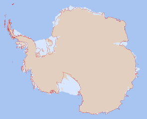
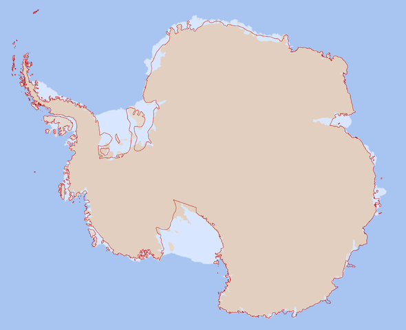
This map shows the current (February 2013) OSM coastline as thin red line and MOA-derived data that is proposed to be imported into OSM.
| Contains map data © OpenStreetMap contributors, made available under the terms of the Open Database License (ODbL).
The ODbL does not require any particular license for maps produced from ODbL data, produced maps may be subject also to other licences. |
File history
Click on a date/time to view the file as it appeared at that time.
| Date/Time | Thumbnail | Dimensions | User | Comment | |
|---|---|---|---|---|---|
| current | 14:05, 4 March 2013 | | 1,884 × 1,534 (254 KB) | Joto (talk | contribs) | This map shows the current (February 2013) OSM coastline as thin red line and MOA-derived data that is proposed to be imported into OSM. |
You cannot overwrite this file.
File usage
The following page uses this file: