File:Area highway intersection example.png
Jump to navigation
Jump to search

Size of this preview: 800 × 351 pixels. Other resolutions: 320 × 141 pixels | 640 × 281 pixels | 1,680 × 738 pixels.
Original file (1,680 × 738 pixels, file size: 407 KB, MIME type: image/png)
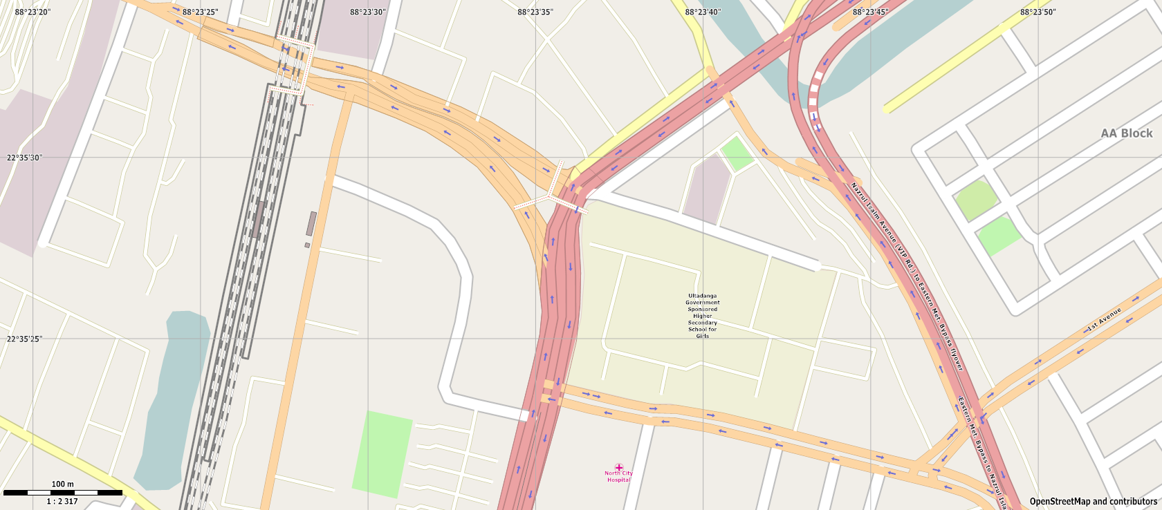
An example showing how an oddly shaped intersection would look when rendered as an area.
Licensing
![]()
![]()
This screenshot contains OpenStreetMap Carto rendering.
The OpenStreetMap Carto map style is made available under the Creative Commons CC-0 1.0 Universal Public Domain Dedication.
- Attribution to the map data:
| Contains map data © OpenStreetMap contributors, made available under the terms of the Open Database License (ODbL).
The ODbL does not require any particular license for maps produced from ODbL data, produced maps may be subject also to other licences. |
File history
Click on a date/time to view the file as it appeared at that time.
| Date/Time | Thumbnail | Dimensions | User | Comment | |
|---|---|---|---|---|---|
| current | 06:52, 5 May 2013 | | 1,680 × 738 (407 KB) | Japa (talk | contribs) | An example showing how an oddly shaped intersection would look when rendered as an area. |
You cannot overwrite this file.
File usage
The following page uses this file: