File:Blockgletscher Hangschutt.jpg
Jump to navigation
Jump to search

Size of this preview: 800 × 600 pixels. Other resolutions: 320 × 240 pixels | 640 × 480 pixels | 960 × 720 pixels.
Original file (960 × 720 pixels, file size: 204 KB, MIME type: image/jpeg)
Summary
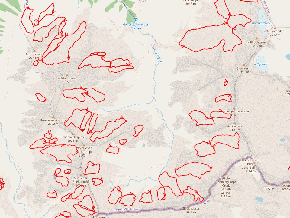
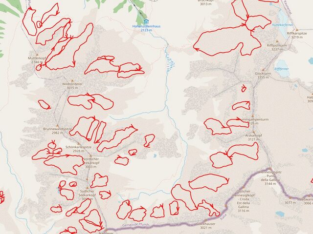
| Description | Rock glaciers (red outline) under Scree near Radurschlbach |
|---|---|
| Author | |
| Source | Austrian rock glacier inventory RGI_1, OSM-Carto |
Licensing
![]()
![]()
![]()
This work is licensed under the Creative Commons Attribution-ShareAlike 4.0 License.
Attribution not specified as a parameter! THIS LICENSE ALWAYS REQUIRES ATTRIBUTION! Use {{CC-BY-SA-4.0|Attribution, typically name of author}} See Template:CC-BY-SA-4.0 for full description this template should be used.
Attribution not specified as a parameter! THIS LICENSE ALWAYS REQUIRES ATTRIBUTION! Use {{CC-BY-SA-4.0|Attribution, typically name of author}} See Template:CC-BY-SA-4.0 for full description this template should be used.
| Contains map data © OpenStreetMap contributors, made available under the terms of the Open Database License (ODbL).
The ODbL does not require any particular license for maps produced from ODbL data, produced maps may be subject also to other licences. |
File history
Click on a date/time to view the file as it appeared at that time.
| Date/Time | Thumbnail | Dimensions | User | Comment | |
|---|---|---|---|---|---|
| current | 16:05, 29 July 2023 | | 960 × 720 (204 KB) | Hungerburg (talk | contribs) | {{Information | description=Rock glaciers (red outline) under Scree near Radurschlbach | description:de=Blockgletscher (rot umranded) unter Hangschutt nahe Radurschlbach | source=Austrian rock glacier inventory RGI_1, OSM-Carto | date= | author= | other_versions= }} |
You cannot overwrite this file.
File usage
There are no pages that use this file.