File:Chéméré Bourg.png
Jump to navigation
Jump to search


Size of this preview: 712 × 600 pixels. Other resolutions: 285 × 240 pixels | 570 × 480 pixels | 912 × 768 pixels | 1,216 × 1,024 pixels | 2,432 × 2,048 pixels | 8,976 × 7,558 pixels.
Original file (8,976 × 7,558 pixels, file size: 7.69 MB, MIME type: image/png)
Summary
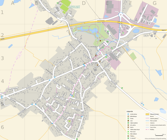
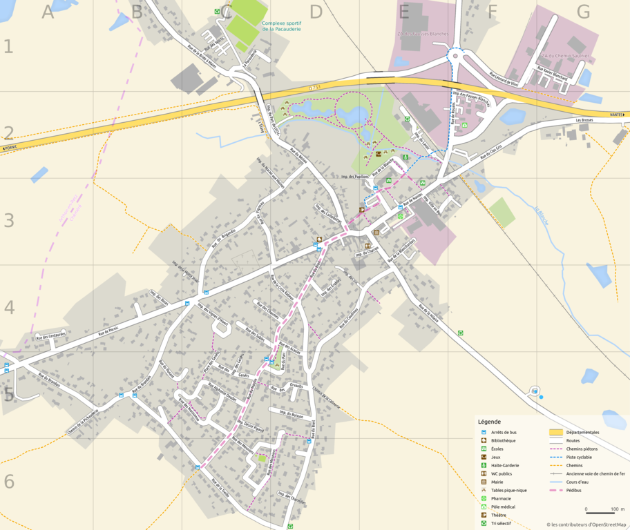
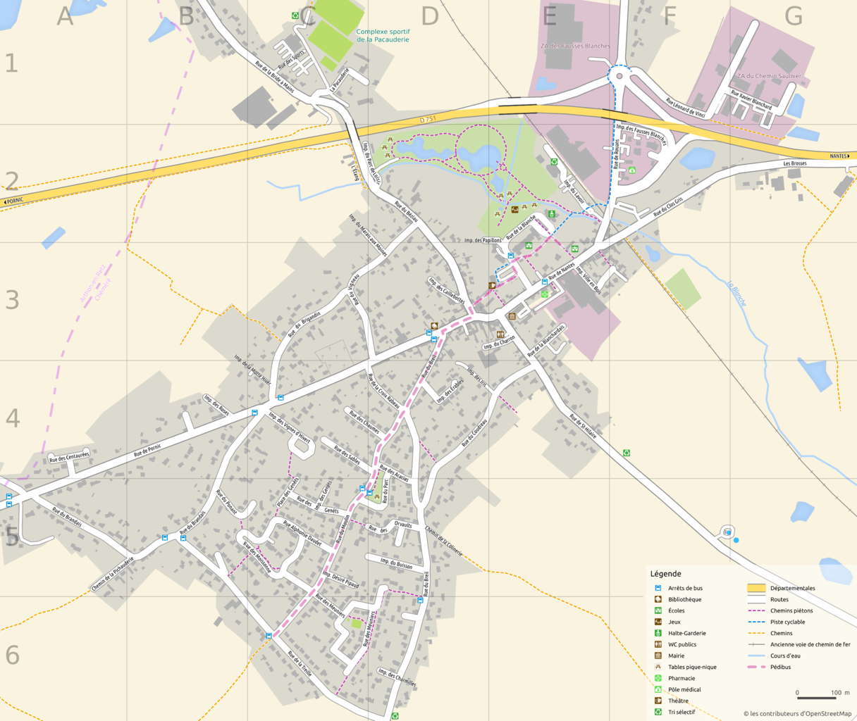
Carte du bourg de Chéméré créé à partir des données OpenStreetMap et les logiciels QGIS et Inskcape
Licensing
![]()
![]()
![]()
This work is licensed under the Creative Commons Attribution-ShareAlike 3.0 License.
Missing attribution. You have to add the authors!
THIS LICENSE REQUIRES ATTRIBUTION!
Use {{CC-BY-SA-3.0|Authors}}
Missing attribution. You have to add the authors!
THIS LICENSE REQUIRES ATTRIBUTION!
Use {{CC-BY-SA-3.0|Authors}}
| Contains map data © OpenStreetMap contributors, made available under the terms of the Open Database License (ODbL).
The ODbL does not require any particular license for maps produced from ODbL data, produced maps may be subject also to other licences. |
File history
Click on a date/time to view the file as it appeared at that time.
| Date/Time | Thumbnail | Dimensions | User | Comment | |
|---|---|---|---|---|---|
| current | 19:21, 26 November 2015 | | 8,976 × 7,558 (7.69 MB) | Naomap (talk | contribs) | Carte du bourg de Chéméré créé à partir des données OpenStreetMap et les logiciels QGIS et Inskcape |
You cannot overwrite this file.
File usage
The following page uses this file: