File:ConnectivityExample5.png
Jump to navigation
Jump to search


Size of this preview: 480 × 599 pixels. Other resolutions: 192 × 240 pixels | 495 × 618 pixels.
Original file (495 × 618 pixels, file size: 416 KB, MIME type: image/png)
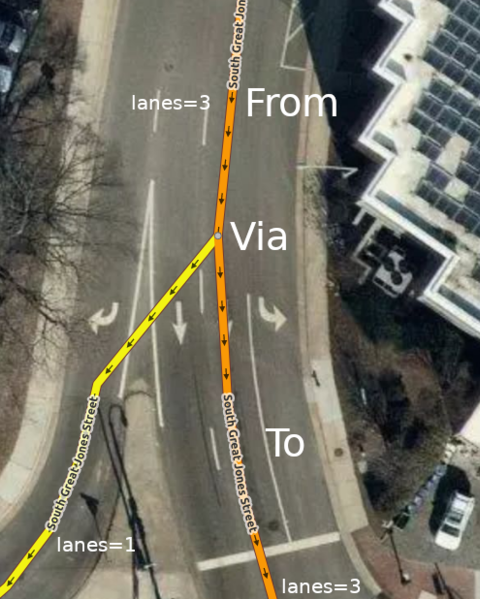
Summary
Mapbox Satellite Imagery of this location: https://www.osm.org/#map=19/35.99722/-78.90552
File history
Click on a date/time to view the file as it appeared at that time.
| Date/Time | Thumbnail | Dimensions | User | Comment | |
|---|---|---|---|---|---|
| current | 19:10, 1 June 2019 | | 495 × 618 (416 KB) | LeifRasmussen (talk | contribs) | Higher resolution imagery and correct roadway mapping. |
| 18:31, 23 May 2019 |  | 693 × 806 (1,002 KB) | LeifRasmussen (talk | contribs) | Mapbox Satellite Imagery of this location: https://www.osm.org/#map=19/35.99722/-78.90552 |
You cannot overwrite this file.
File usage
The following 3 pages use this file: