File:DenHaag-SecondMappingParty.jpg
Jump to navigation
Jump to search

No higher resolution available.
DenHaag-SecondMappingParty.jpg (595 × 565 pixels, file size: 72 KB, MIME type: image/jpeg)
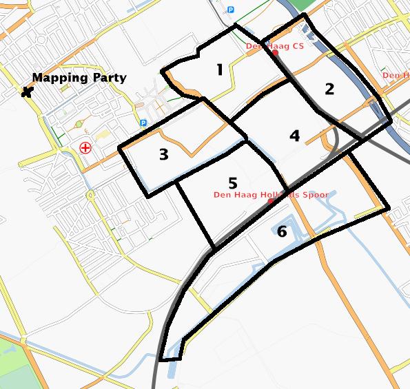
Some of the areas that will be mapped in the second mapping party in The Hague, 30 June/1 July 2007. See Den Haag.
Licensing
![]()
Contains map data © OpenStreetMap contributors, made available under the terms of the Creative Commons Attribution-ShareAlike 2.0 (CC-BY-SA-2.0).
File history
Click on a date/time to view the file as it appeared at that time.
| Date/Time | Thumbnail | Dimensions | User | Comment | |
|---|---|---|---|---|---|
| current | 21:27, 24 June 2007 | | 595 × 565 (72 KB) | Eugene van der Pijll (talk | contribs) | Some of the areas that will be mapped in the second mapping party in The Hague, 30 June/1 July 2007. See Den Haag. |
You cannot overwrite this file.
File usage
The following page uses this file: