File:Disaster routing with raw gps track.jpg
Jump to navigation
Jump to search

Size of this preview: 714 × 600 pixels. Other resolutions: 286 × 240 pixels | 572 × 480 pixels | 915 × 768 pixels | 1,219 × 1,024 pixels | 1,280 × 1,075 pixels.
Original file (1,280 × 1,075 pixels, file size: 281 KB, MIME type: image/jpeg)
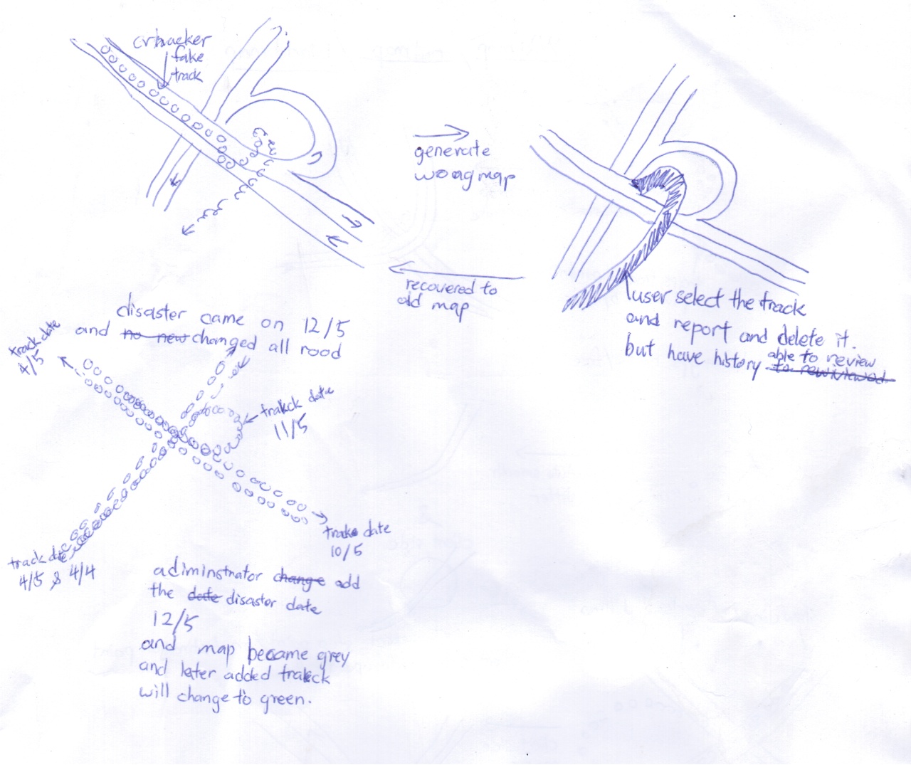
Some idea for disaster routing.
- This media file was uploaded by author of the work and its copyright holder.
![]()
![]()
![]()
This work is licensed under the Creative Commons Attribution-ShareAlike 4.0 License.
Attribution: Cyysky
Attribution: Cyysky
see https://wiki.openstreetmap.org/w/index.php?title=User_talk:Cyysky&diff=2253309&oldid=2251964
File history
Click on a date/time to view the file as it appeared at that time.
| Date/Time | Thumbnail | Dimensions | User | Comment | |
|---|---|---|---|---|---|
| current | 23:14, 16 January 2010 | | 1,280 × 1,075 (281 KB) | Cyysky (talk | contribs) | Some idea for disaster routing. |
You cannot overwrite this file.
File usage
The following page uses this file: