File:Forest road Slavne 2017 G8.jpg
Jump to navigation
Jump to search

Size of this preview: 800 × 533 pixels. Other resolutions: 320 × 213 pixels | 640 × 427 pixels | 1,024 × 683 pixels | 1,280 × 853 pixels | 2,560 × 1,707 pixels | 4,500 × 3,000 pixels.
Original file (4,500 × 3,000 pixels, file size: 5.91 MB, MIME type: image/jpeg)
This file and its description are from Wikimedia Commons.
Summary
| Description |
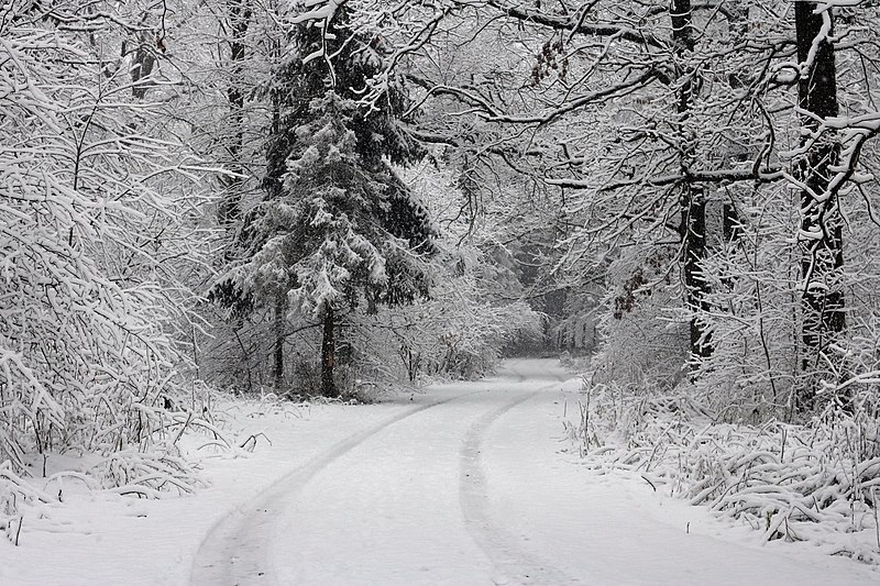
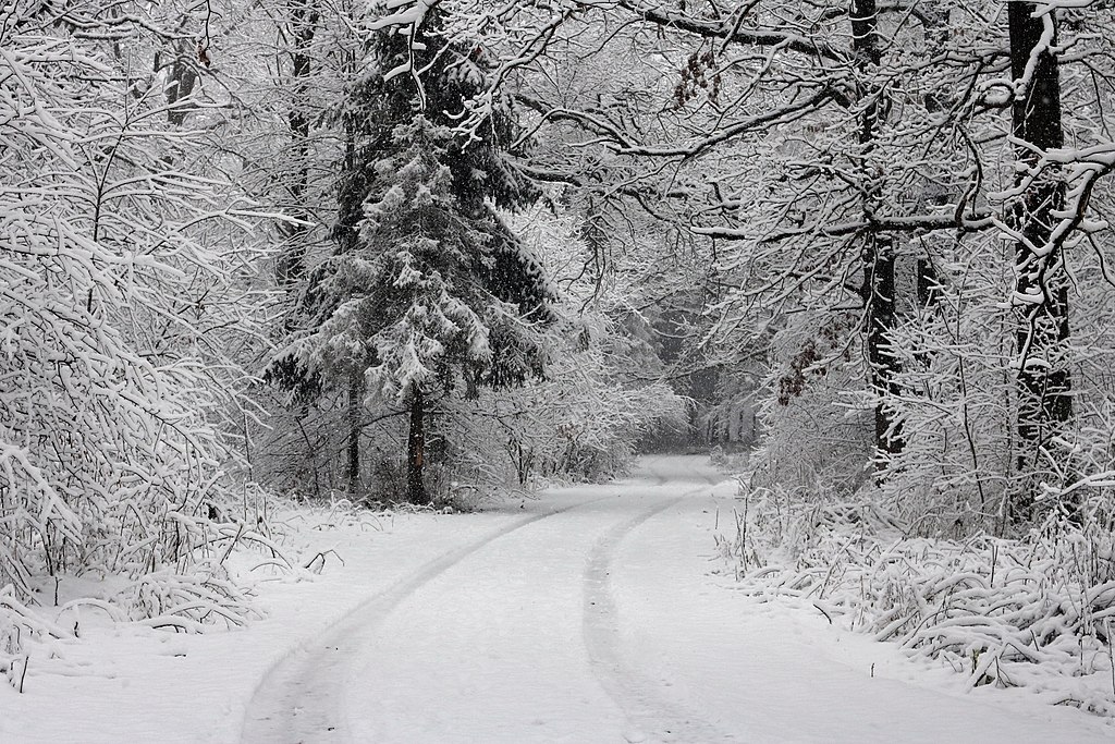
English: Forest road between Desenka railway station and the settlement of Slavne. Ukraine, Vinnytsia district, Vinnytsia region
Español: Vista invernal del camino forestal desde la plataforma del tren de Desenka hasta el asentamiento de Slavne. Raión de Vínnytsia, óblast de Vínnytsia, Ucrania.
Français : Route forestière entre Desenka et Slavne, région de Vinnytsia, Ukraine.
Polski: Leśna droga z przystanku osobowego Desenka do miejscowości Sławne w rejonie winnickim, w obwodzie winnickim, na Ukrainie.
Українська: Лісова дорога від залізничної платформи Десенка до селища Славне. Україна, Вінницький район Вінницької області
Русский: Лесная дорога от железнодорожной платформы Десенка до поселка Славное. Украина, Винницкий район Винницкой области
Čeština: Zasněžená lesní cesta na Ukrajině.
Deutsch: Forststraße vom Haltepunkt Desenka zum Dorf Slawne, Rajon Winnyzia, Oblast Winnyzia, Ukraine
Magyar: Erdei út a Deszenka vasútállomás és Szlavne között (Vinnicjai járás, Vinnicjai terület, Ukrajna)
Italiano: Vista invernale della strada forestale dalla stazione di Desenka al paese di Slavne, Oblast' di Donec'k, Ucraina.
한국어: 우크라이나 빈니차주 빈니차 지방의 데센카 기차역 플랫폼에서 슬라브네 마을로 향하는 숲길
Македонски: Шумски пат кај Славне во Виничката област, Украина
Эрзянь: Вирень ки Десенка чугункань платформанть эйстэ Славное вишка веленть видс. Украина, Винницань ёнкс, Винницань буе.
Português: Estrada na floresta vista da plataforma ferroviária de Desenka para a vila de Slavne, distrito de Vinnytsia, região de Vinnytsia, Ucrânia. |
||
| Date | Taken on 10 December 2017, 12:16:29 | ||
| Source | Self-photographed | ||
| Author | George Chernilevsky | ||
| Permission (Reusing this file) |
|
Assessment
|
This image was selected as picture of the day on Wikimedia Commons for 28 January 2020. It was captioned as follows: English: Forest road from the train platform Desenka to the settlement Slavne. Ukraine, Vinnytsia oblast, Vinnytsia rajon Other languages:
Čeština: Zasněžená lesní cesta na Ukrajině. Deutsch: Forststraße vom Haltepunkt Desenka zum Dorf Slawne, Rajon Winnyzia, Oblast Winnyzia, Ukraine English: Forest road from the train platform Desenka to the settlement Slavne. Ukraine, Vinnytsia oblast, Vinnytsia rajon Español: Vista invernal del camino forestal desde la plataforma del tren de Desenka hasta el asentamiento de Slavne. Raión de Vínnytsia, óblast de Vínnytsia, Ucrania. Italiano: Vista invernale della strada forestale dalla stazione di Desenka al paese di Slavne, Oblast' di Donec'k, Ucraina. Magyar: Erdei út a Deszenka vasútállomás és Szlavne között (Vinnicjai járás, Vinnicjai terület, Ukrajna) Polski: Leśna droga z przystanku osobowego Desenka do miejscowości Sławne w rejonie winnickim, w obwodzie winnickim, na Ukrainie. Português: Estrada na floresta vista da plataforma ferroviária de Desenka para a vila de Slavne, distrito de Vinnytsia, região de Vinnytsia, Ucrânia. Македонски: Шумски пат кај Славне во Виничката област, Украина Русский: Лесная дорога от железнодорожной платформы Десенка Юго-Западной железной дороги до посёлка Славное в Винницком районе Винницкой области Украины Українська: Лісова дорога від залізничної платформи Десенка до селища Славне. Україна, Вінницький район Вінницької області 한국어: 우크라이나 빈니차주 빈니차 지방의 데센카 기차역 플랫폼에서 슬라브네 마을로 향하는 숲길 |
File history
Click on a date/time to view the file as it appeared at that time.
| Date/Time | Thumbnail | Dimensions | User | Comment | |
|---|---|---|---|---|---|
| current | 20:02, 30 June 2018 | | 4,500 × 3,000 (5.91 MB) | wikimediacommons>George Chernilevsky | User created page with UploadWizard |
File usage
The following page uses this file: