File:French power substation find gdo 2.jpg
Jump to navigation
Jump to search

Size of this preview: 800 × 568 pixels. Other resolutions: 320 × 227 pixels | 640 × 454 pixels | 1,024 × 727 pixels | 1,280 × 909 pixels | 1,599 × 1,135 pixels.
Original file (1,599 × 1,135 pixels, file size: 1.08 MB, MIME type: image/jpeg)
Summary
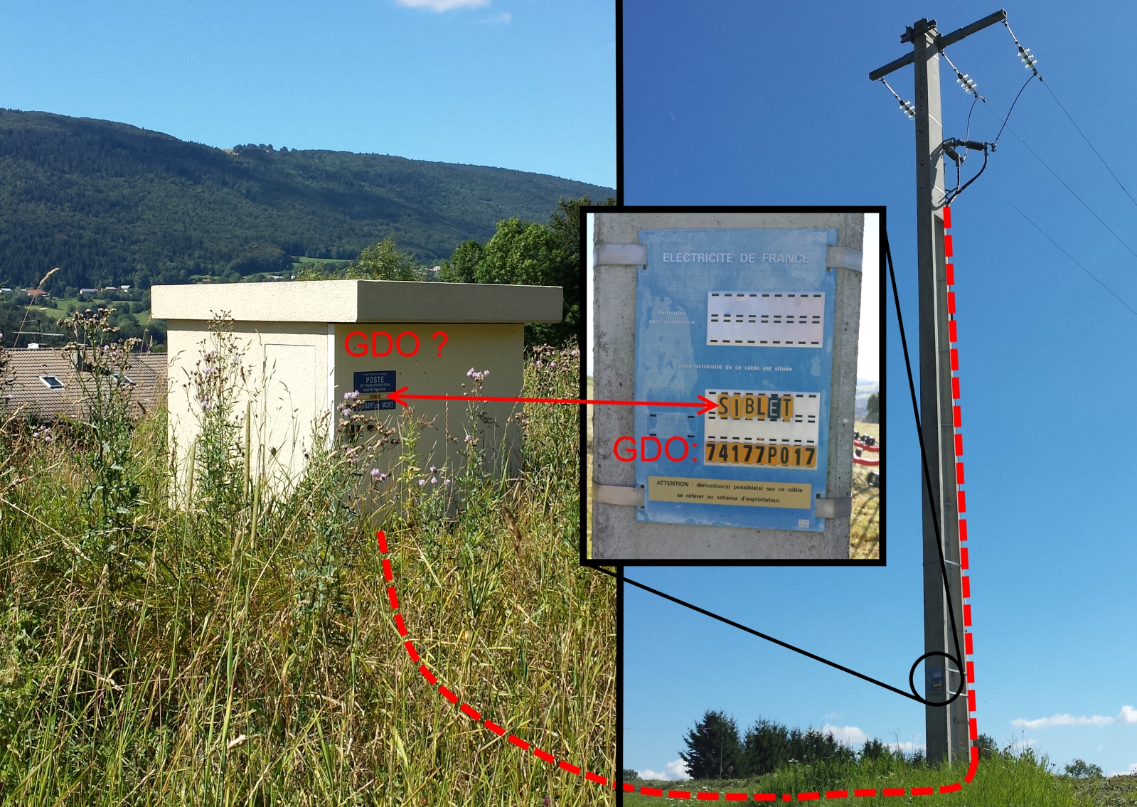
A method to find the GDO code of a French power substation using the nearest transition pole.
Une méthode de détermination du code GDO d'un poste de transformation local en utilisant d'autres éléments du réseau comme les remontées aéro-souterraines.
Licensing
![]()
![]()
![]()
This work is licensed under the Creative Commons Attribution-ShareAlike 2.0 License.
Attribution not specified as a parameter! THIS LICENSE ALWAYS REQUIRES ATTRIBUTION! Use {{CC-BY-SA-2.0|Attribution, typically name of author}} See Template:CC-BY-SA-2.0 for full description how this template should be used.
Note, there is
There is also
Attribution not specified as a parameter! THIS LICENSE ALWAYS REQUIRES ATTRIBUTION! Use {{CC-BY-SA-2.0|Attribution, typically name of author}} See Template:CC-BY-SA-2.0 for full description how this template should be used.
Note, there is
{{CC-BY-SA-2.0 OpenStreetMap}} for files based on old OSM map data, before the license change made on 2012-09-12.There is also
{{OSM Carto screenshot||old_license}} for files based on old OSM map data, before the license change made on 2012-09-12, created using OSM Carto map style.
File history
Click on a date/time to view the file as it appeared at that time.
| Date/Time | Thumbnail | Dimensions | User | Comment | |
|---|---|---|---|---|---|
| current | 10:08, 12 August 2013 | | 1,599 × 1,135 (1.08 MB) | Fanfouer (talk | contribs) | A method to find the GDO code of a French power substation using the nearest transition pole. Une méthode de détermination du code GDO d'un poste de transformation local en utilisant d'autres éléments du réseau comme les remontées aéro-souterra... |
You cannot overwrite this file.
File usage
The following page uses this file: