File:Gaza.png
Jump to navigation
Jump to search


Size of this preview: 653 × 599 pixels. Other resolutions: 262 × 240 pixels | 523 × 480 pixels | 715 × 656 pixels.
Original file (715 × 656 pixels, file size: 450 KB, MIME type: image/png)
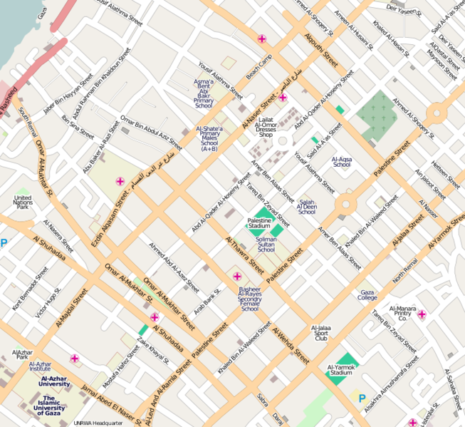
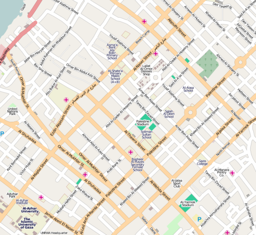
A view of Gaza city showing the progress made in the past year.
Licensing
![]()
![]()
![]()
This screenshot contains OpenStreetMap Carto rendering.
The OpenStreetMap Carto map style is made available under the Creative Commons CC-0 1.0 Universal Public Domain Dedication.
- Attribution to the map data:
![]()
Contains map data © OpenStreetMap contributors, made available under the terms of the Creative Commons Attribution-ShareAlike 2.0 (CC-BY-SA-2.0).
File history
Click on a date/time to view the file as it appeared at that time.
| Date/Time | Thumbnail | Dimensions | User | Comment | |
|---|---|---|---|---|---|
| current | 18:04, 1 December 2009 | | 715 × 656 (450 KB) | PeterIto (talk | contribs) | A view of [http://www.openstreetmap.org/?lat=31.52242&lon=34.44983&zoom=15&layers=B000FTFT Gaza city] showing the progress made in the past year. |
You cannot overwrite this file.
File usage
There are no pages that use this file.