File:Germany and Hungary postcode delivery route.png
Jump to navigation
Jump to search

Size of this preview: 471 × 599 pixels. Other resolutions: 189 × 240 pixels | 377 × 480 pixels | 604 × 768 pixels | 1,211 × 1,540 pixels.
Original file (1,211 × 1,540 pixels, file size: 968 KB, MIME type: image/png)
Summary
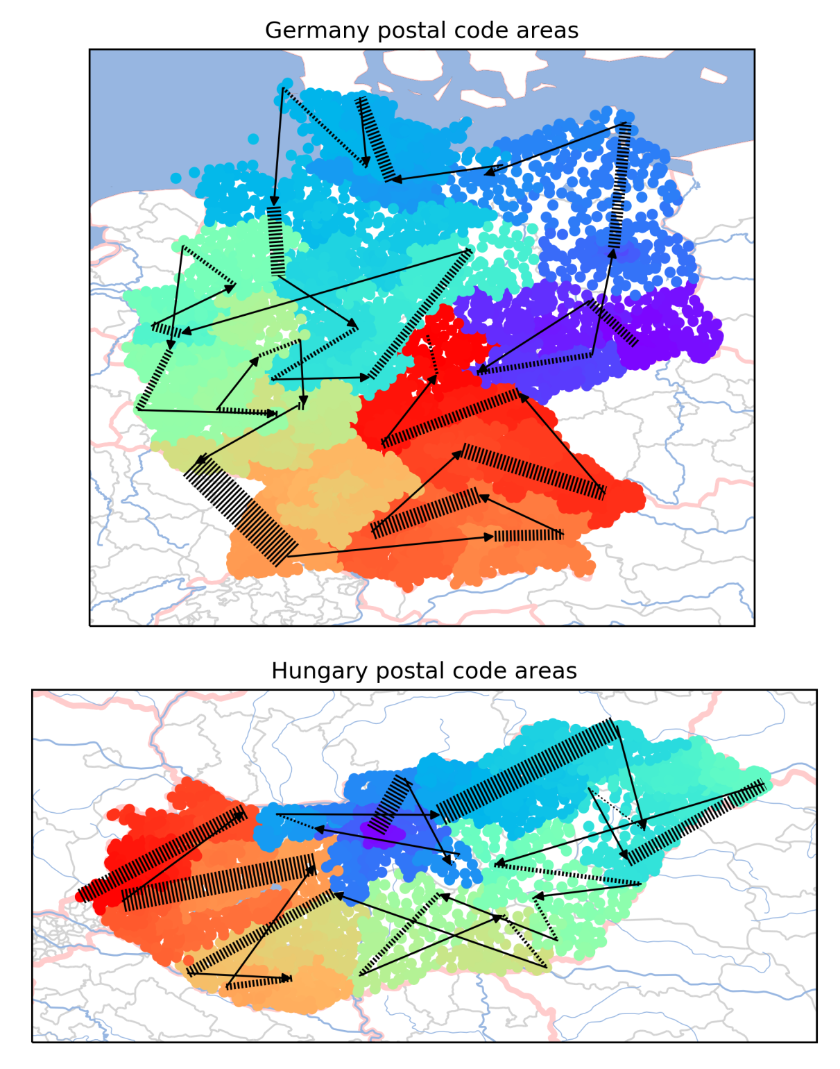
Bence Mélykúti blogged about Santa's Christmas delivery route and the fun he had with OpenStreetMap data for Germany and Hungary.
Licensing
![]()
![]()
![]()
This work is licensed under the Creative Commons Attribution-ShareAlike 4.0 License.
Missing attribution. You have to add the authors!
THIS LICENSE REQUIRES ATTRIBUTION!
Use {{CC-BY-SA-4.0|Authors}}
Missing attribution. You have to add the authors!
THIS LICENSE REQUIRES ATTRIBUTION!
Use {{CC-BY-SA-4.0|Authors}}
File history
Click on a date/time to view the file as it appeared at that time.
| Date/Time | Thumbnail | Dimensions | User | Comment | |
|---|---|---|---|---|---|
| current | 14:41, 3 December 2018 | | 1,211 × 1,540 (968 KB) | Harry Wood (talk | contribs) | Bence Mélykúti [https://melykuti.me/2018/08/20/santas-christmas-delivery-route-revealed/ blogged about Santa's Christmas delivery route] and the fun he had with OpenStreetMap data for Germany and Hungary. |
You cannot overwrite this file.
File usage
The following 10 pages use this file:
- Featured images/Oct-Dec 2018
- List of featured images/2018
- Pt:Featured images/Oct-Dec 2018
- Zh-hans:Featured images/Oct-Dec 2018
- Zh-hant:Featured images/Oct-Dec 2018
- Template:Iotw image/2018-49
- DE:Featured images/Oct-Dec 2018
- FR:Featured images/Oct-Dec 2018
- ES:Featured images/Oct-Dec 2018
- IT:Featured images/Oct-Dec 2018