File:Germany landuse without buildings.jpg
Jump to navigation
Jump to search

Size of this preview: 425 × 600 pixels. Other resolutions: 170 × 240 pixels | 340 × 480 pixels | 544 × 768 pixels | 725 × 1,024 pixels | 1,700 × 2,400 pixels.
Original file (1,700 × 2,400 pixels, file size: 854 KB, MIME type: image/jpeg)
Summary
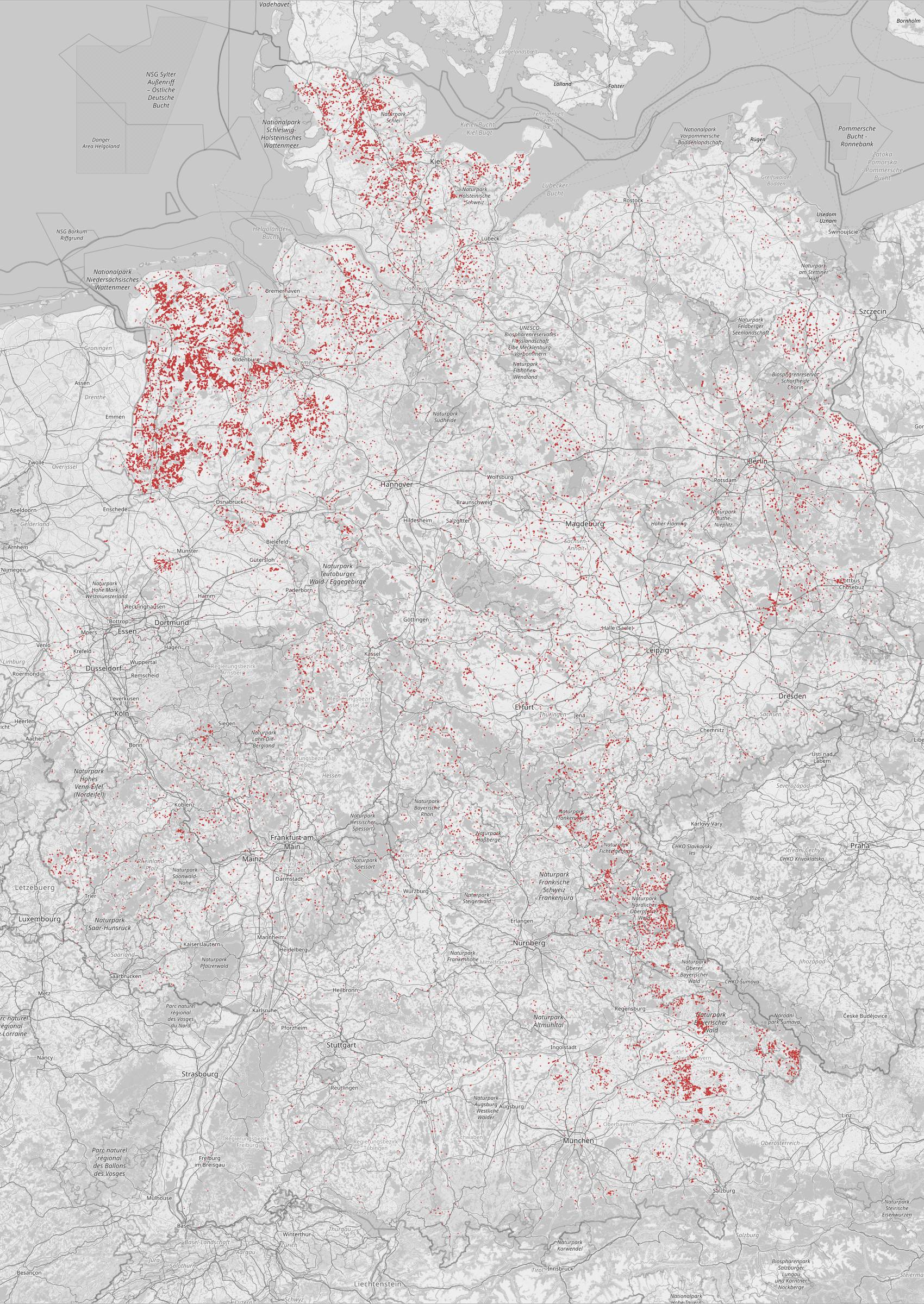
An analysis of land use areas and buildings in OpenStreetMap showing residential land use areas which don’t contain any buildings. Based on data from January 2021. These land use areas were “fixed” in the meantime by adding buildings.
Licensing
![]()
I, the creator of this work, hereby release it into the public domain. This applies worldwide.
In case this is not legally possible, I grant anyone the right to use this work for any purpose, without any conditions, unless such conditions are required by law.
Notice to creator or uploader: Please consider using {{CC0-self}} instead for your work.
"Releasing work to public domain" has some issues, as it is not well defined in some jurisdictions and/or it is not actually possible to "release to public domain". Using CC0 license achieves the intended effect while avoiding such problems and is well suited for media files.
File history
Click on a date/time to view the file as it appeared at that time.
| Date/Time | Thumbnail | Dimensions | User | Comment | |
|---|---|---|---|---|---|
| current | 21:45, 10 November 2021 | | 1,700 × 2,400 (854 KB) | Hs (talk | contribs) | An analysis of land use areas and buildings in OpenStreetMap showing residential land use areas which don’t contain any buildings. Based on data from January 2021. These land use areas were “fixed” in the meantime by adding buildings. |
You cannot overwrite this file.
File usage
There are no pages that use this file.