File:HOT Open Mapping Hub regional coverage.png
Jump to navigation
Jump to search

Size of this preview: 800 × 379 pixels. Other resolutions: 320 × 152 pixels | 640 × 304 pixels | 1,208 × 573 pixels.
Original file (1,208 × 573 pixels, file size: 307 KB, MIME type: image/png)
Summary
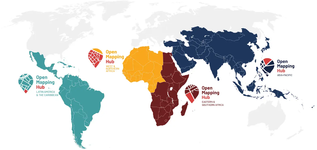
| Description | Map showing the geographical areas covered by each of HOT's four Open Mapping Hubs |
|---|---|
| Author | |
| Source | HOT |
| Date | 05 Dec 2024 |
Licensing
![]()
![]()
This work is licensed under the Creative Commons Attribution 4.0 License.
Missing attribution. You have to add the authors!
THIS LICENSE REQUIRES ATTRIBUTION!
Use {{CC-BY-4.0|Authors}}
Missing attribution. You have to add the authors!
THIS LICENSE REQUIRES ATTRIBUTION!
Use {{CC-BY-4.0|Authors}}
File history
Click on a date/time to view the file as it appeared at that time.
| Date/Time | Thumbnail | Dimensions | User | Comment | |
|---|---|---|---|---|---|
| current | 11:23, 5 December 2024 | | 1,208 × 573 (307 KB) | Pedrito1414 (talk | contribs) | {{Information | description=Map shoeing the geographical areas covered by each of HOT's four Open Mapping Hubs | source=HOT | date=05 Dec 2024 | author= | other_versions= }} |
You cannot overwrite this file.
File usage
The following page uses this file: