File:Madrid.png
Jump to navigation
Jump to search


Size of this preview: 786 × 599 pixels. Other resolutions: 315 × 240 pixels | 630 × 480 pixels | 960 × 732 pixels.
Original file (960 × 732 pixels, file size: 1,002 KB, MIME type: image/png)
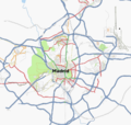
Map of Madrid and M-40
Contains map data © OpenStreetMap contributors, made available under the terms of the Creative Commons Attribution-ShareAlike 2.0 (CC-BY-SA-2.0).
File history
Click on a date/time to view the file as it appeared at that time.
| Date/Time | Thumbnail | Dimensions | User | Comment | |
|---|---|---|---|---|---|
| current | 19:42, 2 February 2009 |  | 960 × 732 (1,002 KB) | Sergionaranja (talk | contribs) | |
| 16:37, 23 February 2008 |  | 1,194 × 846 (567 KB) | Nako (talk | contribs) | ||
| 16:30, 23 February 2008 |  | 1,280 × 999 (636 KB) | Nako (talk | contribs) | Actualization at 23rd February 2008 for the presentation of the one year evolution of Madrid for the spanish 1st anniversary mapping party in Zaragoza. | |
| 12:34, 7 November 2007 |  | 1,028 × 768 (381 KB) | Frsantos (talk | contribs) | Updated to 2007/11/7 | |
| 10:50, 18 October 2007 |  | 1,024 × 768 (362 KB) | Nako (talk | contribs) | Reverted to earlier revision | |
| 10:47, 18 October 2007 |  | 887 × 840 (399 KB) | Nako (talk | contribs) | ||
| 16:13, 27 July 2007 |  | 1,024 × 768 (362 KB) | Frsantos (talk | contribs) | Updated to 2007/07/27 | |
| 18:03, 13 February 2007 |  | 500 × 478 (80 KB) | Frsantos (talk | contribs) | Map of Madrid and M-40 |
You cannot overwrite this file.