File:Mashhad history.gif
Jump to navigation
Jump to search


Size of this preview: 739 × 600 pixels. Other resolutions: 296 × 240 pixels | 592 × 480 pixels.
Original file (800 × 649 pixels, file size: 482 KB, MIME type: image/gif, 61 frames, 1 min 1 s)
Note: Due to technical limitations, thumbnails of high resolution GIF images such as this one will not be animated.
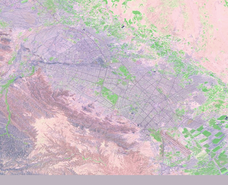
Animation of OSM data in Mashhad metropol area, Iran between 2008 and 2010 on a background of Landsat imagery (Template:PD-USGov). Created by me using an online tool in 2010 that doesn't seem to be available any longer.
![]()
Contains map data © OpenStreetMap contributors, made available under the terms of the Creative Commons Attribution-ShareAlike 2.0 (CC-BY-SA-2.0).
File history
Click on a date/time to view the file as it appeared at that time.
| Date/Time | Thumbnail | Dimensions | User | Comment | |
|---|---|---|---|---|---|
| current | 19:05, 16 May 2010 | | 800 × 649 (482 KB) | Grille Chompa (talk | contribs) |
You cannot overwrite this file.
File usage
There are no pages that use this file.