File:Mejorasyopalsentinel2.jpg
Jump to navigation
Jump to search

No higher resolution available.
Mejorasyopalsentinel2.jpg (399 × 200 pixels, file size: 36 KB, MIME type: image/jpeg)
Summary
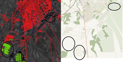
Before and after using new Sentinel2 as an alternative to Landsat satellite images Sentinels Scientific Data Hub [1]
Licensing
| Contains map data © OpenStreetMap contributors, made available under the terms of the Open Database License (ODbL).
The ODbL does not require any particular license for maps produced from ODbL data, produced maps may be subject also to other licences. |
File history
Click on a date/time to view the file as it appeared at that time.
| Date/Time | Thumbnail | Dimensions | User | Comment | |
|---|---|---|---|---|---|
| current | 14:03, 3 January 2016 | | 399 × 200 (36 KB) | Harrierco (talk | contribs) | Before and after using new Sentinel2 as an alternative to Landsat satellite images [https://scihub.copernicus.eu/dhus/#/home Sentinels Scientific Data Hub] [http://www.openstreetmap.org/#map=15/5.2887/-72.4166] |
You cannot overwrite this file.
File usage
The following page uses this file: