File:Railway station node placement flowchart.png
Jump to navigation
Jump to search

Size of this preview: 297 × 599 pixels. Other resolutions: 119 × 240 pixels | 238 × 480 pixels | 381 × 768 pixels | 508 × 1,024 pixels | 1,548 × 3,121 pixels.
Original file (1,548 × 3,121 pixels, file size: 235 KB, MIME type: image/png)
Summary
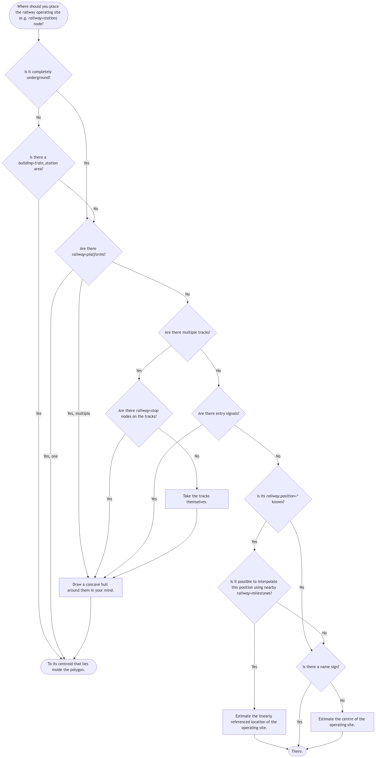
| Description | A Mermaid flow chart that helps deciding where to place the node of a railway operating site. You may edit it here. After editing, please update the embedded link in the previous sentence! |
|---|---|
| Author | Gymate |
| Source | https://community.openstreetmap.org/t/railway-station-as-an-area/104839/223 |
| Date | 2024-08-03 |
Licensing
- This media file was uploaded by author of the work and its copyright holder.
![]()
![]()
File history
Click on a date/time to view the file as it appeared at that time.
| Date/Time | Thumbnail | Dimensions | User | Comment | |
|---|---|---|---|---|---|
| current | 22:07, 18 January 2025 | | 1,548 × 3,121 (235 KB) | Gymate (talk | contribs) | {{Information | description=A Mermaid flowchart that helps deciding where to place the node of a railway operating site. You may edit it [https://mermaid.live/edit#pako:eNp1VF1v2jAU_SuWn1pEEbSlQKSu2tQ97GF7WadpI9Vqkkuw6tiR7ZRlwH_f9Q35KGrzkMS-1-ec--UdT0wKPOJrZbbJRljPHu5jzfBxHldny5g__dyABeY2plQpq0zJCiUSYH4DzAqptqJipgArvNQZc9IDO4NRNmKDo_UWobw0enDONLLdPcX88bwmCc_FxQf245PY6B1yfXFMepaYvFDgQVWs1CnYzBr8hoOH-hz5h5P7X-D2QZBfn1q-mT1bqVRnR1xPYQg2WJVSpaj11qNA_adRx4QF0eOgsx1HAtrbs-WDQYGuXhmZIqrwTElA3drJtE5L... |
You cannot overwrite this file.
File usage
The following 2 pages use this file: