File:SOTM Africa 2017 balcony group photo.jpg
Jump to navigation
Jump to search


Size of this preview: 798 × 599 pixels. Other resolutions: 320 × 240 pixels | 639 × 480 pixels | 1,023 × 768 pixels | 1,280 × 962 pixels | 1,704 × 1,280 pixels.
Original file (1,704 × 1,280 pixels, file size: 613 KB, MIME type: image/jpeg)
Summary
State of the Map Africa 2017 group photo off the balcony.
This is a Featured image, which means that it has been identified as one of the best examples of OpenStreetMap mapping, or that it provides a useful illustration of the OpenStreetMap project. If you know another image of similar quality, you can nominate it on Featured image proposals.
Front-page image for week 29 of 2017 (17–23 Jul.).
- Image descriptions
- Deutsch : Die erste State of the Map Africa fand vor einer Woche in Kampala (Uganda) statt.
- English : The first “State of the Map Africa” conference took place one week ago in Kampala, Uganda.
- français : La première conférence « State of the Map Africa » a eu lieu il y a une semaine à Kampala en Ouganda.
- italiano : La prima conferenza State of the Map Africa si è svolta una settimana fa a Kampala, in Uganda.
- 中文(简体) : 第一次 “State of the Map Africa 大会” 一周前在乌干达坎帕拉举行。
- 中文(繁體) : 第一次 “State of the Map Africa 大會” 一週前在烏干達坎帕拉舉行。
Licensing
slightly ambiguous permission received to release this with an open license. TODO: name the photographer here. Was it Geoffrey Kateragga?
![]()
![]()
![]()
This work is licensed under the Creative Commons Attribution-ShareAlike 2.0 License.
Attribution not specified as a parameter! THIS LICENSE ALWAYS REQUIRES ATTRIBUTION! Use {{CC-BY-SA-2.0|Attribution, typically name of author}} See Template:CC-BY-SA-2.0 for full description how this template should be used.
Note, there is
There is also
Attribution not specified as a parameter! THIS LICENSE ALWAYS REQUIRES ATTRIBUTION! Use {{CC-BY-SA-2.0|Attribution, typically name of author}} See Template:CC-BY-SA-2.0 for full description how this template should be used.
Note, there is
{{CC-BY-SA-2.0 OpenStreetMap}} for files based on old OSM map data, before the license change made on 2012-09-12.There is also
{{OSM Carto screenshot||old_license}} for files based on old OSM map data, before the license change made on 2012-09-12, created using OSM Carto map style.
File history
Click on a date/time to view the file as it appeared at that time.
| Date/Time | Thumbnail | Dimensions | User | Comment | |
|---|---|---|---|---|---|
| current | 13:42, 19 July 2017 | | 1,704 × 1,280 (613 KB) | Verdy p (talk | contribs) | similar crop but initial image quality restored |
| 13:59, 17 July 2017 | 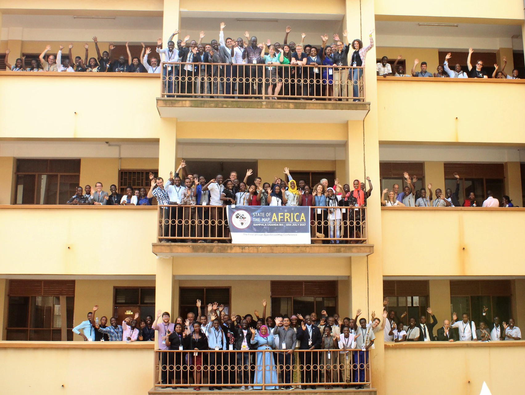 | 1,703 × 1,281 (562 KB) | Wille (talk | contribs) | cropped | |
| 01:07, 11 July 2017 |  | 2,048 × 1,365 (445 KB) | Harry Wood (talk | contribs) | State of the Map Africa 2017 group photo off the balcony |
You cannot overwrite this file.
File usage
The following 14 pages use this file:
- Featured images/Jul-Sep 2017
- List of featured images/2017
- Pt:Featured images/Jul-Sep 2017
- State of the Map Africa 2017
- Uk:Featured images/Jul-Sep 2017
- Zh-hans:Featured images/Jul-Sep 2017
- Zh-hant:Featured images/Jul-Sep 2017
- Template:Iotw image/2017-29
- DE:Featured images/Jul-Sep 2017
- FR:Featured images/Jul-Sep 2017
- ES:Imágenes destacadas/Jul-Sep 2017
- IT:Featured images/Jul-Sep 2017
- RU:Featured images/Jul-Sep 2017
- JA:Featured images/Jul-Sep 2017