File:SanPabloCityProper Cake.PNG
Jump to navigation
Jump to search


Size of this preview: 600 × 600 pixels. Other resolutions: 240 × 240 pixels | 480 × 480 pixels | 768 × 768 pixels | 1,024 × 1,024 pixels.
Original file (1,024 × 1,024 pixels, file size: 231 KB, MIME type: image/png)
Summary
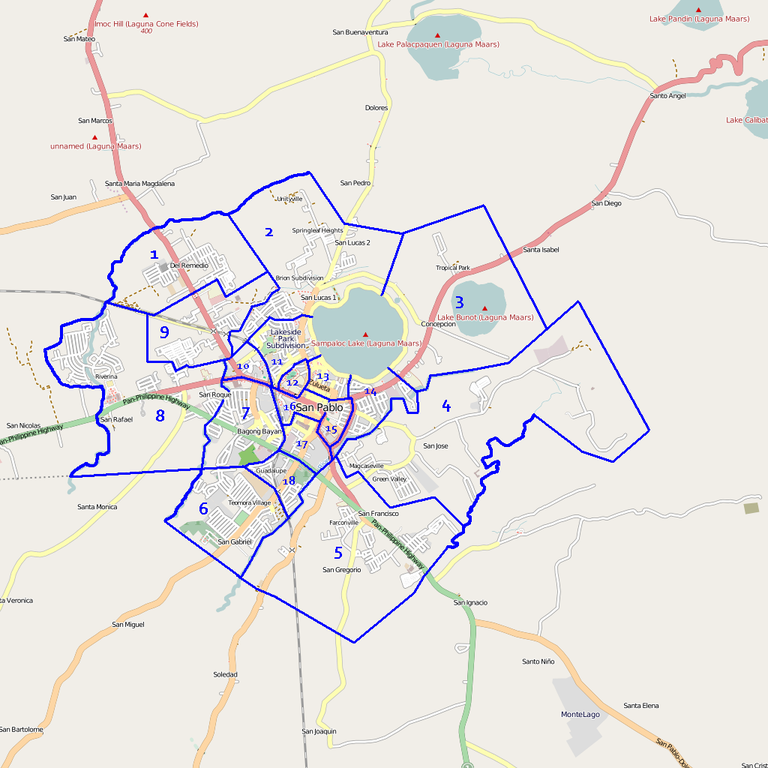
| Description | Map showing the downtown San Pablo City area and the 18 slices described in the San Pablo, Laguna status page. |
|---|---|
| Author | Ianlopez1115 |
| Source | OpenStreetMap (map); author (labels and other annotations) |
| Date | 4 July 2009 (first upload) |
| Permission | See below |
| Other versions | none |
Licensing
Licensing
![]()
![]()
![]()
This screenshot contains OpenStreetMap Carto rendering.
The OpenStreetMap Carto map style is made available under the Creative Commons CC-0 1.0 Universal Public Domain Dedication.
- Attribution to the map data:
![]()
Contains map data © OpenStreetMap contributors, made available under the terms of the Creative Commons Attribution-ShareAlike 2.0 (CC-BY-SA-2.0).
File history
Click on a date/time to view the file as it appeared at that time.
| Date/Time | Thumbnail | Dimensions | User | Comment | |
|---|---|---|---|---|---|
| current | 05:41, 10 April 2011 | | 1,024 × 1,024 (231 KB) | Ianlopez1115 (talk | contribs) | Re-uploading after 2-3 botched attempts. |
| 05:38, 10 April 2011 |  | 1,024 × 1,024 (231 KB) | Ianlopez1115 (talk | contribs) | Previously uploaded version was the right version. | |
| 05:30, 10 April 2011 |  | 1,024 × 1,024 (231 KB) | Ianlopez1115 (talk | contribs) | This is the newer version (older version mistakenly uploaded) | |
| 05:28, 10 April 2011 |  | 1,024 × 1,024 (231 KB) | Ianlopez1115 (talk | contribs) | Updated/tweaked map | |
| 12:01, 14 May 2010 | 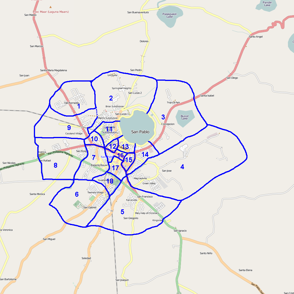 | 1,024 × 1,024 (195 KB) | Ianlopez1115 (talk | contribs) | updated and "standardized" image. | |
| 07:31, 4 July 2009 | 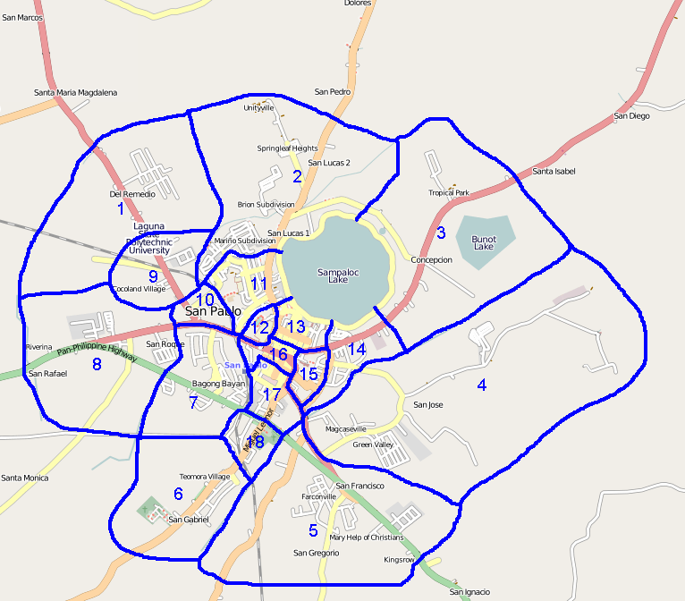 | 766 × 672 (117 KB) | Ianlopez1115 (talk | contribs) | Shows the downtown San Pablo City area (and the 18 slices described in the San Pablo City status page.) |
You cannot overwrite this file.
File usage
The following page uses this file: