File:Screenshot-Kastelholm DiscGolfPark-GoogleMaps-sattellite.png
Jump to navigation
Jump to search


Size of this preview: 584 × 600 pixels. Other resolutions: 234 × 240 pixels | 468 × 480 pixels | 748 × 768 pixels | 997 × 1,024 pixels | 1,499 × 1,539 pixels.
Original file (1,499 × 1,539 pixels, file size: 3.49 MB, MIME type: image/png)
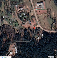
Kastelholm DiscGolfPark shown on Google Maps - aerial photography base layer
Illustration-only for discussion in User:Freephile/Proposal:Disc golf course
NOT FOR DISTRIBUTION
Screenshot from Google Maps Map data © 2025 United States
Licensing
 |
This work is copyrighted (or assumed to be so) and unlicensed. Though it is not covered by a non-free content license listed at Category:Media license templates, it is believed that the use of this work:
Any other uses of this image, on OpenStreetMap Wiki or elsewhere, may be copyright infringement. |
File history
Click on a date/time to view the file as it appeared at that time.
| Date/Time | Thumbnail | Dimensions | User | Comment | |
|---|---|---|---|---|---|
| current | 17:46, 4 March 2025 | | 1,499 × 1,539 (3.49 MB) | Freephile (talk | contribs) |
You cannot overwrite this file.
File usage
The following page uses this file: