Mashhad
(Redirected from Iran:Khorasan Razavi:Mashhad)
Jump to navigation
Jump to search
Mashhad, the holiest city of Iran (because of Imam Reza shrine) and capital of Khorasan Razavi province, is located at latitude N 36°17' 45 and longitude E 59° 36' 43.
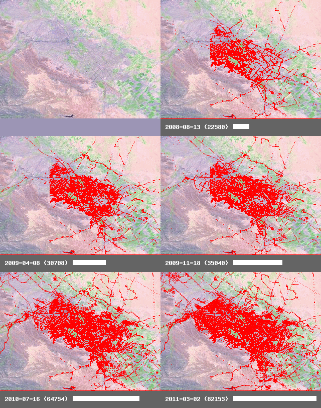
Progress Summary
Claudius started tracing streets and landuse from Yahoo satellite imagery in mid 2008. Some place and street names were given by locals.
After February 2010, Kesler as an active local mapper contributed an important role on naming streets and correcting one-way roads, also completing non-mapped area and POIs.
For the progress status, see the current state of the map.
Goals
- Mashhad into the map (July 2011: about 90%)
- street names (May 2010: about 33%) - naming of cross-streets halted until Mapnik rendering gets fixed
- connections to country-wide motor- and highways (√ Done as of February 2010)
- Light rail line from Toroqbeh to the east (√ Done as of July 2011)
- new metro line from south to north (July 2011: only raw line without stations and based on guess)
- Bus lines and stations
- Map Ferdowsi university campus (√ Streets done as of May 2010 - Next step: Footways and micro-mapping)
History
History animation done by Frederik Ramm.

