WikiProject Lesotho
| V・T・E |
| latitude: -29.6, longitude: 28.2 |
| Browse map of Lesotho 29°36′00.00″ S, 28°12′00.00″ E |
| Edit map |
|
External links:
|
| Use this template for your locality |
Lesotho is a country in Africa at latitude 29°36′00.00″ South, longitude 28°12′00.00″ East. This page contains information relating to mapping activity that is specific to Lesotho.
#MapLesotho Phase 4 - Now Underway
Find out more here.
Goals
If you have a goal that you are working towards or one that you would like to see get done (and are maybe willing to get the ball rolling) then add it to the list here, create a section where it can be coordinated and tracked, and a way of measuring progress. And then get on with it :-)
- #MapLesotho! Part of a memorandum of understanding between the Government of Lesotho and Fingal County Council. See MapLesotho and maplesotho.wordpress.com.
- Buggy Idle is trying to map all the petrol pumps of Lesotho to build a motorist friendly app
Road Mapping
Beware of Copyright!
Make sure you are not infringing on any copyright when contributing to OSM. In particular, note that it is not allowed to trace from copyright-protected maps. It is also not allowed to copy street names, etc. Read the FAQ and documentation carefully before you start, so that you are aware of any issues that you might not have thought about before.
MapLesotho Community
Contact
Feel free to use any of the following methods to contact any of the Lesotho mappers.
- See the MapLesotho blog
- Tweet #MapLesotho or tweet @tshedy who is the Mapping Queen of Lesotho.
Identify yourself as a Lesotho mapper on the wiki by adding the following to your wiki user page [[Category:Users_in_Lesotho|YOUR_WIKI_USERNAME_HERE]]
See Category:Users_in_Lesotho for a list of all users
Events
1. The Lesotho Mapathon was a global event which took place on 25th July 2014. Mapping parties were organised in Mafeteng, Dublin, London, Munster, Warsaw, and Ottowa.
2. A Lesotho Mapathon was conducted on 17th January 2015, this time involving mappers in Maseru, Dublin and Chattanooga.
3. Another #MapLesotho Mapathon was held on the 17th February 2016. The main event will be held at the Avani Maseru Hotel at 02hr00.
4. A birthday celebration involving mapping Lesotho was held at the Lesotho Embassy on the 13th August 2016
5. OSM Africa June Mapathon: #MapLesotho. This event will held both virtually, on zoom and physically, in Maseru, on Friday 3rd June 2022 at 02:00pm - 05:00pm SAST. Grab your free ticket here Learn more....
Phases of Mapping
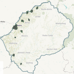
This section simply outlines the history of previous efforts at mapping Lesotho. It should be acknowledged that around 20,000 nodes existed in Lesotho at the start of 2014. Predominantly these were the main highways, and tourism locations and a selection of large public buildings in Maseru City. This mapping was sporadic. The first "co-ordinated" effort to Map Lesotho started in February 2014, initially in a residential suburb called Ha Foso, which is at the north of Maseru City straddling the border with Berea district.
Phase 1 - Completed Mar - Jun 2014
A pilot phase existing for a few months between March and June 2014. Here the mapping related to specific towns, and also to a cluster of rural villages to establish any issues that could arise in the future with tagging, tracing and network use in Lesotho. The following tasks existed at at time.
- Mafeteng which was 100% done and 27% validated
- Qacha's Nek which was 99% done and 2% validated
- Hlotse which was 99% done and 13% validated
- Mokhlakeng which was 99% done and 5% validated
Phase 2 - July 2014 - May 2016
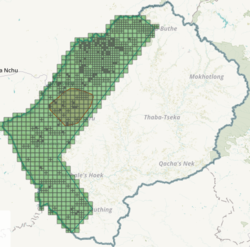
There were four large tasks set up for the Lesotho Mapathon basemap phase that started in July 2014. These tasks enabled the completion of a basic base map for the country comprising of all highway types, all waterway types and settlements mapped as landuse=residential. These tasks were completed in May 2016,
| Task # 597 | Task # 599 | Task # 894 | Task # 1169 |
|---|---|---|---|
| Link | Link | Link | Link |

|

|

|

|
Phase 3 - Jun 2016 - Nov 2017
These tasks began in June 2016. These involved mapping the whole country in much finer detail, down to the level of buildings, barriers, landuse, highway classification etc. These tasks were broken out according to district boundaries as well as Maseru City having a task on its own due to the volume of mapping to be completed in that area. All tasks were largely completed by Nov 2017. Details of each task associated with this phase are listed in the table below.
| Job no. | Location | Task mapping status |
|---|---|---|
| http://tasks.hotosm.org/project/1936 | Berea District | Complete 100% |
| http://tasks.hotosm.org/project/1935 | Butha-Buthe District | Complete 99% |
| http://tasks.hotosm.org/project/1937 | Leribe District | Underway 85% |
| http://tasks.hotosm.org/project/1938 | Mafeteng District | Complete 99% |
| http://tasks.hotosm.org/project/1944 | Maseru City | Complete 99% |
| http://tasks.hotosm.org/project/1945 | Maseru District | Underway 60% |
| http://tasks.hotosm.org/project/1939 | Mohale's Hoek District | Complete 99% |
| http://tasks.hotosm.org/project/1946 | Mokhotlong District | Complete 98% |
| http://tasks.hotosm.org/project/1942 | Qacha's Nek District | Complete 100% |
| http://tasks.hotosm.org/project/1941 | Quthing District | Complete 99% |
| http://tasks.hotosm.org/project/1947 | Thaba-Tseka District | Complete 99% |
Phase 4
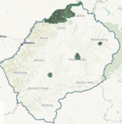
The final phase of #MapLesotho moves away from the tasking manager and aerial imagery and towards ground surveys instead, utilizing tools such as Mapillary, Field Papers and StreetComplete. This phase is envisaged to move more towards traditional surveying and mapping in the OSM context where an area is selected, surveyed in detail and mapped to a greater degree.
There is a series of guides outlining how to complete phase 4 mapping available from here.
Special Lesotho Content
This section provides those special features that are there in Lesotho and not found in other countries. The table below provides those features and their tagging names as they appear in JOSM.
| CLASSIFICATION | DESCRIPTION | TAGS | PICTURE | SATELLITE IMAGE |
|---|---|---|---|---|
| Khotla | A place where only men and boys spend their evenings close to the kraal (Lesaka) and women and girls are not allowed to stay.
For this area no existing tags. |
area=yes
female=no male=yes |
||
| Motebo | A small hut enclosed by a kraal in the cattle post areas used by shepherds as shelter and keeping their valuable materials. | building=hut
hut=motebo |
||
| Mophato | A place and normally a small hut in the mountains where circumcision takes place. | building=hut
hut=mophato access=private |
||
| Mokhoro | A round Basotho house constructed by stones and straw roofing. | building=hut
hut=mokhoro roof:material=thatch |
||
| Lipatlo | White zebra markings on the road allowing pedestrians to cross the street often includes a traffic calming hump. | traffic_calming=table | ||
| Spaza | Small shop constructed by using corrugated iron and sell informally. | building=shop
shop=convenience shop:convenience=spaza |
||
| Lesaka | An enclosure for domestic animals usually constructed by rocks. | barrier=wall |
Language
Lesotho has 2 official languages, Sotho (Sesotho or Southern Sotho) and English. It is also home to several other languages, including Phuthi, Xhosa and Zulu
Use the following language codes when naming features
- English - lang:en
- Sesotho - lang:st
- Phuthi - lang:ss
- Xhosa - lang:xh
- Zulu - lang:zu
Road Network
Tagging schema for mapping the Lesotho road network is being done in accordance with Highway_Tag_Africa
The Classification is divided according to Urban and Rural areas. Code relates to the Lesotho route reference.
| CLASSIFICATION | CODE | DESCRIPTION | URBAN | RURAL |
|---|---|---|---|---|
| Primary | A | The main artery connecting districts | Yes | Yes |
| Secondary | B | Shorter roads, normally paved, and connecting towns within districts | Yes | Yes |
| Tertiary | C | roads connecting villages from town centers | Yes | Yes |
| Residential | D | roads within a residential area, connected to tertiary roads | Yes | Yes |
| Unclassified | D | Roads connecting different Residential areas, they connect to Tertiary roads on the one end, and Residential roads on the other | Yes | Yes |
| Path | D | Paths not large enough for cars, normally unpaved and mainly for pedestrians, both inside and outside residential areas. | Yes | Yes |
| Track | D | The small roads going outside the residential areas, mainly for agricultural and forestry purposes. In general these roads do not have connecting function with other roads. | No | Yes |
Air
There are a total of 28 airports in Lesotho, of which 3 have paved runways.[2] The only international airport is the Moshoeshoe I International Airport in Mazenod, a short distance southeast from Maseru. The main runway of the Moshoeshoe Airport is the only one with a runway longer than 1,523 meters; it measures at 3,200 meters.
Of the other airports, one has a paved runway between 914 and 1,523 meters in length and one a paved runway with a length of under 914 meters. Four of the airports have unpaved runways of between 914 and 1,523 meters in length, and the others have unpaved runways of less than 914 meters.[2] All of the classifications are made by the length of the longest runway on an airport.
Useful Resources
As always, respect copyright & licences if they are applicable to any of the following
OSM Related
- OSMStats - Daily, weekly & monthly stats for qty of people editing, nodes added, deleted & modified
- New Mappers - Shows 2 day & 7 day markers for new people editing in the Lesotho area
External To OSM
- Since the beardies left is the activity after February 2016 when the three Irish OSM trainers left Lesotho.
- The MapLesotho blog is a narrative of words, sounds and pictures focussed primarily on the unfolding story of mapping in Lesotho. Secondary content is about the Planning issues in Lesotho.
- Websites such as [1] and [2] are often helpful for finding ICAO codes. IATA codes can be obtained from the official IATA database (search by → location name).
