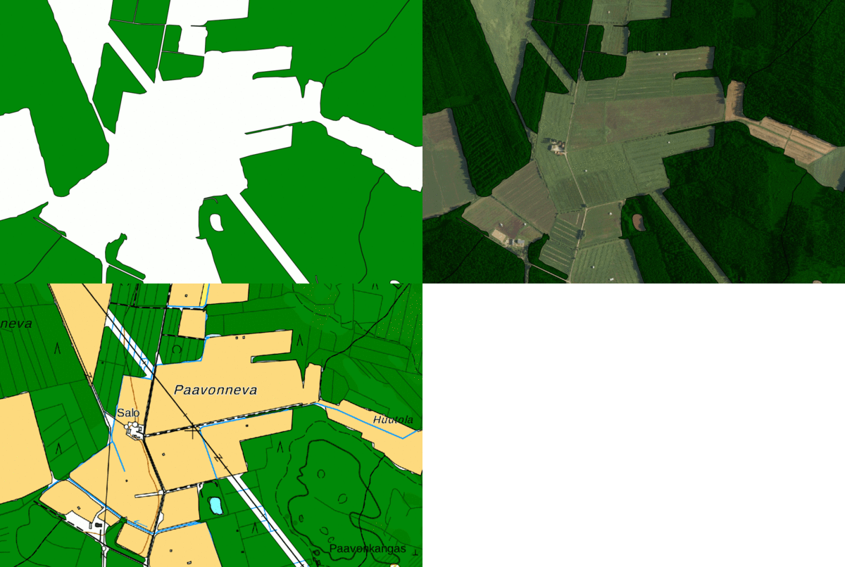
Finland Forest 2019 Creation
This page describe how Finland Forest coverage import was attempted.
Background information
Finnish Forest cover has been problematic since 2012 (or even earlier). Check more details from Finland Corine 2006 Import
Process description
Brief process workflow
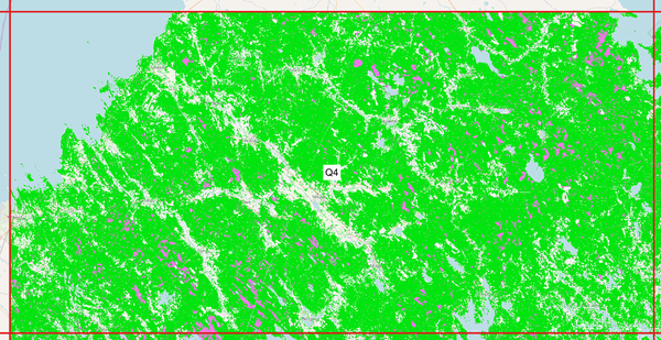
- Forest are created from LUKE's multi-source national forest inventory (MS-NFI) from 2015 (download service, license)
- Clip out OSM features from forest plots
- Clip out National Land Survey of Finland's Topographic Database features from forest plots
- Import forest plots to OSM
Data sources
All raw source data sets are openly licensed.
- Natural Resouce Institute Finland (LUKE)
- National Land Survey of Finland (MML)
Process workflow
Note: all processes are based on Finnish national map sheet grid. This is most convient way to handle Finnish GIS datasets, you download grid from NLS.FI's download service.
Load MS_NFI data to PostGIS
Loading of MS_NFI raster data to PostGIS is done with raster2pgsql -command. Basic command is:
raster2pgsql -s 3067 -t 100x100 -a tilavuus_vmi1x_1216_Q4.tif mvmi.tilavuus
Finnish coordinate system is EPSG:3067, we use "volume of growing stock" datasaset (Puuston tilavuus kuutioina (in Finnish)). LUKE is delivering data in 200k map sheets.
Raw source data has information about volume of forest in cubic meters, cell size is 16 x 16 meters.
Vectorize forestry data
Next step is to vectorize forestry data with PostGIS ST_DumpAsPolygons -function. Following SQL-pseudo-code also includes selection of data for 25k map sheets (for easier/faster processing):
CREATE TABLE q4233.forest_q4233 AS (
	WITH aoi AS (
	 SELECT geom, lehtitunnu
	 FROM nlsfi.utm25
	 WHERE lehtitunnu = upper('q4233')
	)

	SELECT val,geom
	FROM (
		SELECT (ST_DumpAsPolygons(a.rast)).*
		FROM mvmi.tilavuus a, aoi b
		WHERE ST_Intersects(a.rast, b.geom)
		) AS foo
	WHERE val > 3
);
Avoid sharp lines
To avoid sharp lines, we create circles around squares, with PostGIS function ST_MinimumBoundingCircle-function:
UPDATE q4233.forest_q4233
	SET geom_circle = ST_MinimumBoundingCircle(geom);
Clustering forests
Then we cluster forestry circles with ST_ClusterIntersecting -function:
...
clust AS (
 SELECT unnest(ST_ClusterIntersecting(geom_circle)) as geom
 FROM forest
...
Note: ST_ClusterIntersecting has limitations (PostgreSQL arrays size is limiting), so all process after this is made with 10k sheets (6 km x 6 km squares).
Smoothing borders
Next step will be smoothing borders with ST_ChaikinSmoothing -function:
CREATE TABLE q4233.forest_chs_q4233d AS (
  SELECT ST_MakeValid(ST_ChaikinSmoothing(ST_SimplifyPreserveTopology(geom,12),5)) as geom
  FROM q4233.forest_plot_q4233d
);
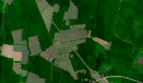
Comparing to existing OpenStreetMap features
This creation will not overwrite any existing natural or landuse tagged features. This migh be very conservative way to handle automatic mapping, but this is how I decide to handle situation.
Also highway -features are buffered with following buffered sizes (meters):
...
CASE
  WHEN highway = 'motorway' THEN 10
  WHEN highway = 'trunk' THEN 8
  WHEN highway = 'primary' THEN 8
  WHEN highway = 'secondary' THEN 7
  WHEN highway = 'tertiary' THEN 5
  WHEN highway = 'unclassified' THEN 4
  WHEN highway = 'service' THEN 4
  WHEN highway = 'residential' THEN 4
  WHEN highway = 'track' THEN 3
  WHEN highway = 'cycleway' THEN 2
  WHEN highway = 'footway' THEN 2
  WHEN highway = 'path' THEN 1
  ELSE 0.5
END
...
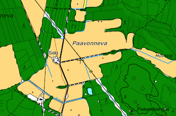
Comparing to National Land Survey of Finland's features
For preparing future and ongoing imports of NLS.FI's data sets, forestry plots are clipped also with NLS.FI topographic database features.
Area features
| NLS.fi name | in English | Notes |
|---|---|---|
| Maatalousmaa | Farmland | |
| Niitty | Meadow | |
| Virtavesialue | River (area) | |
| Järvi | Lake |
Line features
| NLS.fi name | in English | Notes |
|---|---|---|
| Sähkölinja | Electric lines | Class 22311 (high voltage) buffered with 20 meters
Class 22312 (low voltage) buffered with 5 meters |
| Tieviiva | Highways | Class 12111 buffered with 10 meters
Class 12112 buffered with 8 meters Class 12121 buffered with 6 meters Class 12122 buffered with 6 meters Class 12131 buffered with 3 meters Class 12132 buffered with 3 meters Class 12141 buffered with 2 meters Class 12313 buffered with 0,5 meters Class 12314 buffered with 1,5 meters Class 12316 buffered with 1,5 meters |
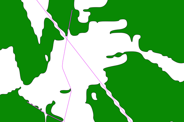
Finalisation of forest polygons
Forestry polygons are finally slighly simplifies with ST_SimplifyPreserveTopology:
UPDATE q4233.forest_final_q4233d
	SET geom = ST_Force2D(ST_SimplifyPreserveTopology(geom,1));
Also smallish polygons (less than 1000 m²) are deleted.
Preparation for loading to OpenStreetMap
Limit of OSM changeset is 10k elements. Separated PostGIS function has been developed to group forestry polygons to at maximum 9000 points / changeset.
ogr2osm.py has been used to create OSM import files.
Loading to OpenStreetMap
Modified version of bulk_upload.py has been used. Modification was mainly convert to use Python 3 ( orginal version of bulk_upload.py is Python 2 script).
Loading has been done with posiki_import_forest -account. Changeset has been named with 10K sheet names.
Sample area has been uploaded to OSM with two (2) changesets:
Problems
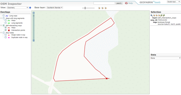
Self-intersecting forestry plots
Easiest way to detect self-intersecting forestry polygons is Geofabrik's OSM Inspector.
Solution
JOSM is easy tool to correct these kind of problems. Just download polygon to JOSM and delete one point. Sometimes self-intersections could be triggier to correct.
Disclaimer: in PostGIS this is valid polygon, but not in OpenStreetMap. This is how GeoWorld is different in differenent spaces ;-)
Removing forest plots
After feedback and discussion in OSM Forum, I have decided to remove all forestry imports which are done by me.
Method
All created forest plots (nodes, ways and relations) will be removed, unless other users has _not_ edited features.
Progress
Reverting of forests has been started on May 2021 and end November 2021
Misc notes
Feedback
Send by email to pos (at) iki.fi or via by OSM account (posiki_import_forest or posiki)
Disclaimer
This is not really import, but automatic creation of new features from open data sources. IMHO. I agree your disagree, if you disagree.
