Proposal:Payment centre
| Payment centre | |
|---|---|
| Proposal status: | Draft (under way) |
| Tagging: | amenity=payment_centre |
| Applies to: | node |
| Definition: | A non-bank place, where people can pay bills of public and private services and taxes. |
| Statistics: |
|
| Draft started: | 2016-02-24 |
Proposal
A payment centre is a non-bank place, where people can pay bills of public and private services and taxes. It is usually attended by a (human) teller.
Usually, a payment centre it's an exclusive place to provide this service of collecting, although it can also be inside a supermarket, kiosk, gas station, etc. It is composed of several boxes, operated by a human cashier, where people are arranged in rows and when is his turn pays cash for their services and taxes.
Rationale and examples
This tag is necessary because in many countries they are very popular among people to pay for their services. In Argentina, only one of the two large companies (Rapipago), has 3,000 branches. The other major player (Pago Fácil) handles roughly the same number of branches. Other smaller companies that handle 20% of the market remaining in the field. Which would give an estimate of about 7,000 POIs that would use this tag only in Argentina. ([1])
Other Latin American countries also have networks of payment centre. Chile (Servipag, Sencillito), Uruguay (RedPagos, Abitab) and Colombia (MovilRed, Via Baloto).
Tagging
The proposed tag is amenity=payment_centre, combined with brand=* or network=* (with "Rapipago", "Pago Fácil", "Cobro Express", or other values).
This tag is in replacement of the previous amenity=payment_center, which until now it was used (British English is preferred rather than American English).
Previously (even it remain in the present), many payment centre were erroneously labeled as Atm.
This tag, payment_centre, should not be confused with amenity=payment_terminal, which themselves are similar to ATM.
Applies to
It could be applied to nodes and areas (combined with building=commercial, for the case of an exclusive local)
Rendering
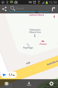
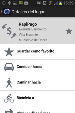
Magic Earth, an Android app shows an icon for payment centre that could be used in Mapnik.
Examples for Rapipago, Magic Earth app for Android:
Features/Pages affected
Move all "payment_center" (taginfo) to "payment_centre".
Comments
Please comment on the discussion page.


