Proposal:Banks
| banks | |
|---|---|
| Proposal status: | Abandoned (inactive) |
| Proposed by: | Sletuffe |
| Tagging: | natural=bank |
| Applies to: | ways |
| Definition: | For tagging banks of all sorts of water bodies (river, lake, pond, reservoir, ...) |
| Statistics: |
|
| Draft started: | |
| Proposed on: | 2012-09-13 |
Description
This tag describe the separation line between any water body tagged as a surface and land. Like waterway=riverbank it should mark the maximum extends of the water. But unlike waterway=riverbank this proposal is to tag linear only features (a bank is linear).
For oceans ands seas use natural=coastline instead.
Tagging
| Tag | Description |
|---|---|
| natural=bank | The natural bank of the water surface |
| optional bank=natural | for naturaly formed bank. |
| optional bank=man_made | when it was constructed by man (dam, floodbank, walls) |
| optional bank_of=lake bank_of=river bank_of=reservoir | Specify what type of water body this bank is (whatever is valid for water=* is valid for this one) |
| optional name=* | Name of this bank if it has a name |
Examples
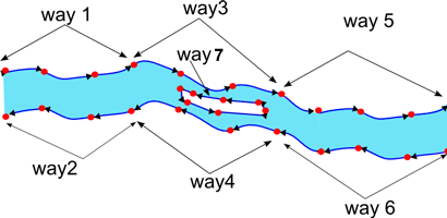
 In this example of a large river (created with a relation type=multipolygon+waterway=riverbank containing ways 1 to 7 ) with an island, way 1 to 7 can all have natural=bank
Why that and not just waterway=riverbank on the surface ?
waterway=riverbank is used to mark the area of a named river, but all borders of the river isn't always a bank (some people use it to tag rivers in several pieces of connected polygons, and the arbitrary junction isn't a bank) Also on confluence point of 2 rivers, the joining line if often marked as "riverbank" which it is not. This proposal aims at recording real banks.
It can be used without conflict with waterway=riverbank ( or natural=water if used on a relation) because those are used to tag area, while this proposal is for ways.
Use case exemple
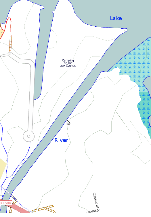
It's currently impossible (or very hard ?) to have such a rendering (ie a smooth junction between the river banks and the lake banks when you need special rendering for them) because there is nothing in the data to express the fact that the connection line between 2 bodies of water isn't a bank : 
problems to solve (or not)
- natural=bank + bank=man_made looks weird
- is it usefull at all to specify what water body this bank is of ?
- for a non-relation lake natural=water + natural=bank on the same way is not possible
