Zh-hant:Map Features
開放街圖呈現地表上的自然圖徵 (Feature)(例如:道路或建物,並利用標籤(tags)附加其基本的資料結構(例如:節點 (Node)![]() 、路徑 (way)
、路徑 (way)![]() 和關係 (Relation)
和關係 (Relation)![]() ),每一個標籤藉由特定的節點、路徑與關係描述圖徵的地理屬性。
),每一個標籤藉由特定的節點、路徑與關係描述圖徵的地理屬性。
開放街圖的自由標籤系統允許地圖納入無限個描述圖徵的屬性,開放街圖社群形成對特定鍵 (Key)與值 (Value)組合的共識作為標籤的正式標準。然而,使用者仍能新增新的標籤以改善地圖的風格或協助分析圖徵中過去未曾被繪製的屬性。圖徵頁面內展示關於特定主題或興趣的標籤簡易說明。
多數的圖徵能夠僅使用數個標籤標記,例如一條路徑能使用分類標籤highway=footway表示這條路徑是「步道」,也能添加名稱標籤 name=*。開放街圖是一個擴及全世界且包羅萬象的地圖,因此擁有不同的圖徵類型,幾乎全部的圖徵都以標籤進行標記。
更多關於標籤的詳情及修改現存標籤的倡議,請參考"提出圖徵" (Proposed Features)、 "不活躍的圖徵"(Inactive Features) 和 "棄用圖徵" (deprecated features)。 如果您無法在此列表中找到適合的標籤,請自由地創造出合適的標籤,只要標籤的值 (Value) 可被驗證。待一段時間後,您可能發現標籤被修改為符合多數共識的名稱,然而多數優良的標籤都是先被使用、後被編輯為條目。
主要圖徵
空中纜線 (Aerialway)
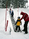
空中纜線中包含許多種型態的運輸人或貨物的纜線,包含纜車、纜椅、和滑雪拖曳,請閱讀Aerialway 以獲得更多資訊。
| 關鍵字(key) | 值 (value) | 幾何 (element) | 描述 (desc) | 地圖標註 (render) | 照片 (photo) | Taginfo |
|---|---|---|---|---|---|---|
| 種類 (Types) | ||||||
| aerialway | cable_car | 台灣的 |
| |||
| aerialway | gondola | 台灣的 |
| |||
| aerialway | chair_lift |
| ||||
| aerialway | mixed_lift |
| ||||
| aerialway | drag_lift | 這個標籤意謂著 oneway=yes (往上) 。 |
| |||
| aerialway | t-bar | 此標籤意謂著oneway=yes。 |
| |||
| aerialway | j-bar | 此標籤意謂著oneway=yes (往上)。 |
| |||
| aerialway | platter | 此標籤意謂著oneway=yes (往上)。 |
| |||
| aerialway | rope_tow | 此標籤意謂著oneway=yes。 |
| |||
| aerialway | magic_carpet | 此標籤意謂著oneway=yes (往上)。 |
| |||
| aerialway | zip_line | 此標籤意謂著 oneway=yes (往下)。 |
| |||
| 設備 (Equipments) | ||||||
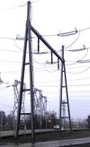
| aerialway | pylon |
| ||||
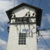
| aerialway | station | 纜車站,乘客進出上下纜車的地方。 | 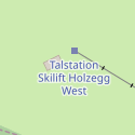
|
| ||
| 其他 (Others) | ||||||
| 現已廢止。請改用 aerialway=zip_line 。 此標籤意謂著 oneway=yes (往下)。 |
| |||||
| aerialway | goods | 有爭議。請考慮使用其他 aerialway=* 搭配foot=no 和/或 usage=*。 |
| |||
| aerialway | 使用者自訂 | 到Taginfo查詢常用標籤值 | ||||
This table is a wiki template with a default description in English. Editable here.
此表格由模版自動生成,協助改善中譯版本請按此。
航空施設 (Aeroway)
主要是與航空站、機場、及其它地面設施,以支援飛機和直升場起降操作,看Aeroway 的介紹。
| 關鍵字(key) | 值 (value) | 幾何 (element) | 描述 (desc) | 地圖標註 (render) | 照片 (photo) |
|---|---|---|---|---|---|
| aeroway | aerodrome | 機場,Aerodrome是英式英文,美式英式為airport。 | |||
| aeroway | airstrip | A field or area where light aircraft can land and take off from. | |||
| aeroway | apron | 停機坪,飛機停放地方。 | |||
| aeroway | control_center | ||||
| aeroway | fuel | Fuelling station for aircraft. | |||
| aeroway | gate | 登機門,在機場通常以編號來表示登機門。 | |||
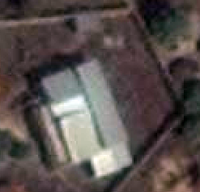
| aeroway | hangar | 機庫,停放飛機或直升機的建築。 | |||
| aeroway | helipad | 直升機起降平台。 | |||
| aeroway | heliport | 直升機場,通常包含一個或數個直升機起降平台。 | |||
| aeroway | highway_strip | ||||
| aeroway | holding_position | 停留點,飛機在跨越跑道時等待清空的地點。 | |||
| aeroway | jet_bridge | Passenger boarding bridge | |||
| aeroway | model_runway | Take-off and landing runway for model aircraft | |||
| aeroway | navigationaid | 供飛機使用的輔助視覺導航設施。 | |||
| airmark | beacon | ||||
| aeroway | parking_position | 停機點,飛機可以停放的地點。 | |||
| aeroway | runway | 起飛跑道,飛機用來起飛和降落的跑道。 | |||
| aeroway | stopway | Stopway is a rectangular surface beyond the end of a runway used during an aborted takeoff. | |||
| aeroway | taxilane | 滑行道路是機場內停機區與機棚的一部分,從2015年10月提案但使用數不多,請特別注意。 | |||
| aeroway | taxiway | 滑行道,連接起飛跑道和停機坪間的跑道。 | |||
| aeroway | terminal | ||||
| aeroway | tower | See also aeroway=control_tower or combination of man_made=tower + service=aircraft_control for similar schemes. |
|||
| aeroway | windsock | ||||
| aeroway | 使用者自訂 | 到Taginfo查詢常用標籤值 |
This table is a wiki template with a default description in English. Editable here. 此表格由模版自動生成,協助改善中譯版本請按此。
生活環境 (Amenity)
該標籤用於繪製供居民或遊客使用的設施,如廁所、電話、銀行、藥局、咖啡店、停車場、學校等,詳情參考Amenities 的介紹。
| 關鍵字(key) | 值 (value) | 元素 (element) | 敘述 (desc) | 圖例 (render) | 照片 (photo) | |
|---|---|---|---|---|---|---|
生活設施 | ||||||
| amenity | bar | 酒吧(販賣酒精飲料場所)。 amenity=pub;bar;restaurant 參考各類酒吧與餐廳的異同。 |
||||
| amenity | biergarten | 德語,英語為beer garden,指戶外提供啤酒、飲料與食物的開放場所。常附設酒館、酒吧或餐廳,以上得以 biergarten=yes與amenity=pub;bar;restaurant標註。 | ||||
| amenity | cafe | 咖啡店,亦提供簡餐與飲料。供餐種類得以標籤 cuisine=* 與 diet:*=*標註。詳情參考amenity=pub;bar;restaurant。 | ||||
| amenity | fast_food | 速食餐廳(詳情參考 amenity=restaurant)。供餐種類得以標籤 cuisine=* 和 diet:*=* 標註。 | ||||
| amenity | food_court | 美食街/美食廣場,附設各類餐廳的區域,常見於購物中心、百貨公司或機場。 | ||||
| amenity | ice_cream | 冰店。已停用shop=ice_cream | ||||
| amenity | pub | 酒館。與酒吧(bar)相較,酒館氣氛較為閒適,常供餐。酒館與酒吧的差異請參考amenity=bar 與 amenity=pub。 | ||||
| amenity | restaurant | 餐廳(不含速食,速食餐廳請參考amenity=fast_food)。菜式種類得以標籤 cuisine=* 與 diet:*=* 標註。 | ||||
教育設施 | ||||||
| amenity | college | 學院校地或建物。 | ||||
| amenity | dancing_school | A dancing school or dance studio | ||||
| amenity | driving_school | 駕駛訓練班(駕訓班)。 | ||||
| amenity | first_aid_school | A place where people can go for first aid courses. | ||||
| amenity | kindergarten | 幼稚園/托兒所,照顧與教導未達正規教育年齡孩童之場所。 | ||||
| amenity | language_school | 語言學校。 | ||||
| amenity | library | 公共圖書館(大學/公立) | ||||
| amenity | surf_school | A surf school is an establishment that teaches surfing. | ||||
| amenity | toy_library | 可以借遊戲或玩具的地方,或是在現場玩的地方。 | ||||
| amenity | research_institute | An establishment endowed for doing research. | ||||
| amenity | training | Public place where you can get training. | ||||
| amenity | music_school | 音樂學院/音樂學校。 | ||||
| amenity | school | 學校與其校地。 | ||||
| amenity | traffic_park | Juvenile traffic schools | ||||
| amenity | university | 大學校地。 | ||||
交通設施 | ||||||
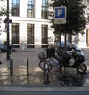
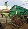
| amenity | bicycle_parking | 自行車停車場。 | ||||
| amenity | bicycle_repair_station | 自行車自助維修站。 | ||||
| amenity | bicycle_rental | 自行車租借站。提供出租自行車服務的店家或設施。 | ||||
| amenity | bicycle_wash | Clean a bicycle | ||||
| amenity | boat_rental | 船舶租借處。 | ||||
| amenity | boat_sharing | 船舶共乘處。 | ||||
| amenity | bus_station | 公車總站,已經改為用 public_transport=station。 | ||||
| amenity | car_rental | 汽車出租處。 | ||||
| amenity | car_sharing | 汽車共乘處。 | ||||
| amenity | car_wash | 洗車站。 | ||||
| amenity | compressed_air | A device to inflate tires/tyres (e.g. motorcar, bicycle) | ||||
| amenity | vehicle_inspection | 車輛監理機構驗車處/政府授權的民間驗車處。 | ||||
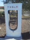
| amenity | charging_station | 電動車充電站。 | ||||
| amenity | driver_training | A place for driving training on a closed course | ||||
| amenity | ferry_terminal | 渡輪站/渡輪碼頭,渡輪停靠站可供人和車輛上船。 | ||||
| amenity | fuel | 加油站、加氣站、船舶加油站。由道路通往加油站的通道常使用 highway=service | ||||
| amenity | grit_bin | 儲存砂、砂鹽、砂礫的容器。 | ||||
| amenity | motorcycle_parking | 摩托車停車場。 | ||||
| amenity | parking | 停車場。沒有 access標籤的點(node)或面(area)將顯示停車場圖例。面(Area)顯示時以顏色區分。路邊停車位常使用 highway=service 與 service=parking_aisle | ||||
| amenity | parking_entrance | 進出地下或立體停車場的出入口。複合停車場出入口使用 type=site 與 site=parking 標籤。請勿混用 amenity=parking。 | Underground Multi-storey | |||
| amenity | parking_space | 單一停車格。複合停車格使用 type=site 與 site=parking 標籤,請勿混用 amenity=parking。 | ||||
| amenity | taxi | 計程車招呼站。 | ||||
| amenity | weighbridge | A large weight scale to weigh vehicles and goods | ||||
金融設施 | ||||||
| amenity | atm | 自動提款機。 | ||||
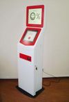
| amenity | payment_terminal | Self-service payment kiosk/terminal | ||||
| amenity | bank | 銀行。若銀行中設有自動提款機(ATM),建議加設點(node)標註每台ATM。 | ||||
| amenity | bureau_de_change | 外幣兌換處。bureau_de_change為英式英文,美式英文為currency exchange,提供各種貨幣交換與旅行支票兌換的地方。 | ||||
| amenity | money_transfer | A place that offers money transfers, especially cash to cash | ||||
| amenity | payment_centre | A non-bank place, where people can pay bills of public and private services and taxes. | ||||
醫療設施 | ||||||
| amenity | baby_hatch | 嬰兒收留所。供因為某些理由而無法繼續養育嬰兒(通常是新生兒)的家長得匿名將嬰兒收留於此,由特定人士收養。 | ||||
| amenity | clinic | 診所(中型規模的醫療設施或健康中心)。 | ||||
| amenity | dentist | 牙科診所,牙醫執業和進行牙科手術之處。 | ||||
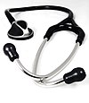
| amenity | doctors | 診所(單名醫生執業或進行手術)。 | ||||
| amenity | hospital | 醫院,常同時以 emergency=* 標籤辨別是否設有急救設備。 | ||||
| amenity | nursing_home | 安養院/老人院(供失能或年老者長期看護)。參見 emergency=*。 | ||||
| amenity | pharmacy | 藥局/藥房。 dispensing=yes (得購買處方藥) dispensing=no/omitted (配有藥劑師,僅得購買指示藥。) |
||||
| amenity | social_facility | 提供社會服務的設施。 | ||||
| amenity | veterinary | 獸醫。 | ||||
娛樂、藝術與文化設施 | ||||||
| amenity | arts_centre | 藝術中心。 | ||||
| amenity | brothel | 妓院。 | ||||
| amenity | casino | 賭場。提供多種賭博類型的賭桌,如輪盤、21點、體育賽事賭注或其他具有賠率的賭博活動。 | ||||
| amenity | cinema | 電影院。美式英文為movie theater。 | ||||
| amenity | community_centre | 社區中心,供舉辦地方活動或節慶。 | ||||
| amenity | conference_centre | 舉行會議的大型建築。 | ||||
| amenity | events_venue | 舉行活動的建築或場地。A | ||||
| amenity | exhibition_centre | An exhibition centre | ||||
| amenity | fountain | 噴泉(文化/裝飾/休閒目的)。 | ||||
| amenity | gambling | 賭博電玩店(含賓果機、柏青哥機台等)。此標籤不等同於:書商 shop=bookmaker、投注站 shop=lottery、賭場 amenity=casino 或成人遊戲中心 leisure=adult_gaming_centre。 | ||||
| amenity | love_hotel | 愛情旅館是供短時間使用,讓客人能隱密地進行性活動。 | ||||
| amenity | music_venue | An indoor place to hear contemporary live music. | ||||
| amenity | nightclub | 夜店/夜總會。供飲酒或跳舞。 | ||||
| amenity | planetarium | 天文館。 | ||||
| amenity | public_bookcase | 開放書架/漂書站。置於街頭收藏書籍的書櫃,得自由取放書籍。 | ||||
| amenity | social_centre | 舉辨免費或非營利活動的場所。 | ||||
| amenity | stage | 舉辨免費或非營利活動的場所。 | ||||
| amenity | stripclub | 脫衣舞店。(提供性服務使用 amenity=brothel) |
||||
| amenity | studio | 工作室/錄音室(電視/
廣播/錄音)。 |
||||
| amenity | swingerclub | 德語的sex club。 | ||||
| amenity | theatre | 歌劇院/戲院。電影院使用 amenity=cinema。 | ||||
公共設施 | ||||||
| amenity | courthouse | 法院 | ||||
| amenity | fire_station | 消防局 | ||||
| amenity | police | 警察局、派出所 | ||||
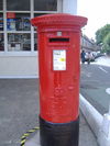
| amenity | post_box | 郵筒 | ||||
| amenity | post_depot | 郵件處理中心或是快遞中心,提供郵件或是包裹在送件前收集與整理的地方。 | ||||
| amenity | post_office | 郵局 | ||||
| amenity | prison | 監獄 | ||||
| amenity | ranger_station | 國家公園遊客中心/管理站 | ||||
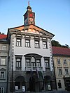
| amenity | townhall | 市政廳、地方政府(鄉、鎮、市)公所/辦公大樓或社區中心 | ||||
Facilities | ||||||
| amenity | bbq | 烤肉店/燒烤店,常見於戶外公共場所。使用標籤fuel=*說明火源的燃料種類,如 fuel=wood;electric;charcoal。標註桌椅使用標籤tourism=picnic_site。標註戶外營火請改用 leisure=firepit。 | ||||
| amenity | bench | 長椅。供乘坐或休息。 | ||||
| amenity | dog_toilet | 犬隻廁所,提供犬隻排尿與大便的區域。 | ||||
| amenity | dressing_room | Area designated for changing clothes. | ||||
| amenity | drinking_water | 飲水處/取水處。 | ||||
| amenity | give_box | 惜物站,小的設施提供人們免費捐出來或是拾獲各種不同物品,供再利用的地方。 | ||||
| amenity | mailroom | A mailroom for receiving packages or letters. | ||||
| amenity | parcel_locker | Machine for picking up and sending parcels | ||||
| amenity | shelter | 涼亭。涼亭的種類請使用 shelter_type=* 標籤標註 | ||||
| amenity | shower | 公共淋浴間、公共澡堂 | ||||
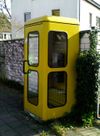
| amenity | telephone | 公共電話亭 | ||||
| amenity | toilets | 公共廁所(可能需付費) | ||||
| amenity | water_point | 加水站/飲水機 | ||||
| amenity | watering_place | 動物飲水槽/儲水槽,非供人飲水使用。供人飲水處請使用amenity=drinking_water。 | ||||
Waste Management | ||||||
| amenity | sanitary_dump_station | 露營車、公車、船舶等廢水回收站
A station to empty the blackwater tanks of motorhomes, buses and ships |
||||
| amenity | recycling | 資源回收站/場。應加註recycling_type=container(資源回收站)或recycling_type=centre(資源回收場/中心)。 | ||||
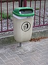
| amenity | waste_basket | 垃圾筒 | ||||
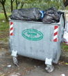
| amenity | waste_disposal | 垃圾/資源回收收集站/子母車 | ||||
| amenity | waste_transfer_station | 垃圾轉運站 | ||||
其他設施 | ||||||
| amenity | animal_boarding | 寵物旅館/寄託站。供寵物收留的付費服務。 | ||||
| amenity | animal_breeding | 繁殖場,為繁殖寵物的地方,通常是養來賣的。 | ||||
| amenity | animal_shelter | 供瀕危動物收留的籠子或園區 | ||||
| amenity | animal_training | A facility used for non-competitive animal training | ||||
| amenity | baking_oven | 烘焙用窯爐,通常位於 building=bakehouse之中。 | ||||
| amenity | clock | 時鐘 | ||||
| amenity | crematorium | 火葬場/殯儀館 | ||||
| amenity | dive_centre | 潛水中心。提供潛水員潛水或進行潛水教學的場所。 | ||||
| amenity | funeral_hall | 舉行喪葬儀式但不是宗教場所的地方。 | ||||
| amenity | grave_yard | 小型墓園。大型墳場應使用 landuse=cemetery。 | ||||
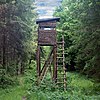
| amenity | hunting_stand | 狩獵用暸望台。 | ||||
| amenity | internet_cafe | 網路咖啡廳(網咖)。提供個人網路瀏覽服務。 | ||||
| amenity | kitchen | 設施內供任何人或顧客使用的公共廚房 | ||||
| amenity | kneipp_water_cure | 戶外泡腳池。除冷泉池外,台灣多見熱水 (溫泉) 泡腳池。流行於德語國家的泡腳池常配有扶手。 | ||||
| amenity | lounger | 提供人躺下來的物件。 | ||||
| amenity | marketplace | 市場/市集。 | ||||
| amenity | monastery | 修道院是修道院或是修士、修女生活的地方。 | ||||
| amenity | mortuary | A morgue or funeral home, used for the storage of human corpses. | ||||
| amenity | photo_booth | 快速照相站。 | ||||
| amenity | place_of_mourning | 瞻仰廳,提供家庭、朋友在喪禮前,能夠檢視死亡人員屍體的房間或建築。 | ||||
| amenity | place_of_worship | 宗教場所,如教堂、清真寺或寺廟等。建議同時標注religion=*(所屬宗教)、denomination=*(宗派)、 name=* 與amenity=place_of_worship。 詳細參考place_of_worship=*。 |
||||
| amenity | public_bath | 公共澡堂,例如日本湯屋、土耳其浴場、溫泉澡堂。 | ||||
| 公共建物,已停用。請改用office=government | ||||||
| amenity | refugee_site | 提供難民或是國內流離失所人的人類聚集地。 | ||||
| amenity | vending_machine | 自動販賣機。商品種類使用 vending=* | ||||
| amenity | 使用者自訂 | 到Taginfo查詢常用標籤值 | ||||
This table is a wiki template with a default description in English. Editable here. 此表格由模版自動生成,協助改善中譯版本請按此。
屏障物 (Barrier)
用來描述線性障礙物及其上的點狀出入口,詳請請見Barriers。
| 關鍵字(key) | 值 (value) | 幾何 (element) | 描述 (desc) | 地圖標註 (render) | 照片 (photo) | |
|---|---|---|---|---|---|---|
線形障礙物(Linear barriers) | ||||||
| barrier | cable_barrier | 又稱為鋼索護欄。 這是一個在路肩或中央分隔島用鋼絲繩製成的薄弱防護。 參考更多維基百科的介紹。 | ||||
| barrier | city_wall | 城牆,為城堡建築用來抵禦可能的入侵者,從過去到現在,城牆都是用來圍住聚落。 | ||||
| barrier | ditch | 為一溝道,渠道,或溝壑,通常在底部有水流,用腳不容易跨過。 可以和 waterway=stream 或 waterway=drain一起使用。 |
||||
| barrier | fence | 籬笆,為一獨立之構造物用來限制或預防跨過界線,這一般而言較為輕便不像圍牆的構造。 | ||||
| barrier | guard_rail | 鋼板護欄,也稱為防撞護欄。左駕放置於外側,反之亦然。 | ||||
| barrier | handrail | 扶手。設計給手部抓握,提供使用者支撐及穩定動作。 | ||||
| barrier | hedge | 圍籬,是一個圍住一個地區的灌木叢,這個灌木被種成線狀的阻礙物成為一個區域的界線。 | ||||
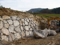
| barrier | retaining_wall | 擋土牆用來抵擋土層的側向壓力。 | ||||
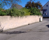
| barrier | wall | 牆,為一獨立之構造物設計用來用來限制或預防跨過界線的磚造物,堅硬的岩石且可以阻擋視線。 | ||||
點狀障礙物 (Node barriers) | ||||||
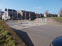
| barrier | block | 擋石,為一大型、堅固且不能移動的阻擋設施,只能用重型機械移動。 通常是大的水泥塊來阻擋車輛通行,一些狀況下有時也會用自然的大石塊。 |
||||
| barrier | bollard | 短柱,堅固(通常是水泥或金屬)的柱子,將這些柱子設在路中央來防止車輛跨越。 | ||||
| barrier | border_control | 邊界管制哨,是一個二個國家邊界間的控制點,通常會確認證明身份的證件,如護照。 | ||||
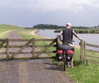
| barrier | bump_gate | 裝有活動車輪的柵欄,能防止牲畜通過但駕駛不必下車。 | ||||
| barrier | bus_trap | 一種防止自小客車通過,但巴士能通過的陷阱。 | ||||
| barrier | cattle_grid | 攔畜溝柵。設置在路面上的條狀物可讓有輪的車輛過行但動物則無法跨越 如 Texas Gate。 |
||||
| barrier | coupure | A cut through a flood protection feature (e.g., (flood)wall, levee, or dyke) for a road or railway, that is readily made flood tight if required. | ||||
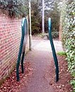
| barrier | cycle_barrier | 自行車柵欄。通常用直角的鋼管條交錯且有間隔讓行人可通過。 | ||||
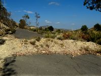
| barrier | debris | 碎石組成的道路障礙。 | ||||
| barrier | entrance | 在線狀障礙物中的開口,為限制通行的非特定設施,access=yes 是讓人了解這是一個可以穿越的標籤。 | ||||
| barrier | full-height_turnstile | 全高式十字轉門。 | ||||
| barrier | gate | 大門。可以被開啟或關閉的穿越障礙的通道 適合和access=*一起使用。 |
||||
| barrier | hampshire_gate | 鐵絲網中一段可以被暫時移除的區塊。 根據情況併用 access=* 。 | ||||
| barrier | height_restrictor | 高度限制門。與限制高度的標籤 maxheight=* 一起使用。 | ||||
| barrier | horse_stile | 馬梯磴,是可以讓馬或行人跨越圍籬,但讓摩托車很難通行,牲畜無法通過。 | ||||
| barrier | kent_carriage_gap | 肯特馬車間隙(Kent carriage gap),是英國地方治理單位用來防止車輛進入但可以讓馬車通行, 現在成為英國鄉間小道的常見的設施 |
[1] | |||
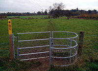
| barrier | kissing_gate | 一個閘口可以讓人通過但牲畜不能。 | ||||
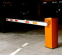
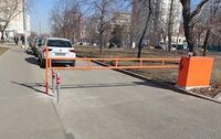
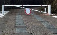
| barrier | lift_gate | 起降桿閘門,是用一個橫桿來控制進出,當橫桿升起為垂直時,可以通行,當橫桿放下為水平時,禁止通行, 在適當時候,應與access=* 一起使用。 |
||||
| barrier | motorcycle_barrier | 防止機車通過的車阻。 | ||||
| barrier | planter | A plant box, or simply a planter, is a structure containing plants for decoration, which (in this context) has the primary purpose of preventing large vehicles from passing. | ||||
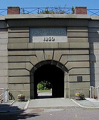
| barrier | sally_port | 突破口sally_port,碉堡的出入口、有哨戒的大門。用以通過厚牆或城牆進入碉堡,通常設二道門增加防禦性。 | ||||
| barrier | sliding_beam | Something between barrier=sliding_gate and barrier=lift_gate: it has a quite thin bar like in lift gate, but the bar slides aside to allow through. | ||||
| barrier | sliding_gate | Gates open sideways; usually automatic.
Combine with access=* where appropriate. |
||||
| barrier | spikes | 活動拒馬,通常可被輕易的移除。 | ||||
| barrier | stile | 梯磴,是可以讓馬或行人跨越圍籬,但不是真正「開放」的障譺,(和閘門不一樣,梯磴有少許或沒有移動的部份)。 | ||||
| barrier | sump_buster | 同barrier=bus_trap。 | ||||
| barrier | swing_gate | 類似起降桿閘門,但是以橫向旋轉。可以阻擋車子,但行人和腳踏車容易通過。 | ||||
| barrier | toll_booth | 收費站,道路上用來收費的地方。 | ||||
| barrier | turnstile | 十字轉門 (或稱 baffle gate),是用來允許每次由一個人通過。 | ||||
| barrier | wedge | A wedge-shaped barrier that rises out of the ground to block traffic. | ||||
| barrier | wicket_gate | A wicket gate, or simply a wicket, is a pedestrian door or gate, particularly one built into a larger door or into a wall or fence. | ||||
| barrier | yes | 無法確認護欄種類時,使用barrier=yes,例如使用照航拍圖影像作圖時。 | ||||
Linear barriers or access control on highways (e.g., along or for blocking a path or road) | ||||||
| 關鍵字(key) | 值 (value) | 幾何 (element) | 描述 (desc) | Photo for along | 地圖標註 (render) | 照片 (photo) |
| barrier | bar | A fixed horizontal bar which blocks motor vehicles but can usually be bypassed on foot or bike. Often placed at trailheads. | ||||
| barrier | barrier_board | A barrier board to restrict the passage of a way or to block off an area. | ||||
| barrier | bollard | 短柱,堅固(通常是水泥或金屬)的柱子,將這些柱子設在路中央來防止車輛跨越。 | ||||
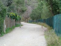
| barrier | chain | 用一條鎖鍊來防止車輛通行。 | ||||
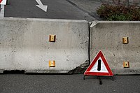
| barrier | jersey_barrier | 紐澤西護欄。 | ||||
| barrier | kerb | Kerb 意指道路邊的緣石,用來區分車輛和人行道的界線。緣石的高度可用height來標示。 | ||||
| barrier | log | 由木頭組成的道路障礙,但是登山車能輕易的通過。 | ||||
| barrier | rope | 由纖維或塑膠組成的圍籬,通常是用來阻止行人進入。 | ||||
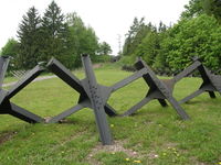
| barrier | tank_trap | 置於定點的反坦克拒馬,例如: |
||||
| barrier | tyres | A crash barrier made from tyres stacked on top of each other, commonly found at motor racing circuits. | ||||
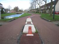
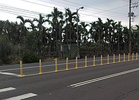
| barrier | delineators | A barrier made of plastic/rubber posts, common on one-way two-lane roads where overtaking is prohibited, or on busy roads to prevent forbidden turns or parking along the curb. | ||||
| barrier | user defined | All commonly used values according to Taginfo | ||||
This table is a wiki template with a default description in English. Editable here. 此表格由模版自動生成,協助改善中譯版本請按此。
邊界線 (Boundary)
用來描述行政界線及其它邊界,詳情請見Boundary。
台灣的部份可參閱 Tag:boundary_administrative。
| 關鍵字(key) | 值 (value) | 幾何 (element) | 描述 (desc) | 地圖標註 (render) | 照片 (photo) | |
|---|---|---|---|---|---|---|
Boundary types | ||||||
| boundary | aboriginal_lands | A boundary representing official reservation boundaries of recognized aboriginal / indigenous / native peoples. | ||||
| boundary | administrative | 行政界線,各級地方政府所管轄之區域,搭配使用admin_level=* | ||||
| boundary | border_zone | A border zone is an area near the border where special restrictions on movement apply. Usually a permit is required for visiting. | ||||
| boundary | A census-designated boundary delineating a statistical area, not necessarily observable on the ground. | |||||
| boundary | forest | A delimited forest is a land which is predominantly wooded and which is, for this reason, given defined boundaries. It may cover different tree stands, non-wooded areas, highways… but all the area within the boundaries are considered and managed as a single forest. | ||||
| boundary | forest_compartment | A forest compartment is a numbered sub-division within a delimited forest, physically materialized with visible, typically cleared, boundaries. | ||||
| boundary | hazard | A designated hazardous area, with a potential source of damage to health, life, property, or any other interest of value. | ||||
| boundary | health | Health division boundaries. Some mappers use health_level=* instead of admin_level=* to specify level in the health system hierarchy. | ||||
| boundary | historic | 非現行、已成歷史的行政邊界。 | ||||
| boundary | local_authority | Describes the territory of a local authority. | ||||
| boundary | low_emission_zone | A geographically defined area which seeks to restrict or deter access by certain polluting vehicles with the aim of improving the air quality. | ||||
| boundary | maritime | 海事邊界。 | ||||
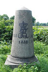
| boundary | marker | A boundary marker, border marker, boundary stone, or border stone is a robust physical marker that identifies the start of a land boundary or the change in a boundary, especially a change in direction of a boundary. See also historic=boundary_stone | ||||
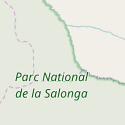
| boundary | national_park | 國家公園邊界。 | ||||
| boundary | place | boundary=place is commonly used to map the boundaries of a place=*, when these boundaries can be defined but these are not administrative boundaries. | ||||
| boundary | political | 選區,選舉的邊界。 | ||||
| boundary | postal_code | 郵遞區號邊界。 | ||||
| boundary | protected_area | 保護區,如為了國家公園,水源,或原住民保留地。 | ||||
| boundary | religious_administration | 宗教上的區域劃分,如教區、堂區等。請見Talk:Key:boundary#Religious authority boundaries。 | ||||
| boundary | special_economic_zone | A government-defined area in which business and trade laws are different. | ||||
| boundary | [[ Too many Data Items entities accessed. | statistical ]] | An official boundary recognised by government for statistical purposes. | ||||
| boundary | disputed | An area of landed claimed by two or more parties (use with caution). See also Disputed territories. | ||||
| boundary | timezone | Boundaries of time zone | ||||
| boundary | 使用者自訂 | 到Taginfo查詢常用標籤值 | ||||
屬性 (Attributes) | ||||||
| admin_level | (number) | 應用於 boundary=administrative,除了德國會用到11之外,通常範圍為1到10。 | ||||
| health_level | (number) | Used by some mappers instead of admin_level=* in conjunction with boundary=health and is usually in the range 1 to 10. | ||||
| postal_code_level | (number) | Used by some mappers instead of admin_level=* in conjunction with boundary=postal_code and is usually in the range 1 to 10. | ||||
| [[ Data item not found. Check your spelling. | religious_level ]] | (number) | Used by some mappers instead of admin_level=* in conjunction with boundary=religious_administration and is usually in the range 1 to 10. | ||||
| border_type | * | 用來區分同一種邊界的類別,或設定某一種邊界,例如,在海事邊界中可以有不同類別boundary=maritime,如同admin_level=*用在boundary=administrative,border_type=*的使用可以相當廣泛,可參考該標籤的完成描述。 | ||||
| start_date | (date) | Useful if the boundary is very recent (or if it will become effective in a near future). | ||||
This table is a wiki template with a default description in English. Editable here. 此表格由模版自動生成,協助改善中譯版本請按此。
建築物類別 (Building typology)
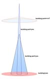
這個標籤用以標示個別的建築物或是一群相連得建築物。請詳閱 Buildings 條目,以獲得更多細節,請閱讀man_made=* 用以標注其他構造。
| 關鍵字(key) | 值 (value) | 描述 (desc) | 照片 (photo) | |||
|---|---|---|---|---|---|---|
住宿 (Accommodation) | ||||||
| building | apartments | 公寓或大廈。分割為個別的住所的建築物。通常每層樓為不同戶。有時一樓會有零售商店店面。 | ||||
| building | barracks | Buildings built to house military personnel or laborers. | ||||
| building | bungalow | 別墅、度假小屋。一層樓的獨棟房屋,例如俄國的 |
||||
| building | cabin | 小木屋 是小型粗造的房屋。通常外表是木造的,通常位於鄉村地區。 | ||||
| building | detached | 透天厝在美國稱做 single-family home,加拿大稱為single-detached dwelling,紐西蘭稱為 separate house。由單一住戶所居住,會共用廚房等的設施。 | ||||
| building | dormitory | 宿舍。指共用的的住宅,如同大學供學生住的那般 (不一定是多人房)。若為大學宿舍,另外一種標籤方式為 building=residential+ residential=university。 | ||||
| building | farm | 農舍專指農場內的住宅。其他農業相關建築物參見 building=farm_auxiliary、building=barn。如果農舍外觀與一般住宅相仿,不妨標註為 building=house。另請閱讀 landuse=farmyard。 | ||||
| building | ger | A permanent or seasonal round yurt or ger. | ||||
| building | hotel | 旅館、旅社。分割為很多獨立房間供人過夜住宿的建築物。通常會另外用 tourism=hotel 表示旅館用地,涵蓋休閒區和停車。 | ||||
| building | house | 住宅。由單一住戶所居住的建築物 (單一住戶可以指一個家庭或一個小團體,會共用廚房等的設施)。建築的形式可能是獨棟、相互獨立的對半或是連排房子中的一個。建築物相連之處應該要和隔壁住戶有至少兩個共用的點 (nodes)作為 |
||||
| building | houseboat | 船屋。以住家為主要用途的船隻。 | ||||
| building | residential | 住宅。泛指以居住為主要用途的建築物。如果可以的話,建議選擇 building=apartments、building=terrace、building=house或building=detached,這類更精確的標籤。 | ||||
| building | semidetached_house | A residential house that shares a common wall with another on one side. Typically called a "duplex" in American English. | ||||
| building | static_caravan | |||||
| building | stilt_house | A building raised on piles over the surface of the soil or a body of water | ||||
| building | terrace | 排屋。一排住宅共用一個單一通道,通常每戶又有他們專屬的入口。北美稱為 row-house。可以考慮將個別住戶標注為 building=house。 | ||||
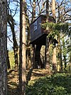
| building | tree_house | An accommodation, often designed as a small hut, sometimes also as a room or small apartment. Built on tree posts or on a natural tree. A tree house has no contact with the ground. Access via ladders, stairs or bridgeways. | ||||
| building | trullo | A stone hut with a conical roof. | ||||
商業 (Commercial) | ||||||
| building | commercial | 進行商業活動的建築物,商業活動類別沒有特別限制。若為辦公室請加上office=*。可以把整個商業區用landuse=commercial標註。若該建築物以商店為主,請改用 building=retail。 | ||||
| building | industrial | 工廠。進行工業生產的建築物。若該建築物的主要用途是儲存和派送物品,請以building=warehouse標註。可以把整個工業區用landuse=industrial + industrial=* 形容它的工業用途。 | ||||
| building | kiosk | 小賣店,提供零售服務的小型建築物 | ||||
| building | office | 請改用building=commercial+ office=*描述辦公室。可以把整個商業區用landuse=commercial標註。若該建築物以商店為主,請改用 building=retail。 | ||||
| building | retail | 零售商店。主要用途是對一般大眾販售商品,加上shop=*用以標註販售的物品種類。可以把周遭區域都標註landuse=retail。 | ||||
| building | supermarket | A building constructed to house a self-service large-area store. | ||||
| building | warehouse | 倉庫。主要用途是儲存物品或商品,或做為派送系統的一員。 | ||||
Religious | ||||||
| building | religious | Unspecific building related to religion. Prefer more specific values if possible. | ||||
| building | cathedral | |||||
| building | chapel | |||||
| building | church | |||||
| building | kingdom_hall | A building that was built as a |
||||
| building | monastery | A building constructed as |
||||
| building | mosque | |||||
| building | presbytery | A building where priests live and work. | ||||
| building | shrine | 神社或神龕。請搭配 amenity=place_of_worship、religion=*以及denomination=*做更詳盡的描述。可以用 landuse=religious 標示週遭的附屬土地。對於比較小的建築物,小到無法容納一個人,建議使用 historic=wayside_shrine。 | ||||
| building | synagogue | |||||
| building | temple | 神殿、廟宇或寺廟。請搭配 amenity=place_of_worship、religion=*以及denomination=*做更詳盡的描述。可以用 landuse=religious 標示週遭的附屬土地。 | ||||
公共設施 (Civic / Amenity) | ||||||
| building | bakehouse | A building that was built as a bakehouse (i.e. for baking bread). Often used in conjunction with another node amenity=baking_oven and oven=wood_fired. | ||||
| building | bridge | 以橋為主要用途的建築物。也可用來表示開合橋的門房。另外也請閱讀 highway=* + bridge=yes。 請不要用這個標籤標示橋樑的輪廓。請改用 man_made=bridge。 | ||||
| building | civic | 公共設施,例如amenity=community_centre、amenity=library、amenity=toilets、leisure=sports_centre、leisure=swimming_pool或amenity=townhall等等。可加上amenity=*或leisure=*做更精確的描述。也請參閱 building=public。 | ||||
| building | college | A college building. Use amenity=college on the whole college area to represent the college as an institution. | ||||
| building | fire_station | A building constructed as fire station, i.e. to house fire fighting equipment and officers, regardless of current use. Add amenity=fire_station on the grounds for an active fire station. | ||||
| building | government | For government buildings in general, including municipal, provincial and divisional secretaries, government agencies and departments, town halls, (regional) parliaments and court houses. | ||||
| building | gatehouse | An entry control point building, spanning over a highway that enters a city or compound. | ||||
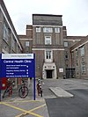
| building | hospital | 醫院內的建物。請用amenity=hospital標示整個醫院用地。 | ||||
| building | kindergarten | For any generic kindergarten buildings. Buildings for specific uses (sports halls etc.) should be tagged for their purpose. If there is currently a kindergarten in the building, use amenity=kindergarten on the perimeter of the kindergarten grounds. | ||||
| building | museum | A building which was designed as a museum. | ||||
| building | public | 公共建築。 請不要再使用 |
||||
| building | school | 校舍。指學校內一般用途的建築物。但若是有特定用途的建築物 (例如體育館),則建議標示為該用途的標籤。請用 amenity=school 標注整個學校用地。 | ||||
| building | toilets | A toilet block. | ||||
| building | train_station | 以鐵道車站、火車站為用途的建築物。 | ||||
| building | transportation | 泛指與大眾運輸、公共運輸相關的建築物。你也可能會想要加上其他標籤做更適當的描述,例如 public_transport=station。請注意火車站已經有特定的標籤 building=train_station。 | ||||
| building | university | 大學的建築物。請用 amenity=university 標注整個大學用地。 | ||||
Agricultural/plant production | ||||||
| building | barn | 穀倉。農業建築物,通常用來儲存物品或作為作為有覆蓋的工作場所。 | ||||
| building | conservatory | A building or room having glass or tarpaulin roofing and walls used as an indoor garden or a sunroom (winter garden). | ||||
| building | cowshed | 牛舍。養牛的建築物,通常在農場裡。 | ||||
| building | farm_auxiliary | 農業設施,農場內非供居住的建築物 (請改用 building=farm或是building=house來標示農舍)。 | ||||
| building | greenhouse | |||||
| building | slurry_tank | A circular building built to hold a liquid mix of primarily animal excreta (also known as slurry). | ||||
| building | stable | 馬廄,養馬的建築物。 | ||||
| building | sty | |||||
| building | livestock | A building for housing/rising other livestock (apart from cows, horses or pigs covered above), or when the livestock changes. | ||||
Sports | ||||||
| building | grandstand | The main stand, usually roofed, commanding the best view for spectators at racecourses or sports grounds. | ||||
| building | pavilion | A sports pavilion usually with changing rooms, storage areas and possibly an space for functions & events. Avoid using this term for other structures called pavilions by architects (see |
||||
| building | riding_hall | A building that was built as a riding hall. | ||||
| building | sports_hall | A building that was built as a sports hall. | ||||
| building | sports_centre | A building that was built as a sports centre. | ||||
| building | stadium | 以體育館、運動館為用途的建築物。 | ||||
Storage | ||||||
| building | allotment_house | A small outbuilding for short visits in a allotment garden. | ||||
| building | boathouse | A boathouse is a building used for the storage of boats. | ||||
| building | hangar | |||||
| building | hut | |||||
| building | shed | |||||
Cars | ||||||
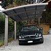
| building | carport | A carport is a covered structure used to offer limited protection to vehicles, primarily cars, from the elements. Unlike most structures a carport does not have four walls, and usually has one or two. | ||||
| building | garage | |||||
| building | garages | 公共車庫。由許多不同住戶所擁有的儲存空間所組成的建築。也請參考 building=garage。 | ||||
| building | parking | Structure purpose-built for parking cars. | ||||
Power/technical buildings | ||||||
| building | digester | 沼氣槽、分解槽。為一種將生物質透過生物反應器轉化為生物氣體的設施。 | ||||
| building | service | 機房,通常設施建築物是小型無人建築物,存放機器(如泵或變電設施) | ||||
| building | tech_cab | Small prefabricated cabin structures for the air-conditioned accommodation of different technology. | ||||
| building | transformer_tower | 變壓塔。通常是高塔,並包含一個變壓配電器,連接中電壓的供應電網。供應電網的線路常常已經地下化了,但這類的建築物還是常常作為變電所。如果該建築也同時有變電所的功能,應該標示為 power=substation + substation=minor_distribution。 | ||||
| building | water_tower | A water tower. | ||||
| building | storage_tank | Storage tanks are containers that hold liquids | ||||
| building | silo | A silo is a building for storing bulk materials | ||||
其他 (Other) | ||||||
| building | beach_hut | A small, usually wooden, and often brightly coloured cabin or shelter above the high tide mark on popular bathing beaches. | ||||
| building | bunker | 碉堡、掩體。強化的軍事建築物。也可用 military=bunker標示。 | ||||
| building | castle | A building constructed as a castle. Can be further specified with historic=castle + castle_type=*. | ||||
| building | construction | 建造中的建築物。請使用 construction=* 標註該建築物完工後的用途。 | ||||
| building | container | For a container used as a permanent building. Do not map containers placed temporarily, for example used in shipping or construction. | ||||
| building | guardhouse | A small building constructed to house guard(s). | ||||
| building | military | A military building. Also use military=*. | ||||
| building | outbuilding | A less important building near to and on the same piece of land as a larger building. | ||||
| building | pagoda | A building constructed as a pagoda. | ||||
| building | quonset_hut | A lightweight prefabricated structure in the shape of a semicircle. | ||||
| building | roof | 棚架,僅含屋頂而沒有外牆的結構,例如涼亭、遮雨棚、加油站。 | ||||
| building | ruins | 廢墟,廢棄的房舍、村屋或其他種類建築物 | ||||
| building | tent | For a permanently placed tent. Do not map tents placed temporarily. | ||||
| building | tower | A tower-building. | ||||
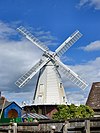
| building | windmill | A building constructed as a traditional windmill, historically used to mill grain with wind power. | ||||
| building | yes | 當你不確定建築物屬性屬於那個特定標籤時使用 | ||||
| building | 使用者自訂 | 到Taginfo查詢常用標籤值 | ||||
附加屬性 (Additional attribution)
| 關鍵字(key) | 值 (value) | 幾何 (element) | 描述 (desc) | 照片 (photo) |
|---|---|---|---|---|
| building:architecture | <architectural style> | Architectural style of a building | ||
| building:colour | <RGB hex triplet> | <W3C colour name> | Indicates colour of the building | ||
| building:fireproof | yes | no | 建築物的防火程度 | ||
| building:flats | <number> | The number of residential units (flats, apartments) in an apartment building (building=apartments), residential building (building=residential), house (building=house), detached house (building=detached) or similar building. | ||
| building:levels | <number> | 建築物的樓層數 | ||
| building:material | <material type> | Outer material for the building façade | ||
| building:min_level | <number> | For describing number of values, "filling" space between ground level and bottom level of building or part of building | ||
| building:part | As building | To mark a part of a building, which has attributes, different from such ones at other parts | ||
| building:soft_storey | yes | no | reinforced | A building where any one level is significantly more flexible (less stiff) than those above and below it | ||
| construction_date | <date> | The (approximated) date when the building was finished. | ||
| entrance | yes | main | exit | service | emergency | 建築物入口,請用這個標籤取代停用的building=entrance標籤。 | ||
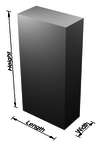
| height | <number> | 用公尺計算建築物的高度。 | ||
| max_level | <number> | 採用簡單室內繪圖標準時,建築內的最大室內樓層數 | ||
| min_level | <number> | 採用簡單室內繪圖標準時,建築內的最小室內樓層數 | ||
| non_existent_levels | <number> | 選擇性,採用簡單室內繪圖標準時,列出建築內不存在的樓層數 | ||
| start_date | <date> | The (approximated) date when the building was finished. |
This table is a wiki template with a default description in English. Editable here. 此表格由模版自動生成,協助改善中譯版本請按此。
工藝場所 (Crafts)
這些地方提供的是客製化產品生產或服務。詳請看Crafts。
| 關鍵字(key) | 值 (value) | 描述 (desc) | 地圖標註 (render) | 照片 (photo) |
|---|---|---|---|---|
| craft | agricultural_engines | 設計與建造農業機械的廠商或販賣。農具行、農具店、農積店、農具製造廠。 | ||
| craft | atelier | A place where visual artists work | ||
| craft | bag_repair | A place where bags/luggage are repaired. | ||
| craft | bakery | A workplace for fresh bakery goods. No shop. | ||
| craft | basket_maker | 製作籃子的地方。在台灣,相似的行業有:藤製品製造業。 | ||
| craft | beekeeper | 養蜂場,為生產蜂蜜、蜂蠟和花粉而養殖蜜蜂的地方。 | ||
| craft | blacksmith | 鐵匠鋪、鑄鐵廠。 | ||
| craft | boatbuilder | 造船廠。 | ||
| craft | bookbinder | 提供書籍裝訂服務的店家。在台灣,影印店是最接近的。 | ||
| craft | brewery | 啤酒廠。 | ||
| craft | builder | 建築工程行、營造工程公司。提供建造房舍、道路修築等服務。 | ||
| craft | cabinet_maker | A person who makes fine wooden furniture. | ||
| craft | carpenter | 木工、木匠的工作場所或營業據點。提供建築物或傢俱的建置、安裝維護,等服務。台灣類似此標籤的行業有:裝潢行、傢俱行。 | ||
| craft | carpet_layer | 鋪地毯工人的工作場所或辦公室。 | ||
| craft | caterer | 提供到會餐飲、外燴、辦桌等服務的供應商。 | ||
| craft | chimney_sweeper | 清煙囪工人的工作場所。 | ||
| craft | clockmaker | 鐘錶工人的工作場所或辦公室。 | ||
| craft | confectionery | 糕點糖果製造的人之工作場所 | ||
| craft | distillery | 蒸餾室 | ||
| craft | door_construction | A workplace of someone constructing doors. | ||
| craft | dressmaker | 為滿足個人需求,而生產、修改或修補衣服的工作場所 | ||
| craft | electrician | 電工之工作場所或辦公室。 | ||
| craft | floorer | 鋪設地板的服務商 另見 craft=parquet_layer craft=carpet_layer craft=tiler |
||
| craft | gardener | 園藝設計的人之工作場所或辦公室。如,園藝設計公司。 | ||
| craft | glaziery | 玻璃工人的工作場所。 | ||
| craft | handicraft | 生產手工藝品之工作場所。 | ||
| craft | hvac | 熱氣、通風和空調系統設計者之工作場所,相當於台灣做「風管的」。hvac為"Heating, Ventilating, and Air Conditioning"的縮寫 | ||
| craft | insulation | 建築物隔熱設計的人之工作場所。 | ||
| craft | jeweller | 珠寶製造和修復的工作場所。 | ||
| craft | joiner | An artisan who builds things by joining pieces of wood, particularly furniture or ornamental work. | ||
| craft | key_cutter | 複製鑰匙的工作場所。台灣的配鎖店通常兼俱此營業項目。 | ||
| craft | locksmith | 打造、修理鎖和鑰匙之工作場所(鎖匠)。 | ||
| craft | metal_construction | 鐵工廠,如由鐵打造欄杆。把手、門,等相似的東西之工作場所。 | ||
| craft | optician | 一個可以驗光、校正視力的地方,通常有視光師駐守。 | ||
| craft | painter | 油漆匠、油漆工的工作場所或辦公室。 | ||
| craft | parquet_layer | 鋪拼花地板的人之工作場所或辦公室。 | ||
| craft | photographer | 照相館、影樓,幫顧客拍照片的地方,如證件照。 | ||
| craft | photographic_laboratory | 相片沖印店、相館、沖晒鋪,幫顧客的將數位或底片輸出為紙張或膠膜上的工作場所,幫顧客拍照,也沖洗照片。 | ||
| craft | piano_tuner | A piano tuner or technician. A professional that tunes, regulates and makes the maintenance of pianos. Most of them repair simple problems and some restore a whole piano. | ||
| craft | plasterer | 泥水匠,為房屋內牆的上漿的人之辦公室。 | ||
| craft | plumber | 水管工之工作場所。 | ||
| craft | pottery | 燒陶工之工作場所。 | ||
| craft | rigger | 帆船的索具操縱工之工作場所。 | ||
| craft | roofer | 修屋或鋪設屋頂工之工作場所。 | ||
| craft | saddler | 製造馬鞍的人之工作場所。 | ||
| craft | sailmaker | 製造船帆的人之工作場所。 | ||
| craft | sawmill | 鋸木廠。 | ||
| craft | scaffolder | 做鷹架的人之辦公室或工作場所。 | ||
| craft | sculptor | 雕刻品製造廠。 | ||
| craft | shoemaker | 鞋匠的工作及營業場所、鞋類製作工作室。例如針對特定鞋類提供製造或修改服務的工作室,如皮鞋、靴子、涼鞋、木屐、鹿皮鞋等。也含括提供客製修改、維修鞋類的店家。另見shop=shoes。 | ||
| craft | stand_builder | 製造攤子的工廠。 | ||
| craft | stonemason | 磨石工廠。 | ||
| craft | stove_fitter | A workplace/office of a person/company who designs and builds stoves/tiled stoves. | ||
| craft | sun_protection | A place where sun protection is made, repaired, or delivered for assembly, especially awnings and shutters. 如台灣的帆布行,提供遮陽棚製作服務。 | ||
| craft | tailor | 衣服修改店、裁縫鋪。 | ||
| craft | tiler | 提供磁磚鋪設服務的廠商,例如地板、游泳池等場所的地磚、牆磚鋪設服務。 在台灣,類似於裝潢師傅的營業據點。 | ||
| craft | tinsmith | A tinsmith, or tinner or tinker or tinplate worker. Workplace or office of a person who makes and repairs things made of light-coloured metal, particularly tinware. | ||
| craft | turner | A turner or wood turner. | ||
| craft | upholsterer | A place where furniture, especially seats are provided with padding, springs, webbing, and fabric or leather covers. | ||
| craft | watchmaker | 由一個工匠製造和修理手錶的鐘錶行。 時至今日由於工業生產的緣故,他們大多是負責修理手錶。 對於其他類型的時鐘請見 craft=clockmaker。 | ||
| craft | window_construction | 提供窗戶製作服務的廠商。 | ||
| craft | winery | 釀酒廠 | ||
| craft | 使用者自訂 | 到Taginfo查詢常用標籤值 |
This table is a wiki template with a default description in English. Editable here.
此表格由模版自動生成,協助改善中譯版本請按此。
緊急設施 (Emergency)
用來描述緊急設施和設備地理位置的標籤,詳情請見Emergency。
| 關鍵字(key) | 值 (value) | 元素 (element) | 敘述 (desc) | 圖例 (render) | 照片 (photo) | |
|---|---|---|---|---|---|---|
緊急急救 (Medical Rescue) | ||||||
| emergency | ambulance_station | 救護站,配有救護車、醫師與醫療設備。 | ||||
| emergency | defibrillator | |||||
消防 (Firefighters) | ||||||
| emergency | fire_extinguisher | 滅火器/消火栓。 | ||||
| emergency | fire_flapper | 野地打火工具,在野外用來打火、撲滅火勢之工具。 | ||||
| emergency | fire_hose | 消防軟管/消防喉轆。 | ||||
| emergency | fire_hydrant | 消防栓/消防街喉。 | ||||
| emergency | water_tank | 消防儲水槽。 | ||||
| emergency | fire_water_pond | A man made or natural pond with water for a fire department. | ||||
| emergency | suction_point | A preferred point to pump water off a river or other waters for a fire department. | ||||
水上救生 (Lifeguards) | ||||||
| emergency | lifeguard_base | 救生員基地,備有救援載具、器材與通訊系統。 | ||||
| emergency | lifeguard_tower | 救生員哨塔,監督戲水者以防溺水等意外事故。 | ||||
| emergency | lifeguard_platform | 救生員平台,監督戲水者以防溺水等意外事故。 | ||||
| emergency | lifeguard_place | 救生員看守點,無任何建築或平台。 | ||||
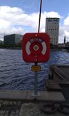
| emergency | life_ring | 救生圈。 | ||||
其他 (Others) | ||||||
| emergency | assembly_point | 緊急避難場所。 | ||||
| emergency | access_point | 緊急通訊處,設於難以抵達的地點。參見highway=emergency_access_point。 | ||||
| emergency | phone | 緊急電話。 | ||||
| emergency | ses_station | 緊急服務站(SES,澳洲在災難時期提供緊急救助的志工組織)。 | ||||
| emergency | siren | 警報器。作為民防設施,發布各類危險、災害警報。 | ||||
| emergency | 使用者自訂 | 到Taginfo查詢常用標籤值 | ||||
此表格由模版自動生成,協助改善中譯版本請按此。
地質類 (Geological)
標示某一區域的地質狀況。更多使用說明請見Geological。
| 關鍵字(key) | 值 (value) | 元素 (element) | 敘述 (desc) | 圖例 (render) | 照片 (photo) |
|---|---|---|---|---|---|
| geological | moraine | 冰磧丘陵。冰磧沉積物堆積於鬆軟的冰川底部。 | |||
| geological | outcrop | 露頭。基岩或岩脈露出地表。 | |||
| geological | palaeontological_site | 古生物化石區。埋藏史前古生物遺跡的場所。 | |||
| geological | 使用者自訂 | 到Taginfo查詢常用標籤值 |
This table is a wiki template with a default description in English. Editable here.
此表格由模版自動生成,協助改善中譯版本請按此。
道路 (Highway)
主要用於描述道路與步道,如何運用請參閱道路。車輛通行限制(車輛種類、時間、日期、載重、用途等,請參閱通行限制。
| 鍵 (Key) | 值 (Value) | 元素 (Element) | 說明 | 圖例 | 圖片 | |
|---|---|---|---|---|---|---|
道路 | ||||||
|
下列為道路網絡的主要標籤,依重要程度由高至低排序。 | ||||||
| highway | motorway | 高速公路:雙向分隔行駛、完全控制出入口的公路,單向常設有兩條以上的車道及供緊急用途的路肩或避車彎。
|
||||
| highway | trunk | 不屬高速公路,國家管轄的重要道路(不一定為雙向分隔行駛)。
|
||||
| highway | primary | 一級道路(連接大型市鎮)
|
||||
| highway | secondary | 二級道路(連接一般市鎮)
|
||||
| highway | tertiary | 三級公路(連接小型聚落或大型市鎮內的衛星市郊)。
|
||||
| highway | unclassified | 一般道路/無編制道路(連結村莊及聚落間):公路系統中最低層級的道路,供公共通行而非連接私人產權(請使用highway=residential)。 公路等級未知、待分類的道路,請使用highway=road。 |
||||
| highway | residential | 住宅區道路:進出住宅區或住宅區內的道路,並非用於穿越聚落或連接聚落的道路。 | ||||
匝道 | ||||||
| highway | motorway_link | 高速公路匝道:連結不同高速公路(Interchange),或由高速公路連結較低等級的公路(Junction)。 ̈
|
||||
| highway | trunk_link | 快速道路匝道:連結不同快速道路(Interchange),或快速道路連結較低等級的公路(Junction)。
|
||||
| highway | primary_link | 省道匝道:連結不同主要道路,或主要道路連結較低等級的道路。 能用於道路交會處的槽化車道。 |
||||
| highway | secondary_link | 二級道路匝道。 | ||||
| highway | tertiary_link | 三級道路匝道。 | ||||
特定道路 | ||||||
| highway | living_street | 生活街道:行人路權高於機動車輛,設置極低的道路限速,允許幼童在街道上玩耍。 | ||||
| highway | service | 服務道路:工業園區、露營地、產業園區或停車場等設施或場域的內部道路或對外聯絡道路。 搭配service=*描述道路用途,如:停車場通道 highway=service+service=parking_aisle。 |
||||
| highway | pedestrian | 人行道/行人徒步區,得用於廣場(圍成區域後加上area=yes)。 | ||||
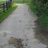
| highway | track | 農路、林道、礦路等產業道路。常鋪剛性路面(水泥/石礫)、柔性路面(碎石/壓實草地、土壤、泥地、砂地)或混合兩者。 。路面品質使用標籤 tracktype=*標記 。 若您想標記一般道路,請使用general highway values。 |
||||
| highway | bus_guideway | 導向巴士道,其他車輛無法使用。 注意:一般公車專用道/巴士專用線請改用access=no, psv=yes 替代。 |
||||
| highway | escape | 緊急避車道:供煞車失效的車輛安全緩衝減速。 | ||||
| highway | raceway | 環形賽道或賽車使用的賽道。 賽跑或賽馬用的賽道,請改用 |
||||
| highway | road | 未知種類的道路:此暫時性標籤用以標記該道路尚未調查其種類,一旦查明應立即標記適當的種類。 若您知道該道路層級,請改用highway=*。 |
||||
| highway | busway | A dedicated roadway for bus rapid transit systems | ||||
路徑(Paths) | ||||||
| highway | footway | 步道。專為行人設計的道路,含散步小徑或碎石步道。 若允許單車通行,請加入 bicycle=yes標籤。 如不清楚路徑的主要用途,請勿使用此標籤。 商店街或住宅區的人行道,請使用highway=pedestrian;若人行道同時能供農業機具通行,請使用highway=track。 |
||||
| highway | bridleway | 為馬匹設計的路徑。等同於 highway=path + horse=designated。 | ||||
| highway | steps | 行人使用的階梯。得配合step_count=*標記階梯階數。 | ||||
| highway | corridor | For a hallway inside of a building. | ||||
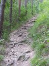
| highway | path | 無特定用途的路徑。 | ||||
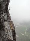
| highway | via_ferrata | A via ferrata is a route equipped with fixed cables, stemples, ladders, and bridges in order to increase ease and security for climbers. These via ferrata require equipment : climbing harness, shock absorber and two short lengths of rope, but do not require a long rope as for climbing. | ||||
When sidewalk/crosswalk is tagged as a separate way | ||||||
| footway | sidewalk | Sidewalk that runs typically along residential road. Use in combination with highway=footway or highway=path | ||||
| footway | crossing | 行人穿越道,如斑馬線(枕木型行人穿越道)。 | ||||
當公路附設人行道時(詳情請見Sidewalks) | ||||||
| sidewalk | both | left | right | no | Specifies that the highways has sidewalks on both sides, on one side or no sidewalk at all | ||||
當自行車擁有專用路權時(詳情請見 Bicycle) | ||||||
| highway | cycleway | 自行車專用道。專門為腳踏車設計的路徑。 如果未受一般進入限制管制,得加入foot=*。 |
||||
自行車道附設於一般道路時(詳情請見 Bicycle) | ||||||
| cycleway | lane | 道路附設的自行車道。 | ||||
| cycleway | opposite | 允許自行車雙向通行,請使用oneway=yes 或 oneway:bycycle=no。 | ||||
| cycleway | opposite_lane | 自行車的行進方向,與道路行進方向相反時,請使用oneway=yes或oneway:bycycle=no。 | ||||
| cycleway | track | 與道路分隔的自行車道。注意:常被標記為highway=cycleway。 | ||||
| cycleway | opposite_track | 與道路分隔的自行車道。自行車行進方向與道路行進方向相反時,請同時使用 oneway=yes。 | ||||
| cycleway | share_busway | There is a bus lane that cyclists are permitted to use. | ||||
| cycleway | opposite_share_busway | Used on ways with oneway=yes that have a bus lane that cyclists are also permitted to use, and which go in the opposite direction to normal traffic flow (a "contraflow" bus lane). Used together with oneway:bicycle=no. | ||||
| cycleway | shared_lane | 公車專用道允許自行車使用。 | ||||
| busway | lane | 公車專用道。 | ||||
Street parking tagged on the main roadway (see Street parking) | ||||||
| parking:left / :right / :both (hereafter: parking:side) |
lane | street_side | on_kerb | half_on_kerb | shoulder | no | separate | yes | 道路附設的自行車道。 | ||||
| parking:sideorientation=* | parallel | diagonal | perpendicular | 道路附設的自行車道。 | ||||
生命週期(Lifecycle) (see also lifecycle prefixes) | ||||||
| highway | proposed | 計畫中道路。 計畫中道路的等級使用proposed=*標記。 |
||||
| highway | construction | 施工中道路。施工中道路的等級使用construction=*標記。 | different colours | |||
屬性(Attributes) | ||||||
| abutters | commercial | industrial | mixed | residential | retail etc. | 詳情參考abutters=*。 | ||||
| bicycle_road | yes | 若住宅區街道視同腳踏車道,使用此標籤。此類車道常擁有腳踏車專屬燈號,汽車則限速管制。 | ||||
| bus_bay | both | left | right | A bus bay outside the main carriageway for boarding/alighting | ||||
| change | yes | no | not_right | not_left | only_right | only_left | Specify the allowed/forbidden lane changes | ||||
| destination | <place name of destination> | Destination when following a linear feature | ||||
| embankment | yes | dyke | A dyke or a raised bank to carry a road, railway, or canal across a low-lying or wet area. | ||||
| embedded_rails | yes | <type of railway> | 公路上的軌道路軌可供一般車輛通行,軌道以獨立線段繪製。 | ||||
| ford | yes | 車輛通過時須橫渡水流或溪流。 | ||||
| ice_road | yes | 結冰水域上的道路,夏季時無法通行。 | ||||
| incline | Number % | ° | up | down | 道路坡度。使用百分比(「5%」)或角度(「20°」)標示。 正數或負數標記該道路通行方向為上升或下降。 |
||||
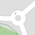
| junction | roundabout | 圓環。 自動設定為單行道 oneway=yes,單行道方向依據線(way)上點(node)的排列方向。 ,圓環亦同時標記為道路highway=*。 |
||||
| lanes | <number> | 車道數/行車綫數目。含公車或特定用途車輛的車道數。 | ||||
| lane_markings | yes | no | Specifies if a highway has painted markings to indicate the position of the lanes. | ||||
| lit | yes | no | 是否設置路燈照明。 | ||||
| maxspeed | <number> | Specifies the maximum legal speed limit on a road, railway or waterway. | ||||
| motorroad | yes | no | 標記屬於封閉專用路權、非高速公路的道路。 | ||||
| mountain_pass | yes | 啞口、鞍部。 | ||||
| mtb:scale | 0-6 | 搭配 highway=path、highway=track使用。標記登山、單車活動的行程難度。 | ||||
| mtb:scale:uphill | 0-5 | 登山車路徑的上坡分級難度。 | ||||
| mtb:scale:imba | 0-4 | 國際登山車協會界定的登山車路徑分級難度。 | ||||
| mtb:description | Text | 標示登山車路徑的行程資訊。適用於highway=path與highway=track。 | ||||
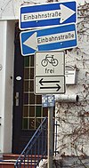
| oneway | yes | no | reversible | Oneway streets are streets where you are only allowed to drive in one direction. | ||||
| oneway:bicycle | yes | no | | Used on ways with oneway=yes where it is legally permitted to cycle in both directions. | ||||
| overtaking | yes | no | caution | both | forward | backward | 標註是否為高乘載或具特殊乘載規定的車道。 | ||||
| parallel | diagonal | perpendicular | marked | no_parking | no_stopping | fire_lane. | 停車位劃設種類。詳情參見 parking:lane=* 。 | |||||
| free | ticket | disc | residents | customers | private | 停車限制。詳情參見 parking:condition=*。 | |||||
| passing_places | yes | 標記會車的路段。 | ||||
| priority | forward | backward | Traffic priority for narrow parts of roads, e.g. narrow bridges. | ||||
| priority_road | designated | yes_unposted | end | Specifying roads signposted as priority roads. | ||||
| sac_scale | hiking | mountain_hiking | demanding_mountain_hiking | alpine_hiking | demanding_alpine_hiking | difficult_alpine_hiking | 標記健行路徑的行程難度。適用於highway=path與highway=footway。 | ||||
| service | alley | driveway | parking_aisle etc. | 詳情請見 service=*。 | ||||
| shoulder | no | yes | right | both | left | Presence of shoulder in highway | ||||
| smoothness | excellent | good | intermediate | bad | very_bad | horrible | very_horrible | impassable | Specifies the physical usability of a way for wheeled vehicles due to surface regularity/flatness. See Key:smoothness for more details. | ||||
| surface | paved | unpaved | asphalt | concrete | paving_stones | sett | cobblestone | metal | wood | compacted | fine_gravel | gravel | pebblestone | plastic | grass_paver | grass | dirt | earth | mud | sand | ground | 道路鋪面材質。詳情請見 surface=*。 | ||||
| tactile_paving | yes | no | 是否鋪設導盲磚。 | ||||
| tracktype | grade1 | grade2 | grade3 | grade4 | grade5 | To describe the quality of the surface. See Key:tracktype for more information. | ||||
| traffic_calming | bump | hump | table | island | cushion | yes | etc. | 詳情請見 traffic_calming=*。 | ||||
| trail_visibility | excellent | good | intermediate | bad | horrible | no | 標記健行路徑的可識別程度。適用於highway=path,highway=footway、highway=cycleway與highway=bridleway。 | ||||
| trailblazed | yes | no | poles | cairns | symbols | Applies to highway=*. Describing trail blazing and marking. See Key:trailblazed for more information. | ||||
| trailblazed:visibility | excellent | good | intermediate | bad | horrible | no | Applies to trailblazed=*. A classification for visibility of trailblazing. See Key:trailblazed:visibility for more information. | ||||
| turn | left | slight_left | through | right | slight_right | merge_to_left | merge_to_right | reverse | The key turn can be used to specify the direction in which a way or a lane will lead. | ||||
| width | <number> | The width of a feature. | ||||
| winter_road | yes | 冬季專用的道路,通常於夏季無法行車。 | ||||
其他功能(Other features) | ||||||
| highway | bus_stop | 公車(巴士)停靠站/站牌。 得使用public_transport=stop_position嚴格標記公車停靠位置,或以public_transport=platform標記乘客候車的月台。詳情參見public_transport=*。 |
||||
| highway | crossing | A.k.a. crosswalk. Pedestrians can cross a street here; e.g., zebra crossing | ||||
| highway | cyclist_waiting_aid | Street furniture for cyclists that are intended to make waiting at esp. traffic lights more comfortable. | ||||
| highway | elevator | 電梯。非手扶梯。 | ||||
| highway | emergency_bay | An area beside a highway where you can safely stop your car in case of breakdown or emergency. | ||||
| highway | emergency_access_point | ,標誌得標定所在位置的特殊編號,供緊急通訊使用,配合 ref=NUMBER_ON_THE_SIGN使用。 | ||||
| highway | give_way | 讓道標誌。 | ||||
| emergency | phone | 緊急電話,配合 ref=NUMBER_ON_THE_SIGN使用。 | ||||
| highway | ladder | A vertical or inclined set of steps or rungs intended for climbing or descending of a person with the help of hands. | ||||
| highway | milestone | Highway location marker | ||||
| highway | mini_roundabout | 無分隔島的小型圓環。 大型圓環請用junction=roundabout。 預設顯示為逆時鐘通行方向,若要使用順時針通行方向請用direction=clockwise。 |
||||
| highway | motorway_junction | 交流道出口(英國稱為junction,美國稱為exit),使用標籤
ref=*標記出口號碼,name=*標記交流道名稱,如台灣國道1號中山高速公路林口交流道北上41B;香港四號幹綫東區走廊東行6A號出口。 |
||||
| highway | passing_place | 標記會車路段(避車處)。 | ||||
| highway | platform | 公車站的月台 | ||||
| highway | rest_area | 休息站:僅供休息,不提供加油服務。 | ||||
| highway | services | 服務區:提供食物、加油站與廁所,常見於高速公路。 | ||||
| highway | speed_camera | 固定式測速相機。 | ||||
| highway | stop | 停止標誌/停車再開標誌/「停」處。 | ||||
| highway | street_lamp | 標示每晚固定開啟的路燈。 | ||||
| highway | toll_gantry | 電子收費門架是一種立於路徑上的門架(常為高速公路),作為電子收費系統的一部分。收費亭或帶有柵欄的收費亭請參閱barrier。 | ||||
| highway | traffic_mirror | 道路反射鏡 | ||||
| highway | traffic_signals | 紅綠燈/行車管控號誌/交通燈。 | ||||
| highway | trailhead | 登山口、步道口:登山健行的步道起點或路線起點。 | ||||
| highway | turning_circle | 迴轉處/掉頭處。通常設於道路盡頭的圓環(迴旋處)或加寬道路,方便車子迴轉(掉頭)。 | ||||
| highway | turning_loop | A widened area of a highway with a non-traversable island for turning around, often circular and at the end of a road. | ||||
| highway | 使用者自訂 | 到Taginfo查詢常用標籤值 | ||||
此表格由模版自動生成,協助改善中譯版本請按此。
歷史相關 (Historic)
用來標註跟古蹟或歷史性的事物。如考古遺址、沉船、廢墟、城堡和古代建築等等。用法詳見Historic。
| 關鍵字(key) | 值 (value) | 幾何 (element) | 描述 (desc) | 地圖標註 (render) | 照片 (photo) |
|---|---|---|---|---|---|
| historic | aircraft | 定點展示的退役飛機。 | |||
| historic | aqueduct | A historic structure to convey water | |||
| historic | archaeological_site | 考古遺址。 | |||
| historic | battlefield | 戰場或戰區遺跡(可能位於陸地或海洋)。 | |||
| historic | bomb_crater | A bomb crater. | |||
| historic | building | 若無法釐清歷史建築的種類,得以此標記為一般性建築。 | |||
| historic | cannon | 古炮/退役大砲。常位於堡壘或戰場。 | |||
| historic | castle | 城堡。 | |||
| historic | castle_wall | A |
|||
| historic | charcoal_pile | Historic site of a charcoal pile. Often still in good condition in hilly forest areas. | |||
| historic | church | A building with historical value for Christian religious activities, particularly for worship services. | |||
| historic | city_gate | 城門。常伴隨城牆存在。 | |||
| historic | citywalls | 城牆。具用於防衛城市。 | |||
| historic | farm | 具歷史價值的農場。 | |||
| historic | fort | 具歷史性的軍事要塞。相較於城堡,要塞的設立年代更晚。 | |||
| historic | gallows | 具歷史價值的絞刑架。 | |||
| historic | highwater_mark | 紀念水災的洪水水位。 | |||
| historic | locomotive | 退役鐵路機關車/火車頭。 | |||
| historic | manor | 具歷史價值的莊園。 | |||
| historic | memorial | 小型紀念碑/紀念牆。 | |||
| historic | mine | Abandoned underground mine workings for minerals such as coal or lead. | |||
| historic | mine_shaft | Vertical shafts of a historic mine | |||
| historic | milestone | 具歷史價值的里程碑、里程牌、方向標。 | |||
| historic | monastery | 具歷史價值的寺廟 | |||
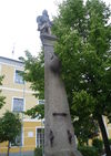
| historic | monument | 大型紀念性建築或碑石,紀念團體或個人。 | |||
| historic | optical_telegraph | 電報站/通訊站。 | |||
| historic | pillory | 頸手枷/枷項. | |||
| historic | railway_car | A decommissioned railway car which generally remains in one place. | |||
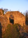
| historic | ruins | 遺跡/遺址。遺跡種類得以 ruins=* 標記,如ruins=castle。 也能以historic=castle + ruins=yes標記。 更多討論及提案,請見Proposed_features/ruins。 |
|||
| historic | rune_stone | 盧恩石刻。 | |||
| historic | ship | 退役的船隻或潛水艇。 | |||
| historic | stone | A stone shaped or placed by man with historical value. | |||
| historic | tank | A decommissioned tank which generally remains in one place. | |||
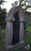
| historic | tomb | 古墓。 | |||
| historic | tower | Historic tower | |||
| historic | |||||
| historic | vehicle | A decommissioned land-based vehicle which generally remains in one place | |||
| historic | wayside_cross | 歷史性十字架,常見於德國南部和奧地利等地。 | |||
| historic | wayside_shrine | 路邊簡易的宗教場所,常搭配religion=*使用。如台灣路邊的小型土地公廟、大樹公、石頭公等;日本的地藏像。右圖為路邊的小教堂,常見於德國南部和奧地利。 | |||
| historic | wreck | 沈船遺跡。 | |||
| historic | yes | 標記物件的歷史重要性,常搭配其他標籤敘述。 | |||
| historic | 使用者自訂 | 到Taginfo查詢常用的標籤值 |
This table is a wiki template with a default description in English. Editable here.
此表格由模版自動生成,協助改善中譯版本請按此。
土地利用 (landuse)
用來標記並描述土地的用途,詳見Landuse。
| 關鍵字(key) | 值 (value) | 元素 (element) | 敘述 (desc) | 圖例 (render) | 照片 (photo) | |
|---|---|---|---|---|---|---|
Common landuse key values - developed land | ||||||
| landuse | commercial | 商業區。以辦公或商業區域為主要用途。 | ||||
| landuse | construction | 施工中的未完工區域,完工後應改為其它用地。 | ||||
| landuse | education | An area predominately used for educational purposes/facilities. | ||||
| landuse | fairground | A site where a fair takes place | ||||
| landuse | industrial | 工業用地,以工坊、工廠或倉庫或相關工業設施為主要用途。 | ||||
| landuse | residential | 住宅區,以房屋或公寓為主。
|
||||
| landuse | retail | 商店/零售。以商店與其附屬設施(如停車場、通道、草地等)為主。 | ||||
| landuse | institutional | Land used for institutional purposes, see The meaning of this tag is ambiguous and unclear. Consider using another tag that better describes the object. For instance landuse=commercial. See talk page for discussion. |
||||
| 關鍵字(key) | 值 (value) | 元素 (element) | 敘述 (desc) | 圖例 (render) | 照片 (photo) | |
Common landuse key values - rural and agricultural land | ||||||
| landuse | aquaculture | Warning: currently, there is no convention on the exact meaning of this tag. Therefore, it makes sense to treat it like "boundary of aquaculture" (without implication of water body), which means, water body should be tagged by its own, using natural=water etc. |
||||
| landuse | allotments | 地方居民的私人菜圃、花圃。 | ||||
| landuse | farmland | 農業用地。以耕作和畜牧(動物養殖與糧食作物、蔬菜、花卉栽種等)為主要用途。 | ||||
| landuse | farmyard | 農業設施,農業相關設施如農舍、農莊、莊園、棚架、馬場、倉庫、農機具車庫、飼料倉庫等,與該設施相鄰之樹林。 | ||||
| landuse | paddy | 土地形狀和地表條件適合種植水稻的水田。 | ||||
| landuse | animal_keeping | An area of land that is used to keep animals, particularly horses and livestock. | ||||
| landuse | flowerbed | An area designated for flowers | ||||
| landuse | forest | 林業用地。供林場管理與保育用途。(Other languages)天然林請改用natural=wood。 | ||||
| landuse | greenhouse_horticulture | 溫室,以溫室栽培植物的土地利用。 | ||||
| landuse | meadow | 牧草地,以栽種草本植物或牧草等作物(如甘蔗、玉米或牧草)為主要用途。 | ||||
| landuse | [[ Too many Data Items entities accessed. | orchard ]] | 果園。栽種供食用為目的樹木或灌木。 | ||||
| landuse | plant_nursery | 育種苗圃,人為栽培新品種植物。 | ||||
| landuse | vineyard | 葡萄園 | ||||
| 關鍵字(key) | 值 (value) | 元素 (element) | 敘述 (desc) | 圖例 (render) | 照片 (photo) | |
Common landuse key values - waterbody | ||||||
| landuse | basin | 流域/集水區。 搭配basin=*標註集水區種類。 |
||||
| 水庫/蓄水池。可能為覆蓋或未覆蓋,覆蓋請參考man_made=reservoir_covered。water=reservoir為替代用法。 | ||||||
| landuse | salt_pond | 鹽田,用於讓海水蒸發以取得鹽的土地。 | ||||
| 關鍵字(key) | 值 (value) | 元素 (element) | 敘述 (desc) | 圖例 (render) | 照片 (photo) | |
Other landuse key values | ||||||
| landuse | brownfield | 計畫開發區域,該區建物已拆除或清除。 | ||||
| landuse | cemetery | 墓地、墳場。能添加標籤 religion=*標註墓地的宗教類別,可選用的類別參見place of worship頁面)。小型墓地(如教堂等設施附屬墓園)得使用 amenity=grave_yard替代。 | ||||
| 已廢止。請改用boundary=protected_area、protected_area=*。 | ||||||
| landuse | depot | An area used as a depot for e.g. vehicles (trains, buses or trams). Consider using rather standard landuse tags like landuse=railway, landuse=commercial, landuse=industrial, with subtag like industrial=depot. | ||||
| landuse | garages | 停車用地。常以磚或鐵皮建造,多屬於私人停車廠商經營。 | ||||
| landuse | grass | 綠地,人工種植、維護的草皮。 種植牧草、草本植物的土地請改用landuse=meadow、 注意此標籤實際為土地覆蓋型態,而非土地利用型態,經提議刪除的標籤。 |
||||
| landuse | greenfield | 預定建造建物的閒置空地,。 |
| |||
| landuse | landfill | 廢棄物掩埋用地 | ||||
| landuse | military | 軍事用地。供軍事使用或由軍方所擁有的土地(無論使用目的為何)。 | ||||
| landuse | port | 濱海工業區(貿易交通受管制)。 | ||||
| landuse | quarry | 露天礦場。 | ||||
| landuse | railway | 鐵路用地。多不開放公眾使用,如車廠/車庫。 | ||||
| landuse | recreation_ground | 遊憩用地。常包含球場、綠地等,多為公立,亦可能屬於大學或私人公司。 | ||||
| landuse | religious | An area used for religious purposes | ||||
| landuse | village_green | 畸零綠地,常用於分隔島、圓環等,原意為歐洲社區共有的綠地。 | ||||
| landuse | winter_sports | An area dedicated to winter sports (e.g. skiing) | ||||
| landuse | 使用者自訂 | 到Taginfo查詢常用的標籤值 | ||||
This table is a wiki template with a default description in English. Editable here. 此表格由模版自動生成,協助改善中譯版本請按此。
娛樂設施(Leisure)
用來標註休閒和運動設施,另見Leisure 的介紹。
| 關鍵字(key) | 值 (value) | 幾何 (element) | 描述 (desc) | 地圖標註 (render) | 照片 (photo) |
|---|---|---|---|---|---|
| leisure | adult_gaming_centre | 提供付費遊戲的室內場所,備有電子遊戲機、模擬駕駛機台、彈珠台、merchandisers等。進場有年齡限制。若無年齡限制請用 leisure=amusement_arcade。 | |||
| leisure | amusement_arcade | 提供付費遊戲的室內場所,備有電子遊戲機、模擬駕駛機台、彈珠台、merchandisers等。沒有進場年齡限制。若有年齡限制請使用 leisure=adult_gaming_centre 。 | |||
| leisure | bandstand | 室外音樂台。開放性的室外結構物,可讓樂團舉辦音樂會。 | |||
| leisure | bathing_place | Public place where you can freely bath in nature. | |||
| leisure | beach_resort | 有管理的海灘。 | |||
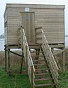
| leisure | bird_hide | 賞鳥亭 | |||
| leisure | bleachers | Raised, tiered rows of benches found at spectator events | |||
| leisure | bowling_alley | 保齡球館 | |||
| leisure | common | 在英國是指公眾的區域。 | |||
| leisure | dance | 公共舞廳。 | |||
| leisure | disc_golf_course | Disc golf course | |||
| leisure | dog_park | 專門設計用來給狗活動的公園,飼主被允許可以不栓鍊子地遛狗。 | |||
| leisure | escape_game | A physical adventure game in which players solve a series of puzzles using clues, hints and strategy to complete the objectives at hand. | |||
| leisure | firepit | 營火台。常被用來生火,承載營火、篝火的地點。 | |||
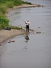
| leisure | fishing | 釣魚點 | |||
| leisure | fitness_centre | 健身房、健身中心 | |||
| leisure | fitness_station | A place with exercise machines, single or collection of, outdoor. | |||
| leisure | garden | 花園、花圃,因裝飾目的而有條理地配置及栽種花卉與植物的地方。或用於研究目的而被栽培,如:植物園。 | |||
| leisure | golf_course | 高爾夫球場,此標籤牽涉到sport=golf。 | |||
| leisure | hackerspace | 協作空間。提供給有共同興趣的群眾使用的場所,可以用來舉行會議、社交或是協作。通常以電腦、技術、科學、數位或電子藝術為主。 | |||
| leisure | horse_riding | 馬場、騎馬體驗 | |||
| leisure | ice_rink | 滑冰場,也可用來玩冰上曲棍球。 | |||
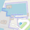
| leisure | marina | 可用來停放遊艇或帆船的港。 | |||
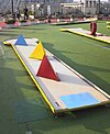
| leisure | miniature_golf | 一個小型的區域,可用來玩微型高爾夫。 | |||
| leisure | nature_reserve | 自然保護區,像是台灣的福山植物園。 | |||
| leisure | outdoor_seating | Areas for outdoor gastronomy. | |||
| leisure | park | 公園 | |||
| leisure | picnic_table | 露營桌 | |||
| leisure | pitch | 球場,描述運動類別使用sport=*。 | |||
| leisure | playground | 兒童遊樂場 | |||
| leisure | resort | A place used for relaxation or recreation, attracting visitors for vacations, tourism and/or going swimming in a pool and/or a nearby body of water. | |||
| leisure | sauna | 桑拿、三溫暖 | |||
| leisure | slipway | 帆船下水處 | |||
| leisure | sports_centre | 運動中心,描述運動類別使用sport=*。 | |||
| leisure | sports_hall | A sufficiently large single room that is suitable for practising sports indoors and does not have a "centre" character. | |||
| leisure | stadium | 體育場,亦可稱為巨蛋,描述運動類別使用sport=*。 | |||
| leisure | summer_camp | 夏令營營區。Summer camp is a supervised program for children or teenagers conducted during the summer months in some countries. Children and adolescents who attend summer camp are known as campers. | |||
| leisure | swimming_area | 戲水區,位於海邊、河川、湖泊或攔水壩等,可允許玩水、游泳的地方。 | |||
| leisure | swimming_pool | 游泳池,另見Proposed_features/Swimming_pool和Tag:amenity=swimming_pool。 | |||
| leisure | tanning_salon | Place where customers can use UV lamps to tan their skin. | |||
| leisure | track | 給人、賽車或馬跑的跑道,描述運動類別使用sport=*。 | |||
| leisure | trampoline_park | An leisure facility consisting of many interlinked trampolines | |||
| leisure | water_park | 水上遊樂場。 | |||
| leisure | wildlife_hide | 動物觀察亭,另見leisure=bird_hide。 | |||
| leisure | 使用者自訂 | 到Taginfo查詢常用標籤值 |
This table is a wiki template with a default description in English. Editable here.
此表格由模版自動生成,協助改善中譯版本請按此。
人為構造物 (man made)
用來標記人工的設施和建築物。詳見Man-made。
| 關鍵字(key) | 值 (value) | 元素 (element) | 敘述 (desc) | 圖例 (render) | 照片 (photo) |
|---|---|---|---|---|---|
| man_made | adit | 水平的地下礦坑坑口。 | |||
| man_made | advertising | A generic advertising device. | |||
| man_made | antenna | An antenna to transmit and/or receive wireless signals. | |||
| man_made | avalanche_protection | A feature to protect from avalanches or to keep them from going off. | |||
| man_made | beacon | 陸上或海上燈塔。 | |||
| man_made | beehive | Beehive | |||
| man_made | borehole | A bore used for a purpose not covered by man_made=petroleum_well or man_made=water_well. | |||
| man_made | breakwater | 海堤/防波堤。 | |||
| man_made | bridge | 橋梁。 | |||
| man_made | bunker_silo | 筒倉。用以裝填貨物/原料。 | |||
| man_made | cairn | A mound of stones, usually conical or pyramidal, raised as a landmark or to designate a point of importance in surveying. | |||
| man_made | carpet_hanger | A construction to hang carpets for cleaning with the help of carpet beaters. | |||
| man_made | cellar_entrance | An entrance into artificially created vault. | |||
| man_made | charge_point | A device for charging electric vehicles. | |||
| man_made | chiller | industrial cooling construction with large diameter fans | |||
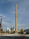
| man_made | chimney | 煙囪。 | |||
| man_made | clarifier | A clarifier of a wastewater treatment plant. | |||
| man_made | clearcut | 皆伐地 | |||
| man_made | column | A column used to support a structure or for decoration. | |||
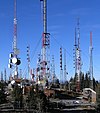
| man_made | communications_tower | 電波塔/通訊塔。 | |||
| man_made | compass_rose | A compass rose or wind rose. | |||
| man_made | compressor | Industrial equipment used to compress a gas by reducing its volume. | |||
| man_made | cooling | Industrial cooling facility. | |||
| man_made | cooling_tower | A cooling tower | |||
| man_made | courtyard | An area that is usually enclosed by walls or buildings. | |||
| man_made | crane | 橋式起重機,常見於港口。 | |||
| man_made | cross | 十字架。 | |||
| man_made | cutline | 森林地界/防火道。 | |||
| man_made | dolphin | A marine structure for berthing and mooring of vessels. | |||
| man_made | dovecote | 鴿籠。 | |||
| man_made | dyke | 防波堤 | |||
| man_made | embankment | 乘載公路、鐵路與運河以橫越低地/濕地的土堤/路堤。 | |||
| man_made | flagpole | 旗桿。 | |||
| man_made | flare | A tower constructed to burn off excess gas. | |||
| man_made | footwear_decontamination | A facility to decontaminate footwear for hikers. | |||
| man_made | frost_fan | A device to stop frosts from damaging crops. | |||
| man_made | fuel_pump | A fuel pump (petrol pump, gas pump) | |||
| man_made | gantry | An overhead structure across a major road usually for holding signs, often variable-message signs. | |||
| man_made | gas_well | A natural gas well | |||
| man_made | gasometer | 煤氣鼓。 | |||
| man_made | geoglyph | A large design or motif (generally longer than 4 metres) produced on the ground | |||
| man_made | goods_conveyor | A conveyor system for transporting materials | |||
| man_made | groyne | 突堤。海堤改用man_made=breakwater | |||
| man_made | guard_stone | A guard stone: a stone built onto or into the corner of a building or wall to prevent carriages from damaging the structure, often found on either side of an entrance to a laneway, or alongside a wall to protect it. | |||
| man_made | guy_wire | Guy wire designed to add stability to a freestanding structure. | |||
| man_made | heap | A large pile of material | |||
| man_made | hongsalmun | A gate for entering a sacred place in Korea. The gate indicates entry to a sacred realm. | |||
| man_made | iljumun | The first gate at the entrance to many Korean Buddhist temples | |||
| man_made | insect_hotel | A structure intended to provide shelter for insects. | |||
| man_made | kiln | 窯。 | |||
| man_made | lighthouse | 海上燈塔/浮標 | |||
| man_made | manhole | Hole with a cover that allows access to an underground service location, just large enough for a human to climb through. | |||
| man_made | mast | 頂端架設天線的桅杆,例如行動電話基地台,通訊塔。 | |||
| man_made | maypole | A tall wooden pole erected as a part of various European folk traditions to celebrate the beginning of summer. | |||
| man_made | milk_churn_stand | A current or former collection point for milk churns. | |||
| man_made | mineshaft | 垂直豎井。 | |||
| man_made | monitoring_station | 遠端遙控站/監測站。 | |||
| man_made | nesting_site | A man made nesting aid that is mounted on a support device. | |||
| man_made | obelisk | Tall, narrow, four-sided, tapered monument which usually ends in a pyramid-like shape at the top. | |||
| man_made | observatory | 天文台。 | |||
| man_made | offshore_platform | 海上作業平台。 | |||
| man_made | oil_gas_separator | Industrial equipment used to separate liquid and gaseous components (oil and gas) produced from a petroleum well. | |||
| man_made | oxidation_ditch | An oxidation ditch of a wastewater treatment plant. | |||
| man_made | paifang | A traditional style of Chinese architectural arch or gateway structure. | |||
| man_made | petroleum_well | 鑽油井。 | |||
| man_made | pier | 桟橋,埠頭。 | |||
| man_made | pipeline | 瓦斯(煤氣)、水或汽油管線。 | |||
| man_made | planter | A structure for planting flowers or other ornamental plants. | |||
| man_made | pump | A device in charge of moving or raising the level of liquids. | |||
| A pumping rig for producing oil. Use of this tag is discouraged. See man_made=petroleum_well instead. | |||||
| man_made | pumping_station | Pumping station: a facility including pumps and equipment for pumping fluids from one place to another | |||
| man_made | quay | A man-made structure alongside navigable water used for loading and unloading vessels. | |||
| man_made | reservoir_covered | 有蓋水庫,如香港的有蓋配水庫。 | |||
| man_made | satellite_dish | A dish-shaped parabolic antenna designed to receive or transmit radio waves to or from a satellite | |||
| man_made | silo | 原料/穀物圓槽。 | |||
| man_made | snow_fence | 用以降低雪崩機率的柵欄。 | |||
| man_made | spoil_heap | Spoil heap, piles of waste rock removed during mining. | |||
| man_made | spring_box | A structure designed for protecting and catching groundwater from a natural spring. | |||
| man_made | storage_tank | 儲油或壓縮瓦斯(煤氣)的儲存槽。 | |||
| man_made | street_cabinet | 變電箱、路燈配置箱、機電箱。 | |||
| man_made | stupa | A Buddhist dome-shaped structure with a spire on top | |||
| man_made | surveillance | 監視器/閉路電視鏡頭。 | |||
| man_made | survey_point | 三角測量點/水準點/圖根點。詳見Wikipedia:zh:水準點。 | |||
| man_made | tailings_pond | Tailings pond: A body of liquid or slurry used to store byproducts of mining operations | |||
| man_made | telescope | 光學/電波望遠鏡 | |||
| man_made | torii | The gate structure found at the entrance of Shinto shrines and (rarely) Japanese Buddhist temples. | |||
| man_made | tower | 高塔。高塔種類配合tower:type=*標註。 | |||
| man_made | threshing_floor | An open air paved area created to thresh the grain harvest and then winnow it. | |||
| man_made | utility_pole | A single pole supporting elevation of any of various and unspecified public utilities, such as power transmission, lighting or telephony. | |||
| man_made | ventilation_shaft | A vertical space in mines, tunnels, or buildings allowing stale air to leave the space underneath and/or fresh air to enter it. | |||
| man_made | video_wall | A digital screen, typically constructed out of smaller LED panels. | |||
| man_made | wastewater_plant | 污水處理廠。 | |||
| man_made | water_tap | 水龍頭。 | |||
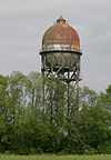
| man_made | water_tower | 儲水塔。 | |||
| man_made | water_well | 水井。 | |||
| man_made | water_works | 淨水廠。 | |||
| man_made | watermill | 傳統水車。 | |||
| man_made | wildlife_crossing | 生態廊道。 | |||
| man_made | windmill | 傳統風車。風力發電機請改用power=generator附加generator:source=wind。 | |||
| man_made | windpump | A device that pumps natural gas or water using the wind, typically mass produced. | |||
| man_made | works | 製造工業產品的工廠。 | |||
| man_made | yes | General tag for man-made (artificial) structures. | |||
| man_made | 使用者自訂 | 到Taginfo查詢常用標籤值 |
This table is a wiki template with a default description in English. Editable here. 此表格由模版自動生成,協助改善中譯版本請按此。
軍事設施 (military)
用來標註陸海空三軍等軍事設施。詳見Military。
| 關鍵字(key) | 值 (value) | 幾何 (element) | 描述 (desc) | 地圖標註 (render) | 照片 (photo) |
|---|---|---|---|---|---|
| military | airfield | 軍機起降場。 | |||
| military | ammunition | 軍用彈藥庫。另見 二戰時期的地堡。 | |||
| military | barracks | 軍事營區、宿舍 | |||
| military | bunker | 軍用碉堡 | |||
| military | checkpoint | 軍事營區人車管制哨口 | |||
| military | danger_area | 危險區域。通常用來標註地雷區、核汙染區域、前方戰線等。 | 
|
||
| military | launchpad | Launchpads used for military purposes, see tag:aeroway=launchpad for civilian use | |||
| military | naval_base | 海軍基地 | |||
| military | nuclear_explosion_site | 核武器試驗場 | |||
| military | obstacle_course | 軍用體能訓練場地。 | |||
| military | office | 軍事機構,例如:參謀本部、軍隊招募中心等 | |||
| military | range | 軍用訓練場地 | |||
| military | training_area | 軍用靶場、武器演習場地 | |||
| military | trench | 戰壕 | |||
| military | 使用者自訂 | 到Taginfo查詢常用標籤值 |
This table is a wiki template with a default description in English. Editable here.
此表格由模版自動生成,協助改善中譯版本請按此。
自然物 (natural)
用來描述自然的物理特徵,詳見Natural。
| 關鍵字(key) | 值 (value) | 元素 (element) | 敘述 (desc) | Tag Usage[1] | 圖例 (render) | 照片 (photo) |
|---|---|---|---|---|---|---|
陸域 | ||||||
| natural | fell | 高山/極地荒原。 | No, see #545. | |||
| natural | grassland | 天然草本植被。人工草皮改用landuse=grass,牧場改用landuse=meadow。 | ||||
| natural | heath | 矮灌木林,以矮林、草本植物為主。 | ||||
| natural | moor | currently not rendered by OSM Carto | ||||
| natural | scrub | 灌木荒地。 | ||||
| natural | shrubbery | An area of shrubbery that is actively maintained or pruned by humans. A slightly wilder look is also possible | currently not rendered by OSM Carto | |||
| natural | tree | 單一顯著的樹。 | ||||
| natural | tree_row | 單排顯著的樹。 | ||||
| natural | tree_stump | A tree stump, the remains of a cut down or broken tree. | ||||
| natural | tundra | Habitat above tree line in alpine and subpolar regions, principally covered with uncultivated grass, low growing shrubs and mosses and sometimes grazed. | ||||
| natural | wood | 非林業管理的天然林。人造林請改用landuse=forest。 | ||||
水域 | ||||||
| natural | bay | 河灣、海灣 | ||||
| natural | beach | 海灘。海水浴場請參見leisure=beach_resort。 | ||||
| natural | blowhole | An opening to a sea cave which has grown landwards resulting in blasts of water from the opening due to the wave action | ||||
| natural | cape | 海岬、陸岬、海角 | ||||
| natural | coastline | 海岸線 | ||||
| natural | crevasse | A large crack in a glacier | ||||
| natural | geyser | 間歇泉 | ||||
| natural | glacier | 冰河 | ||||
| natural | hot_spring | 溫泉 | ||||
| natural | isthmus | A narrow strip of land, bordered by water on both sides and connecting two larger land masses. | ||||
| natural | mud | 泥地。 | ||||
| natural | peninsula | 半島 | ||||
| natural | reef | 礁岩 | ||||
| natural | shingle | 礫石灘。 | ||||
| natural | shoal | An area of the sea floor near the sea surface (literally, becomes shallow) and exposed at low tide. See natural=sand as well. | ||||
| natural | spring | 湧泉 | ||||
| natural | strait | 海峽是兩側陸地包圍的狹長水體 | ||||
| natural | water | 湖/池塘 | ||||
| natural | wetland | 濕地 | ||||
地貌 | ||||||
| natural | arch | A rock arch naturally formed by erosion, with an opening underneath. | currently not rendered by OSM Carto | |||
| natural | arete | 刃脊、瘦稜 | ||||
| natural | bare_rock | 裸岩。植物稀疏或沒有植被,使裸露的岩床清晰可見。 | ||||
| natural | natural=blockfield | A surface covered with boulders or block-sized rocks, usually the result of volcanic activity or associated with alpine and subpolar climates and ice ages. | ||||
| natural | cave_entrance | 天然洞穴口。 | ||||
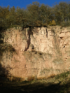
| natural | cliff | 懸崖 | ||||
| natural | dune | A hill of sand formed by wind, covered with no or very little vegetation. See also natural=sand and natural=beach | currently not rendered by OSM Carto | |||
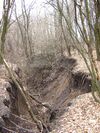
| natural | earth_bank | Large erosion gully or steep earth bank | ||||
| natural | fumarole | A fumarole is an opening in a planet's crust, which emits steam and gases | ||||
| natural | gully | Small scale cut in relief created by water erosion | ||||
| natural | hill | A hill. | currently not rendered by OSM Carto | |||
| natural | peak | 山峰 | ||||
| natural | ridge | 山脊、山稜 | ||||
| natural | rock | 岩地 | currently not rendered by OSM Carto | |||
| natural | saddle | 鞍部、啞口 | ||||
| natural | sand | 沙地。 | ||||
| natural | scree | 碎石坡/崩坍地。 | ||||
| natural | sinkhole | 沉洞、天坑、滲穴 | currently not rendered by OSM Carto | |||
| natural | stone | 顯眼的單顆巨石 | currently not rendered by OSM Carto | |||
| natural | valley | 谷地 | currently not rendered by OSM Carto | |||
| natural | volcano | 火山。 | ||||
| natural | user defined | 到Taginfo查詢常用標籤值 | ||||
This table is a wiki template with a default description in English. Editable here.
辦公室 (office)
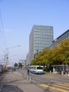
行政部門或專業業務的企業辦公場所。詳情請見Office。
| 關鍵字(key) | 值 (value) | 元素 (element) | 敘述 (desc) | 圖例 (render) | 照片 (photo) |
|---|---|---|---|---|---|
| office | accountant | 會計事務所 | |||
| office | advertising_agency | 廣告、行銷公司 | |||
| office | architect | 建築事務所 | |||
| office | association | 非營利組織(如校友會、運動協會、汽車協會、自行車協會等)辦事處。 | |||
| office | charity | 慈善機構,通常特指以公共利益或慈善為目的並登記在案的非營利組織之辦事處。 | |||
| office | company | 一般公司行號的辦公場所,如未定義時得使用此通用標籤。 | |||
| office | consulting | An office for a consulting firm, providing expert professional advice to other companies or organisations. | |||
| office | cooperative | An office of a cooperative (an autonomous association of persons or organizations). | |||
| office | coworking | 共享工作空間。 | |||
| office | diplomatic | 大使館、領事館、外交辦事處 | |||
| office | educational_institution | 教育機構 | |||
| office | employment_agency | 就業機構/職業介紹所/人力銀行/人力仲介公司 | |||
| office | engineer | An office of an engineer. | |||
| office | energy_supplier | 能源事業辦公處 | |||
| office | [[ Too many Data Items entities accessed. | estate_agent ]] | 房地產仲介所/預售屋接待處。 | |||
| office | financial | An office of a company in the financial sector. | |||
| office | forestry | 林業管理處 | |||
| office | foundation | 基金會辦公處 | |||
| office | geodesist | 土地調查機構 | |||
| office | government | 中央或地方政府機關、辦公大樓。 | |||
| office | graphic_design | An office for a graphic designer. | |||
| office | guide | 旅遊嚮導、登山嚮導、潛水嚮導機構。 | |||
| See healthcare=* for healthcare facilities, office=insurance or Lua error in mw.title.lua at line 209: too many expensive function calls. for a healthcare company. | |||||
| office | insurance | 保險公司辦公處 | |||
| office | it | 資訊產業辦公處 | |||
| office | lawyer | 律師事務所 | |||
| office | logistics | 物流/貨運公司辦公處 | |||
| office | moving_company | 搬家公司辦公處 | |||
| office | newspaper | 報社 | |||
| office | ngo | 非政府組織辦公處 | |||
| office | notary | 公證機構 | |||
| See Lua error in mw.title.lua at line 209: too many expensive function calls. below. | |||||
| office | political_party | 政黨黨部或辦公處 | |||
| office | private_investigator | 私家偵探/徵信社辦公處 | |||
| office | property_management | 物業管理公司辦公場所 | |||
| office | publisher | An office of a company which publishes books or music. | |||
| office | quango | 半官方機構辦公處。 常由政府主導成立、實際運作獨立於政府的機關。如香港:房協、旅發局、醫管局等; 台灣:工研院、資策會、交流協會(實質領館)等。 |
|||
real_estate_agent |
已廢止,請改用Lua error in mw.title.lua at line 209: too many expensive function calls.。 | ||||
| office | religion | 宗教團體辦公處。 如教區/堂區辦公室、廟宇委員會等。 |
|||
| office | research | 研究機構辦公處。 | |||
| office | security | An office for private security guards. | |||
| office | surveyor | 測量師事務所,(如:土地測量、建築測量、產業測量等) | |||
| 政府財政、税務機關。 如:台灣:財政部國稅局/賦稅署、地方稅捐稽徵處等;香港:税務局、差餉物業估價署等;澳門:財政局等;新加坡:內陸稅務局 IRAS。 已停用,改用office=government + Lua error in mw.title.lua at line 209: too many expensive function calls.。 |
|||||
| office | tax_advisor | 專業税務代理人(税務士)辦公室。 | |||
| office | telecommunication | 電信事業 | |||
| office | translator | An office of a translator | |||
| office | travel_agent | 旅行社。 | |||
| office | union | An office of a trade union, an association of workers forming a bargaining unit. | |||
| office | visa | 簽證代辦機構 | |||
| office | water_utility | 自來水事業。 | |||
| office | yes | Generic tag for unspecified office type. | |||
| office | 使用者自訂 | 到Taginfo查詢常用標籤值 |
This table is a wiki template with a default description in English. Editable here.
此表格由模版自動生成,協助改善中譯版本請按此。
地方 (Places)
主要用來標註聚落的細節,詳情請見Place。
| 關鍵字(key) | 值 (value) | 幾何 (element) | 描述 (desc) | 照片 (photo) | Count | |
|---|---|---|---|---|---|---|
行政上宣告的地方 | ||||||
| place | country | 詳見boundary=administrative, Lua error in mw.title.lua at line 209: too many expensive function calls.。 | ||||
| place | state | 詳見boundary=administrative, admin_level=*的變化,不適用於台灣。 | ||||
| place | region | 詳見boundary=administrative, admin_level=*的變化,可能不適用於台灣。對於「自然區域」應查找其它標籤。 | ||||
| place | province | 詳見boundary=administrative, admin_level=*的變化。「省」,其在台灣之編輯強烈參考 [行政區域] | ||||
| place | district | 詳見boundary=administrative, admin_level=*的變化。「區」,其在台灣之編輯強烈參考 [行政區域] | ||||
| place | subdistrict | See boundary=administrative, admin_level=* varies; may not be used in all countries. | ||||
| place | county | 詳見boundary=administrative, admin_level=*的變化。「縣」,其在台灣之編輯強烈參考 [行政區域] | ||||
| place | municipality | 詳見boundary=administrative, admin_level=*的變化,不適用於台灣。 | ||||
人口聚居地,都市 | ||||||
| place | city | 區域內最大的聚落,通常為政府或其他公正的事實所認定,大部分為人口至少有十萬且高於周圍鄉鎮。詳見Lua error in mw.title.lua at line 209: too many expensive function calls.和Lua error in mw.title.lua at line 209: too many expensive function calls.如何在城市中標註地名和鄰里。「市」,其在台灣之編輯強烈參考 [行政區域] | ||||
| place | borough | 詳見boundary=administrative,依照各國,在較大都市的近郊所被集合在一起的行政單元,被稱為「區」(borough),使用「區」(borough)的標籤應避免和國家層級的區混淆。 | ||||
| place | suburb | 都市或城鎮內有明確和獨立的地名。像是:
|
||||
| place | quarter | 被命名的較大聚落中之一部份,而這部份是小於suburb且大於neighbourhood,這並不需要是一個行政實體,quarter一詞的使用有時和neighourhood相同。 | ||||
| place | neighbourhood | 通常為Lua error in mw.title.lua at line 209: too many expensive function calls.、Lua error in mw.title.lua at line 209: too many expensive function calls.和Lua error in mw.title.lua at line 209: too many expensive function calls.的一部分,但小於Lua error in mw.title.lua at line 209: too many expensive function calls.。 | ||||
| place | city_block | 被命名的城市中的街區,可參考 |
||||
| place | plot | 被命名的是一片土地,被某人所擁有。 | ||||
人口聚居地,都市和鄉村 | ||||||
| place | town | 區域內次級的聚落,通常擁有獨立的生活機能(學校、醫院和傳統市場等)。通常有萬人或以上,在低密度區域人口可能更少。詳見Lua error in mw.title.lua at line 209: too many expensive function calls.和Lua error in mw.title.lua at line 209: too many expensive function calls.如何在鄉鎮中標註地名和鄰里。 | ||||
| place | village | 小型且獨立的聚落,通常需要到鄰近的鄉鎮維持生活機能。在不同區域內的聚落人口數常有差異,但人口都不高於一萬。詳見Lua error in mw.title.lua at line 209: too many expensive function calls.如何在聚落中標註鄰。 | ||||
| place | hamlet | 在郊外中通常只有一百多人的聚落。 | ||||
| place | isolated_dwelling | 在郊外用來標示只有幾間房舍的聚落。 | ||||
| place | farm | 標註明顯且獨立的農舍。詳見landuse=farmyard | ||||
| place | allotments | Dacha or cottage settlement, which is located outside other inhabited locality. This value is used mainly in Russia and other countries of the former Soviet Union, where a lot of such unofficial settlements exist | ||||
其他 | ||||||
| place | continent | 世界七大洲,包含非洲、南極洲、亞洲、澳洲、歐洲、北美洲、和南美洲。 | ||||
| place | archipelago | 一個可以區分出是由一群小島或島所組成的地方。 | ||||
| place | island | 一個可區分的海岸線的島(>1平方公里),Lua error in mw.title.lua at line 209: too many expensive function calls.是用於非常小的島。 | ||||
| place | islet | 小於1平方公里的小島或礁。 | ||||
| place | square | 對一個在城鎮中的廣場( |
||||
| place | locality | 標示無人居的區域。 | ||||
| place | polder | 圩 | ||||
| place | sea | A part of an ocean. | ||||
| place | ocean | The world's five main major oceanic divisions. | ||||
| place | User Defined | All commonly used values according to Taginfo | ||||
附加屬性 | ||||||
| population | Number | 標示一地方的的居民人數,更建議的是,人口數可以被用來決定在那一種地圖縮放尺度顯示字體大小。 | ||||
| is_in | Text | 選擇性的。用來描述界線層級的基本方式,例如: Lua error in mw.title.lua at line 209: too many expensive function calls.; name=Eccleshall; Lua error in mw.title.lua at line 209: too many expensive function calls. 。 | ||||
This section is a wiki template with a default description in English. Editable here. 此表格由模版自動生成,協助改善中譯版本請按此。
電力 (power)
用來標註電廠和其分配系統,詳見Power。
| 關鍵字(key) | 值 (value) | 元素 (element) | 敘述 (desc) | 圖例 (render) | 照片 (photo) |
|---|---|---|---|---|---|
| power | cable | 地底/海底電纜(電力或通訊用途)。電纜種類得以Lua error in mw.title.lua at line 209: too many expensive function calls.、Lua error in mw.title.lua at line 209: too many expensive function calls.Lua error in mw.title.lua at line 209: too many expensive function calls.標註。 | |||
| power | catenary_mast | A catenary mast supports system of overhead wires used to supply electricity to electricaly powered vehicle equipped with a pantograph. | |||
| power | compensator | 補償器,用以維持配電電壓與彈性。 | |||
| power | connection | A freestanding electrical connection between two or more overhead wires | |||
| power | converter | 一次變電所。 | |||
| power | generator | 發電機組。發電機組種類得以generator:source=*、Lua error in mw.title.lua at line 209: too many expensive function calls. 與 Lua error in mw.title.lua at line 209: too many expensive function calls.標註。 | |||
| power | heliostat | 定日鏡,用於聚光太能熱發電。 | |||
| power | insulator | 絕緣礙子。 | |||
| power | line | 高壓電線。 | |||
| line | busbar | Specifies that a Lua error in mw.title.lua at line 209: too many expensive function calls. is a busbar in a substation. | |||
| line | bay | Specifies a Lua error in mw.title.lua at line 209: too many expensive function calls. is a bay which connects an incoming circuit to a busbar assembly. | |||
| power | minor_line | 低壓電線。 | |||
| power | plant | 電廠。 電廠內的獨立發電機組應標記為 power=generator。 |
|||
| power | pole | 電線杆。 | |||
| power | portal | Power supporting structure composed of vertical legs with cables between them attached to a horizontal crossarm | |||
| power | substation | A tag for electricity substations. These provide voltage step-up/step-down, switching, conditioning, etc. Substations may be large facilities (up to several acres) for very high voltage transmission lines or just small buildings or kiosks near the street for low voltage distribution lines. Useful combinations: Lua error in mw.title.lua at line 209: too many expensive function calls.,substation=* and Lua error in mw.title.lua at line 209: too many expensive function calls., see the feature page for details. | |||
| power | switch | 變電箱。 | |||
| power | switchgear | The switchgear comprises one or more busbar assemblies and a number of bays each connecting a circuit to the busbar assembly. | |||
| power | terminal | Point of connection between overhead power lines to buildings or walls | |||
| power | tower | 高壓電塔,普通的電力傳輸請使用Lua error in mw.title.lua at line 209: too many expensive function calls.和Lua error in mw.title.lua at line 209: too many expensive function calls.。 | |||
| power | transformer | A static device for transferring electric energy by inductive coupling between its windings. Large power transformers are typically located inside substations. | |||
| power | 使用者自訂 | 到Taginfo查詢常用標籤值 |
This table is a wiki template with a default description in English. Editable here.
此表格由模版自動生成,協助改善中譯版本請按此。
大眾運輸(Public Transport)
有關大眾運輸的功能。詳見Public transport取得更多資訊。
| 關鍵字(key) | 值 (value) | 元素 (element) | 敘述 (desc) | 圖例 (render) | 照片 (photo) |
|---|---|---|---|---|---|
| public_transport | stop_position | 公車停靠站、鐵路招呼站。 | |||
| public_transport | platform | 月台。 | |||
| public_transport | station | 公車轉運站、鐵路車站。 | |||
| public_transport | stop_area | 各類大眾運輸(如鐵路、地鐵、單軌電車、公車、電車、纜車、渡輪)車站用地。 | |||
| public_transport | 使用者自訂 | 到Taginfo查詢常用標籤值 |
This table is a wiki template with a default description in English. Editable here.
此表格由模版自動生成,協助改善中譯版本請按此。
Template:Map Features:railway
此表格由模版自動生成,協助改善中譯版本請按此。
Template:Zh-hant:Map Features:route Template:Zh-hant:Map Features:shop Template:Zh-hant:Map Features:sport Template:T Template:Zh-hant:Map Features:tourism Template:Zh-hant:Map Features:waterway
附屬屬性
Template:Zh-hant:Map Features:addr Template:Zh-hant:Map Features:annotation Template:Zh-hant:Map Features:name Template:Zh-hant:Map Features:properties Template:Zh-hant:Map Features:references Template:Zh-hant:Map Features:restrictions
- ↑ Does not include uses in semi-colon value separated lists
