3D Hydrography Program
See Import/Guidelines and Automated Edits code of conduct for more information. Imports/automated edits which do not follow these guidelines might be reverted!
The 3D Hydrography Program (3DHP) is a United States-wide w:en:hydrography dataset produced by the United States Geological Survey (USGS). It is the successor to the now retired NHD and uses data from the USGS 3D Elevation Program (3DEP). This dataset includes natural and man-made water features: rivers, lakes, drains, springs, sinks, canals, culverts, and pipelines. Unlike the NHD the 3DHP does not make a distinction between lakes and ponds, and between rivers and streams. Named features include GNIS IDs which can specify a stream versus a river however.
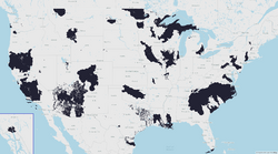
As a product of the US Government, the dataset is in the public domain. The 3DHP is the first nationwide remapping of water in the United States since 1992.[1] The first new data was made available as a service in October 2023. Complete coverage of the United States is expected to be done in 2032.[2]
Getting the data
See: Access 3DHP Data Products | U.S. Geological Survey
The GIS web service usgs_3dhp_all can be found through 3dhp.nationalmap.gov. This service returns data from the old NHD wherever new data is not available. Currently that is almost everywhere.
To filter out NHD data from the web service, workunitid<>'NHD' can be used.
A downloadable copy of the data as of 2024 is available at 3D Hydrography Program (3DHP) 2024 Staged Product (FY25 Release) - ScienceBase-Catalog. The Alaska file is approximately 1.7 gigabytes in FileGDB format or 3 GB as a GeoPackage. The continental United States file is 11 GB in FileGDB format or 20 GB as a GeoPackage.
Eventually there should be 3DHP data available from the USGS National Map.
Data structure and fields
The data in the 3DHP is structured into several different types of features:
- Hydro locations (points)
- Flowlines (lines)
- Waterbodies (polygons)
- Drainage areas (polygons)
- Catchments (polygons)
Drainage areas and catchments are probably not relevant to OpenStreetMap. The flowlines and waterbodies would be the most likely to be of interest.
Common fields
- id3dhp: Unique identifier
- featuredate: Date the feature was created
- mainstemid: A url representing a w:en:Main stem (example 1, example 2)
- gnisid: gnis:feature_id=*
- gnisidlabel: name=*
- featuretype: Indicator of the type of feature
- featuretypelabel: Text description of the above (‘River’, ‘Canal’, …)
Attributes-to-OSM-tags
There does not appear to be any indication of a water feature being intermittent. It could be possible to use the NHD to find features with FCODE 39001, 39010, 43614, 46003, or 46007 and conflate them with data in the 3DHP at the same location.
| Feature type | Code | Description | OSM Tag | Comments |
|---|---|---|---|---|
| Flowline | 1 | River | waterway=stream or waterway=river | |
| Flowline | 2 | Canal | waterway=canal | |
| Flowline | 3 | Drainageway | waterway=drain | |
| Flowline | 4 | Surface Connector | waterway=stream or waterway=river | |
| Flowline | 5 | Waterbody Connector | waterway=link or waterway=flowline | |
| Flowline | 6 | Elevation Breaching Connector | waterway=stream + tunnel=culvert | |
| Flowline | 7 | Hydro Unenforced Connector | man_made=pipeline | |
| Waterbody | 1 | River | natural=water + water=stream or water=river | |
| Waterbody | 2 | Canal | natural=water + water=canal | |
| Waterbody | 3 | Lake | natural=water + maybe water=lake or water=pond or water=reservoir | |
| Waterbody | 4 | Ocean or Great Lake | N/A | |
| Hydrolocation | 1 | Catchment Outlet | N/A | |
| Hydrolocation | 2 | Confluence | N/A | |
| Hydrolocation | 3 | Waterbody Outlet | N/A | |
| Hydrolocation | 4 | Divergence | N/A | |
| Hydrolocation | 5 | Terminus | N/A | |
| Hydrolocation | 6 | Headwater | N/A | |
| Hydrolocation | 7 | Spring | natural=spring | |
| Hydrolocation | 8 | Sink | natural=sinkhole + sinkhole=ponor | |
| Hydrolocation | 9 | External Connection | N/A | |
| Hydrolocation | 10 | Reachcode Start | N/A | Start point of an NHD reach code (found on existing ways with nhd:reach_code=* or NHD:ReachCode=*) |
| Hydrolocation | 11 | Reachcode End | N/A | End point of an NHD reach code |
See also
External links
- 3D Hydrography Program - U.S. Geological Survey
- 3D Hydrography Program For The Nation (3DHP FTN) Information Hub
- 3DHP_all (MapServer)
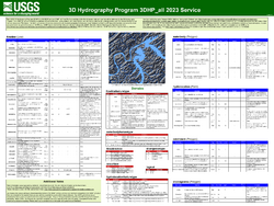
- 3DHP_all 2023 Service Poster
- 3D Hydrography Program Product Specification
- 3DHP_all 2023 Service Specification
- 3DHP_all 2023 Service Specification PDF
- Crosswalk Tables (NHD to 3DHP)
- Understanding the Transition from NHDPlus HR to 3DHP - YouTube
- USGS-NFHP Webinar - The National Map and the 3D Hydrography Program - YouTube
- The 3D Hydrography Program at one year – what was accomplished in FY24, what is planned for FY25? - YouTube
- Dec 2024 USGS Hydrography Community Call: Delivering and Using 3D Hydrography Program (3DHP) Data - YouTube


