Tag:natural=sinkhole
| Description |
|---|
| A natural depression or hole in the surface topography. |
| Group: natural |
| Used on these elements |
| Useful combination |
|
| See also |
| Status: approved |
| Tools for this tag |
|
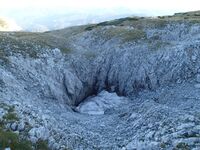
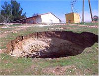
A ![]() sinkhole, also known as a sink, shake hole, snake hole, swallow hole, swallet, doline, or cenote, is a natural depression or hole in the surface topography caused by the removal of soil or bedrock, often both, by water and/or by collapse of an underlying cavity. A typical form of a sinkhole is a crater. Sinkholes are abundant on
sinkhole, also known as a sink, shake hole, snake hole, swallow hole, swallet, doline, or cenote, is a natural depression or hole in the surface topography caused by the removal of soil or bedrock, often both, by water and/or by collapse of an underlying cavity. A typical form of a sinkhole is a crater. Sinkholes are abundant on ![]() karst plateaus.
karst plateaus.
Don't mix this up with a ![]() polje, which is much larger, or with a natural=cave_entrance. On the bottom of a sinkhole, however, there may be a cave entrance. In this case, you may wish to map both, if the sinkhole is of remarkable size; or the cave entrance only, otherwise.
polje, which is much larger, or with a natural=cave_entrance. On the bottom of a sinkhole, however, there may be a cave entrance. In this case, you may wish to map both, if the sinkhole is of remarkable size; or the cave entrance only, otherwise.
Sinkholes vary in size from 1 to 600 m (3.3 to 2,000 ft) both in diameter and depth, and vary in form from soil-lined bowls to bedrock-edged chasms.
Consider also tagging any cliffs using natural=cliff
This tag can be specified using sinkhole=*, to precise the type of sinkhole; for OSM, used with anthropogenic=yes, natural=sinkhole and sinkhole=* can describe an anthropogenic sinkhole-like orifice, a cave-in for instance. Remember that natural=* doesn't necessarily designate natural features.
Photos
Great Blue Hole
 Great Blue Hole - a rare case of a submarine doline (mapped as natural=cave_entrance)
See also
- natural=cave_entrance – for the entrance to an underground cave, often found associated with sinkholes.
- natural=cliff – to map vertical or near-vertical rock faces, including the edges of some sinkholes.
- natural=blowhole – an opening to a sea cave which has grown landwards resulting in blasts of water from the opening due to the wave action.
- waterway=soakhole – The point at which a river or stream percolates into or through the soil.
- man_made=mineshaft – man-made vertical mine entrance
- inlet=bell_mouth – inlet that resembles a ponor sinkhole
- Proposal:Natural=cave – detailed mapping of caves
- hazard=hole


