Amber Valley
| V・T・E |
| latitude: 53.019, longitude: -1.484 |
| Browse map of Amber Valley 53°01′08.40″ N, 1°29′02.40″ W |
| Edit map |
|
External links:
|
| Use this template for your locality |
Amber Valley is a district in Derbyshire at latitude 53°01′08.40″ North, longitude 1°29′02.40″ West.
Amber Valley is a district in the county of Derbyshire.
Locations
Hiking, Biking and Horseriding Trails
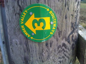
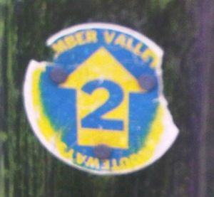
A series of numbered routes ("Amber Valley Routeways") are signed locally ([1]). Walks have green signs, rides (presumably designed for horses) blue:
Amber Valley Routeway Walk 2 is relation 1604114![]() 1604114 (incomplete)
1604114 (incomplete)
Amber Valley Routeway Walk 3 is relation 1701416![]() 1701416 (incomplete)
1701416 (incomplete)
Amber Valley Routeway Walk 4 is relation 1701381![]() 1701381 (incomplete)
1701381 (incomplete)
Amber Valley Routeway Walk 5 is relation 1473232![]() 1473232 (incomplete)
1473232 (incomplete)
Amber Valley Routeway Walk 7 is relation 1741507![]() 1741507 (incomplete)
1741507 (incomplete)
Amber Valley Routeway Walk 8 is relation 1473245![]() 1473245 (incomplete)
1473245 (incomplete)
Amber Valley Routeway Walk 9 is relation 1807442![]() 1807442 (incomplete)
1807442 (incomplete)
Amber Valley Routeway Walk 10 is relation 1959976![]() 1959976 (incomplete)
1959976 (incomplete)
Amber Valley Routeway Walk 11 is relation 1823935![]() 1823935 (incomplete)
1823935 (incomplete)
Amber Valley Routeway Walk 12 is relation 2698629![]() 2698629 (incomplete)
2698629 (incomplete)
Amber Valley Routeway Walk 14 is relation 2097330![]() 2097330 (incomplete)
2097330 (incomplete)
Amber Valley Routeway Walk 16 is relation 1668626![]() 1668626 (incomplete)
1668626 (incomplete)
Amber Valley Routeway Walk 17 is relation 1807359![]() 1807359 (incomplete)
1807359 (incomplete)
Amber Valley Routeway Walk 19 is relation 1604139![]() 1604139 (incomplete)
1604139 (incomplete)
Amber Valley Routeway Walk 20 is relation 1838214![]() 1838214 (incomplete)
1838214 (incomplete)
Amber Valley Routeway Walk 21 is relation 1604142![]() 1604142 (incomplete)
1604142 (incomplete)
There were also two rides. Amber Valley Routeway Ride 1 was relation 1702422![]() 1702422 (incomplete) but was withdrawn by the council on safety grounds.
1702422 (incomplete) but was withdrawn by the council on safety grounds.
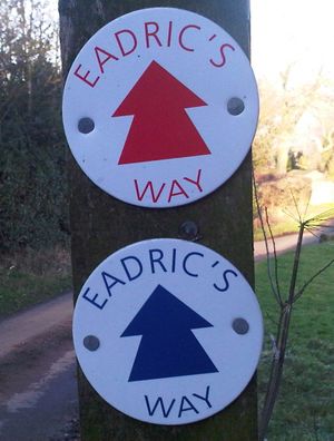
Eadric's Way is a short (red) or slightly longer (blue) walk from Idridghay station. The Red walk is relation 1543714![]() 1543714
1543714
The Cromford Canal Footpath also runs through the Amber Valley.


