Category:Maps of Germany
Jump to navigation
Jump to search
Subcategories
This category has only the following subcategory.
M
Media in category "Maps of Germany"
The following 31 files are in this category, out of 31 total.
- 2008-09-07 GermanRailNetwork.jpg 2,000 × 2,711; 982 KB
- 2013-12-de-postals.png 1,481 × 2,094; 2.3 MB
- Autobahn Process.png 1,676 × 2,244; 856 KB
- DE biergarten - 3D barplot.png 988 × 673; 530 KB
- Designated foot bicycle D Sep 2022.png 651 × 860; 522 KB
- Dresden.jpg 757 × 579; 84 KB
- FacilMap.png 1,920 × 1,080; 3.72 MB
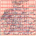
- Garmin Maps Maptiles Germany.png 780 × 780; 156 KB
- German Power Grid Voltage Map screenshot.png 697 × 608; 87 KB
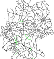
- GermanRailNetwork.png 744 × 1,001; 265 KB
- GermanRailNetworkMar2007.png 744 × 1,001; 193 KB
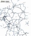
- Germany motorways.jpg 2,851 × 3,252; 317 KB
- Germany overview 1april.jpg 349 × 492; 48 KB
- Germany overview.png 420 × 569; 702 KB
- Germany-users.png 480 × 600; 170 KB
- GermanyCycleRoutes.jpg 1,730 × 2,280; 1.03 MB
- Gt3cover.jpg 320 × 480; 35 KB
- Konsolidierung der PLZ-Relationen in Deutschland 2013 vorher nachher.png 1,502 × 651; 1.27 MB
- Matekate screenshot.png 499 × 400; 202 KB
- Maxheight Map Heatmap Germany.png 992 × 1,403; 1 MB
- Openfietsmap de.jpg 435 × 594; 142 KB
- Openptmap blank bg.png 838 × 909; 263 KB
- Osm3d-germany.jpg 345 × 433; 51 KB
- PLZ-NW.png 451 × 608; 40 KB
- Plz-statistik-brd.png 1,753 × 1,240; 1.43 MB
- Plz-zonen01.png 1,753 × 1,240; 428 KB
- Power line-in-germany.png 2,074 × 2,763; 1.83 MB
- Scr08.png 900 × 617; 473 KB
- Speed-index-germany.png 400 × 539; 293 KB
- Voltage-de.png 2,390 × 3,266; 1.37 MB
- Voltage-on-maperitive.png 632 × 894; 142 KB


