Category:Maps of India
Jump to navigation
Jump to search
Pages in category "Maps of India"
This category contains only the following page.
Media in category "Maps of India"
The following 11 files are in this category, out of 11 total.
- Forest Cover in India.png 1,947 × 2,084; 728 KB
- India Health Facility.jpg 1,101 × 827; 245 KB
- India OSM district boundaries.jpg 2,402 × 2,603; 1.12 MB
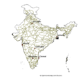
- India-road-network-feb-2021.png 1,086 × 762; 473 KB
- Multilingual-india-map.gif 785 × 492; 614 KB
- National Highways India.png 2,188 × 2,133; 584 KB
- Railways in India.png 1,892 × 2,145; 602 KB
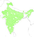
- Reserviors and Ponds in India.png 1,947 × 2,045; 671 KB
- Rivers and its tributaries in India.png 2,107 × 2,063; 819 KB
- Roads India.png 1,965 × 2,048; 981 KB
- Waterways India.png 1,914 × 2,095; 751 KB


