Category:PD-creator-licensed
Jump to navigation
Jump to search
This category is for image files on the wiki which have been released to the public domain by their creator; the cat name is a bit of a misnomer as the public domain is not a license, since it is an attempt to delocalise the so-called moral right (which some jurisdictions have no provision for).
Media in category "PD-creator-licensed"
The following 98 files are in this category, out of 98 total.
- 1000kv 8c.png 922 × 952; 1.04 MB
- 48px-Preferences-system-bw.svg.png 48 × 48; 2 KB
- AfterAH-DomissStyle-w desc.jpg 1,920 × 1,041; 731 KB
- AfterAH-DomissStyle.png 1,920 × 1,039; 2.54 MB
- AfterAH-Javnik-w desc.jpg 1,920 × 1,041; 613 KB
- AfterAH-Javnik.png 1,920 × 1,039; 1.61 MB
- BeforeAH-geop-middle.png 1,920 × 1,040; 1.15 MB
- BeforeAH-w data.png 1,920 × 1,040; 1.41 MB
- Curling-icon-20.png 32 × 24; 582 bytes
- Dept proportional completion pie chart colombia floods 2010.png 278 × 313; 10 KB
- Dupenode map Columbia permalink 20110701 2052 EST.png 1,167 × 758; 191 KB
- English PostBox Panel.jpg 254 × 385; 18 KB
- Example 3 landuse bush.jpg 4,160 × 2,340; 4.06 MB
- Fence.png 300 × 195; 139 KB
- Fragmented-poly.png 1,872 × 1,362; 1.99 MB
- Geoidheight de.svg 600 × 348; 4 KB
- Geoidheight GPS de.png 1,063 × 591; 63 KB
- Give way.jpg 323 × 440; 41 KB
- Gully in the Kharkiv region.jpg 640 × 853; 240 KB
- Headleys Antiques.png 1,628 × 1,488; 3.98 MB
- ILCOR AED sign.jpg 602 × 600; 23 KB
- ITA SS 113.png 348 × 223; 14 KB
- ITA SS 114 route.png 348 × 223; 12 KB
- ITA SS 115 route.png 348 × 223; 14 KB
- ITA SS 116 route.png 348 × 223; 12 KB
- ITA SS 120 route.png 348 × 223; 13 KB
- ITA SS 121 route.png 348 × 223; 13 KB
- ITA SS 124 route.png 348 × 223; 23 KB
- Karwendelhaus.jpg 2,016 × 1,512; 774 KB
- Laurel Hill - VBMP.png 1,836 × 1,788; 2.64 MB
- Lok.png 30 × 30; 967 bytes
- MassGIS Basemap Example.png 1,240 × 230; 462 KB
- MassGIS Parcels Example.png 620 × 320; 12 KB
- MassGIS Shaded Relief LiDAR, Assabet River National Wildlife Refuge.jpg 1,962 × 1,181; 340 KB
- MassGIS Slope LiDAR, Assabet River National Wildlife Refuge.jpg 2,041 × 1,230; 383 KB
- Mf area no.svg 30 × 30; 2 KB
- Mf area query.svg 30 × 30; 2 KB
- Mf area yes.svg 30 × 30; 2 KB
- Mf node no.svg 30 × 30; 1 KB
- Mf node query.svg 30 × 30; 2 KB
- Mf node yes.svg 30 × 30; 1 KB
- Mf relation no.svg 30 × 30; 2 KB
- Mf relation query.svg 30 × 30; 3 KB
- Mf relation yes.svg 30 × 30; 2 KB
- Mf way no.svg 30 × 30; 2 KB
- Mf way query.svg 30 × 30; 3 KB
- Mf way yes.svg 30 × 30; 2 KB
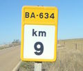
- Milestone BA-634.jpg 597 × 507; 57 KB
- Min level 2.svg 1,135 × 863; 12 KB
- NextRight.png 34 × 153; 966 bytes
- North Winchester.png 1,782 × 1,810; 5.95 MB
- Notes-symbols.png 130 × 70; 3 KB
- OCHA versus prior import boundary discrepancy.png 510 × 438; 26 KB
- Pack Horse Road.png 1,606 × 1,472; 4.15 MB
- Pillbox at Curzon Bridges (South) cropped.jpg 810 × 446; 88 KB
- Place of worship.png 640 × 440; 546 KB
- Pool - Geom Gap.png 1,336 × 1,432; 535 KB
- Primary-photo.jpg 800 × 600; 65 KB
- Proportional completion pie chart 20101226 2320 EST.png 427 × 309; 13 KB
- Providencia and Santa Catalina - landsat and OCHA and OSM data.png 473 × 717; 360 KB
- Rechenknecht-PlattenShelf.jpg 800 × 325; 30 KB
- Rechenknecht-Prozessoren.jpg 1,024 × 783; 211 KB
- Rechenknecht.jpg 1,024 × 768; 149 KB
- RightNextRight.png 35 × 153; 1 KB
- Ru Min level 2.svg 1,135 × 863; 12 KB
- San Andreas southern margin - landsat and OCHA and OSM data.png 461 × 351; 131 KB
- San Damiano.png 1,872 × 1,272; 2.93 MB
- State Exit.svg 32 × 20; 2 KB
- State Exit0.svg 32 × 20; 2 KB
- State Exit1.svg 32 × 20; 2 KB
- State Exit2.svg 32 × 20; 2 KB
- State Exit3.svg 32 × 20; 2 KB
- State Exit4.svg 32 × 20; 2 KB
- State ExitX.svg 32 × 20; 2 KB
- State Train.svg 32 × 20; 4 KB
- State Train0.svg 32 × 20; 4 KB
- State Train1.svg 32 × 20; 4 KB
- State Train2.svg 32 × 20; 4 KB
- State Train3.svg 32 × 20; 4 KB
- State Train4.svg 32 × 20; 4 KB
- State TrainX.svg 32 × 20; 4 KB
- State U-Bahn.svg 32 × 20; 2 KB
- State U-Bahn0.svg 32 × 20; 2 KB
- State U-Bahn1.svg 32 × 20; 2 KB
- State U-Bahn2.svg 32 × 20; 2 KB
- State U-Bahn3.svg 32 × 20; 2 KB
- State U-Bahn4.svg 32 × 20; 2 KB
- State U-BahnX.svg 32 × 20; 2 KB
- State Wheelchair1.svg 32 × 20; 2 KB
- Surface gravel.jpg 2,560 × 1,920; 1.32 MB
- Surface paving stones.jpg 640 × 480; 80 KB
- Upload Chunk Extents.png 1,754 × 1,734; 1.26 MB
- Valley Structures.png 998 × 1,798; 2.8 MB
- Vaupes progress in pink.png 677 × 794; 72 KB
- Wikipedia on OpenStreetMap screenshot.png 538 × 321; 259 KB
- Zug-h.png 30 × 30; 510 bytes
- Zug2.png 30 × 30; 591 bytes


