Category:Tagging explained by drawings
Jump to navigation
Jump to search
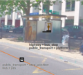
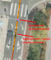
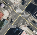
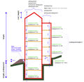
This category collects images which contain tags and explain tagging of features.
Subcategories
This category has the following 3 subcategories, out of 3 total.
P
- Plantuml (1 P, 10 F)
- Platform Edge Images (5 F)
W
- Way Direction Example (2 F)
Media in category "Tagging explained by drawings"
The following 200 files are in this category, out of 372 total.
(previous page) (next page)- 004 interesting tags n.png 532 × 420; 385 KB
- 3 bus stops.svg 372 × 262; 14 KB
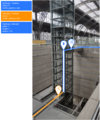
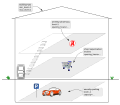
- 3D elevator -3 floor.png 935 × 506; 63 KB
- A-simple-bus-station.svg 1,300 × 717; 28 KB
- A-simple-bus-stop.svg 1,300 × 717; 20 KB
- A-simple-halt.svg 1,296 × 508; 50 KB
- A-simple-station-ru.svg 1,296 × 502; 139 KB
- Access=no Mapnik rendering.png 374 × 177; 11 KB
- Airside crossing example.png 2,002 × 1,161; 38 KB
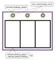
- Amenity charging station.png 631 × 695; 38 KB
- Amenity school pl.svg 375 × 250; 19 KB
- Amenity School Proposal PT.png 500 × 333; 24 KB
- Amenity school usage example complex - Proposal.svg 550 × 250; 12 KB
- Amenity school usage example single school - Proposal.svg 375 × 250; 3 KB
- Amenity school usage example.svg 375 × 235; 5 KB
- Asl tags.svg 174 × 139; 12 KB
- Aufzug mit Tags.png 1,750 × 2,696; 328 KB
- Avalanche protection=gazex.svg 1,280 × 321; 17 KB
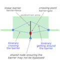
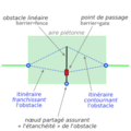
- Barrier and waypoint-EN.png 300 × 300; 33 KB
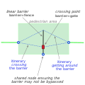
- Barrier and waypoint-EN.svg 270 × 270; 23 KB
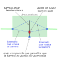
- Barrier and waypoint-ES.svg 270 × 270; 23 KB
- Barrier and waypoint-FR.png 300 × 300; 34 KB
- Base line kerb line DE.png 980 × 640; 139 KB
- Base line kerb line.png 980 × 640; 129 KB
- Beispieltagging einer Bushaltestelle - 1.png 1,315 × 731; 1.75 MB
- Beispieltagging einer Bushaltestelle - 2A.png 1,320 × 743; 1.68 MB
- Beispieltagging einer Bushaltestelle - 2B.png 1,319 × 740; 1.69 MB
- Belgian railway signal F-W.7 in Blankenberge.svg 659 × 1,073; 21 KB
- Bild 2.jpg 545 × 573; 89 KB
- Bild 30.jpg 822 × 594; 124 KB
- Bild 31.jpg 822 × 594; 125 KB
- BottomHeightAndShape.jpg 1,364 × 362; 206 KB
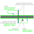
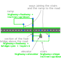
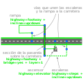
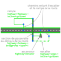
- Bridge steps elevator-EN.png 300 × 300; 31 KB
- Bridge steps elevator-EN.svg 270 × 270; 41 KB
- Bridge steps elevator-ES.svg 270 × 270; 41 KB
- Bridge steps elevator-FR.png 300 × 300; 31 KB
- Buffered lane example.png 499 × 264; 36 KB
- Building complex 1.png 629 × 666; 48 KB
- Building complex 2.png 629 × 666; 47 KB
- Building complex 3.png 629 × 666; 47 KB
- Building house terraced example.svg 770 × 322; 16 KB
- Building indoor elevator-EN.png 300 × 300; 38 KB
- Building indoor elevator-EN.svg 270 × 270; 42 KB
- Building indoor elevator-ES.svg 270 × 270; 42 KB
- Building indoor elevator-FR.png 300 × 300; 39 KB
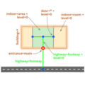
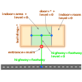
- Building indoor floor level-EN.png 300 × 300; 32 KB
- Building indoor floor level-EN.svg 270 × 270; 25 KB
- Building indoor floor level-ES.svg 270 × 270; 26 KB
- Building indoor floor level-FR.png 300 × 300; 34 KB
- Building indoor routing-FR.png 300 × 300; 21 KB
- Building indoor routing.svg 270 × 270; 23 KB
- Building indoor steps-EN.png 300 × 300; 39 KB
- Building indoor steps-EN.svg 270 × 270; 33 KB
- Building indoor steps-ES.svg 270 × 270; 33 KB
- Building indoor steps-FR.png 300 × 300; 39 KB
- Bus place.jpg 3,264 × 2,448; 2.39 MB
- Bus stop annoté.png 441 × 398; 313 KB
- Bus-n91.jpg 2,231 × 1,604; 337 KB
- Charging station tags fr unique-parking.png 633 × 389; 61 KB
- Charging station tags fr-bis.webp 633 × 389; 23 KB
- Collegiate university example.svg 556 × 211; 15 KB
- Cottage on a chicken foot 3D height definition.jpg 1,389 × 1,760; 230 KB
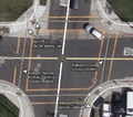
- Crossing junction Hermannplatz.png 1,206 × 1,514; 585 KB
- Crossing scheme russian.png 480 × 323; 55 KB
- Crossover-tagging.svg 694 × 171; 9 KB
- Cycle barrier angular distances.png 361 × 259; 10 KB
- Cycle barrier angular.png 361 × 259; 9 KB
- Cycle barrier double distances.png 361 × 259; 6 KB
- Cycle barrier double.png 361 × 259; 11 KB
- Cycle barrier single distances.png 361 × 259; 3 KB
- Cycleway separation left-right scheme.png 3,529 × 1,603; 144 KB
- Cycleway-asl.png 362 × 421; 67 KB
- Destination vs destination lanes.svg 301 × 151; 29 KB
- Destinationlabel.png 1,000 × 281; 73 KB
- Elevator Dimensions Proposal - Doors of different sizes.svg 1,063 × 1,052; 46 KB
- Elevator Dimensions Proposal - Doors on adjacent sides.svg 1,063 × 1,052; 53 KB
- Elevator Dimensions Tagging Guide OpenStreetMap.jpg 2,000 × 1,500; 506 KB
- Elevator proposal - different doors on different levels.png 1,069 × 531; 52 KB
- Entrance-tagging.png 367 × 299; 12 KB
- Escalator diagram 327.jpg 1,685 × 1,123; 239 KB
- Example Bus station for PTv3.png 737 × 157; 22 KB
- Example kerbs.png 738 × 686; 675 KB
- F3DBAreaStepsAndAreaFootwayExample.jpg 472 × 360; 66 KB
- F3DBbridgeV1.jpg 2,483 × 1,904; 976 KB
- F3DBdoorOpeningDirectionDefinition.jpg 674 × 1,016; 167 KB
- F3DBdoorOpeningDirectionDefinitionV1.jpg 509 × 825; 143 KB
- F3DBdoorOpeningDirectionDefinitionV2.jpg 509 × 981; 161 KB
- F3DBLowestBuildingPoint.jpg 664 × 452; 139 KB
- F3DbuildingSectionV1.jpg 1,244 × 1,217; 467 KB
- Fahrstuhl Schaubild.png 3,524 × 4,213; 12.61 MB
- Farm power plant.png 1,180 × 745; 63 KB
- Flood Prone Area.png 640 × 480; 22 KB
- Flood Prone Bridge.png 640 × 480; 24 KB
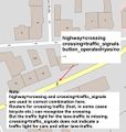
- Footway-crossing.jpg 717 × 445; 57 KB
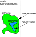
- ForestWithLake.png 640 × 645; 50 KB
- FR Opening hours basic.svg 575 × 250; 20 KB
- Freispiegelströmung.jpg 714 × 410; 29 KB
- Haltestelle.jpg 426 × 234; 9 KB
- Harbour.jpg 900 × 603; 146 KB
- Hochbordradweg Weserstraße beschriftet.jpg 1,990 × 1,455; 911 KB
- Hospital scheme.svg 1,052 × 744; 26 KB
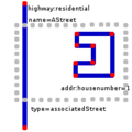
- HouseNumbersInterpolation.png 100 × 200; 3 KB
- HousePolygonNextToRoad.png 200 × 200; 4 KB
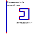
- HousePolygonNextToRoadWName.png 200 × 200; 4 KB
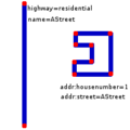
- HousePolygonNextToRoadWRel.png 200 × 200; 6 KB
- Houses of parliament.png 1,105 × 749; 333 KB
- HouseWithHoles.png 640 × 521; 35 KB
- Hungary urban landuse example.png 672 × 538; 88 KB
- Indian-Railways-openstreetmap-tagging-scheme.png 500 × 1,203; 98 KB
- Indoor2.0 elements.svg 1,488 × 461; 210 KB
- Indoor2.0 simple poi.svg 921 × 804; 238 KB
- Japan SAPAmapping irregular.png 2,246 × 1,426; 786 KB
- Kendzi3d windows 4.svg 512 × 384; 122 KB
- Landuse=farmland.jpg 800 × 600; 106 KB
- Landuse=farmyard and landuse=farm.jpg 800 × 600; 81 KB
- Landuse=farmyard and landuse=meadow.jpg 800 × 600; 106 KB
- Landuse=farmyard.jpg 800 × 600; 127 KB
- Lanes-dualcarriageintersection-002.png 862 × 481; 73 KB
- Lanes-dualcarriageintersection-003.png 235 × 479; 20 KB
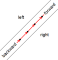
- Left right.png 253 × 262; 10 KB
- LGabledRoofDescription.jpg 4,287 × 3,351; 2.75 MB
- Lighthouse rendering.png 653 × 422; 28 KB
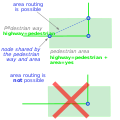
- Line area connection-EN.png 300 × 300; 29 KB
- Line area connection-EN.svg 270 × 270; 20 KB
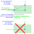
- Line area connection-ES.svg 270 × 270; 21 KB
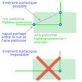
- Line area connection-FR.png 300 × 300; 29 KB
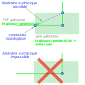
- Line area connection-FR.svg 270 × 270; 19 KB
- Line arrangement underground pipes.png 2,868 × 1,074; 194 KB
- Lineas-VE-02.png 883 × 460; 60 KB
- LivingstonRoundaboutSidewalkTagging.gif 662 × 680; 133 KB
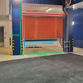
- Loading dock dimensions 1.jpg 4,928 × 3,264; 3.35 MB
- Loading dock dimensions 2.jpg 2,048 × 1,536; 802 KB
- Loading dock dimensions 3.jpg 4,032 × 2,268; 2.7 MB
- Loading dock dimensions 4.jpg 1,816 × 1,816; 587 KB
- Lod1 outline.svg 977 × 740; 11 KB
- Lod2 parts.svg 1,155 × 883; 16 KB
- Lod3 construction.png 2,348 × 1,925; 472 KB
- Map A Junction 2.PNG 720 × 540; 34 KB
- Map A Junction 3.PNG 720 × 540; 32 KB
- Map A Junction 4.PNG 720 × 540; 29 KB
- Map A Junction 5.PNG 720 × 540; 31 KB
- Map A Junction 6.PNG 720 × 540; 42 KB
- Map A Junction 7.PNG 720 × 540; 42 KB
- Map A Junction 8.PNG 720 × 540; 26 KB
- Marek S3DB sumOfMoreElements.jpg 757 × 1,200; 122 KB
- MarekBuildingCullisHeight.jpg 1,198 × 1,460; 353 KB
- MarekCoveredSketch.jpg 1,312 × 917; 100 KB
- MarekCrossingNoExit.jpg 800 × 286; 56 KB
- MarekCrossingTurningCircle.jpg 800 × 344; 68 KB
- MarekCrossingYjunction.jpg 569 × 292; 72 KB
- MarekdServiceAnSecondaryExample.jpg 700 × 339; 65 KB
- MarekJunctionYESStandard.jpg 1,600 × 1,112; 275 KB
- MarekOutlineExample2Tagging.jpg 300 × 473; 58 KB
- MarekPassageSketch.jpg 1,264 × 915; 271 KB
- MarekStairsWithOutlineDescription2.jpg 776 × 304; 96 KB
- MarekStreetsasfacesWithPointsLegend2.jpg 3,611 × 1,888; 1.3 MB
- MarekXjunctionExampleWithTagging.jpg 800 × 416; 146 KB
- MarekYjunction.jpg 569 × 306; 62 KB
- MarekYjunctionStandard.jpg 800 × 556; 112 KB
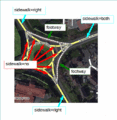
- Marked crossing example.png 712 × 631; 434 KB
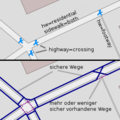
- Maxbe buergersteigrouting getrennt 1.png 300 × 120; 7 KB
- Maxbe buergersteigrouting zusammen 1.png 300 × 120; 6 KB
- Maxbe buergersteigrouting zusammen real.png 300 × 300; 45 KB
- Med cafe tagging example.png 700 × 550; 463 KB
- Min level 2.svg 1,135 × 863; 12 KB
- Minlevel.svg 1,135 × 863; 14 KB
- Minlevel2.svg 1,135 × 863; 13 KB
- MinskPT Stop Tags.png 720 × 400; 76 KB
- Multipolygon en.svg 230 × 473; 118 KB
- Multipolygon ru.svg 230 × 473; 105 KB
- Multipolygon-example forest-2water-scrub-3farmland.svg 469 × 448; 22 KB
- Multipolygon-example forest-2water-scrub-boundary-highway.svg 440 × 340; 23 KB
- Multipolygon-example forest-2water-scrub-farmland.svg 469 × 448; 19 KB
- Multipolygon-example forest-2water-scrub.svg 340 × 310; 11 KB
- Multipolygon-example forest-2water.svg 340 × 310; 8 KB
- Multipolygon-example forest-3wood Practice.svg 270 × 300; 11 KB
- Multipolygon-example forest-3wood Theory.svg 270 × 300; 11 KB
- Multipolygon-example forest-4water-scrub-3farmland.svg 469 × 448; 21 KB
- Multipolygon-example forest-water.svg 340 × 310; 7 KB
- Multipolygon-example forest.svg 350 × 310; 6 KB
- Multipolygon-example meadow-farmland-2forest-scrub.svg 400 × 340; 14 KB
- Multipolygon-example meadow-residential-2forest-scrub.svg 400 × 340; 11 KB
- Multipolygon-example split-forest-water.svg 363 × 331; 12 KB
- Multipolygon-example style.svg 340 × 120; 7 KB
- NavigaTUM indoor room Floorplan tagging proposal.jpg 549 × 421; 71 KB
- North American ranching features.png 622 × 602; 71 KB
- Opening hours basic es.svg 575 × 250; 21 KB
- Opening hours basic uk.svg 575 × 250; 17 KB
- Opening hours basic.svg 575 × 250; 20 KB
- OSM arret-Deymarde.pdf 1,754 × 1,239; 420 KB
- OSM Stop Area.svg 1,348 × 833; 29 KB
- Osm wiki-building passage.png 368 × 276; 6 KB
- OSMFocus Reborn screenshot.png 1,080 × 2,072; 1.01 MB
- OSMfocus Screen01.png 713 × 1,083; 384 KB
- OSMfocus Screen02.png 1,280 × 769; 202 KB
- OSMfocus Screen03.png 641 × 1,054; 266 KB
- OSMfocus Screen04.png 713 × 1,083; 406 KB
- Parking location.png 2,821 × 543; 31 KB


