F4 Map
| F4 Map | ||||||||||||||||||||||||||||||||||||
|---|---|---|---|---|---|---|---|---|---|---|---|---|---|---|---|---|---|---|---|---|---|---|---|---|---|---|---|---|---|---|---|---|---|---|---|---|
| Language: | English
| |||||||||||||||||||||||||||||||||||
| Website: | https://demo.f4map.com/ | |||||||||||||||||||||||||||||||||||
|
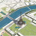
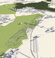
WebGL technology, 3D buildings on a flat map, rotatable, shadows depending on time of day, visible rain depending on weather conditions. Impressions: Animated windmills, Animated Bellagio Fountains |
||||||||||||||||||||||||||||||||||||
| ||||||||||||||||||||||||||||||||||||
The F4 Map is an OSM-based 3D map using the WebGL technology (requires a compatible web browser). The map's 3D views feature OpenStreetMap buildings as well as trees and other data. Extra 3D models are used (not based on buildings data in OSM) for some specific buildings (e.g. the Eiffel Tower).
It is made by F4 group which is an European and Asian video game development company.[1] They are not telling the public much about themselves for the moment.[2]
Rendering
Rendering examples
The F4 map wiki has some other rendering examples.
- Screenshot of the map showing …
Licensing
Downstream: License of the F4 map tiles/rendering for reuse: In terms of the produced work, no license is specified. A request for free access to the assets (source code and extra 3D models) was declined.[3] “[P]roduced work from F4_Map (screenshot and video) are under the CC-BY-NC licence.”[4]
Upstream: OpenStreetMap is properly attributed ("Map data © OpenStreetMap contributors") on the map footer.
See also
- List of OSM-based services
- F4 map
- F4 wiki main page
- F4 Group Website
- F4 Group Github
- user cmif4 presenting it on the OSM forum
- List of supported tags
References
- ↑ http://www.f4-group.com/ENGLISH/main.htm in the header
- ↑ who is/are f4-group.com? in a support forum
- ↑ user cmif4 in a forum thread where he presented their/his new 3D map
- ↑ User:Cmif4 said this here on the wiki


