File:3DHP feature density and alignment compared to NHD.png
Jump to navigation
Jump to search

Size of this preview: 800 × 450 pixels. Other resolutions: 320 × 180 pixels | 640 × 360 pixels | 1,280 × 720 pixels.
Original file (1,280 × 720 pixels, file size: 1.09 MB, MIME type: image/png)
Summary
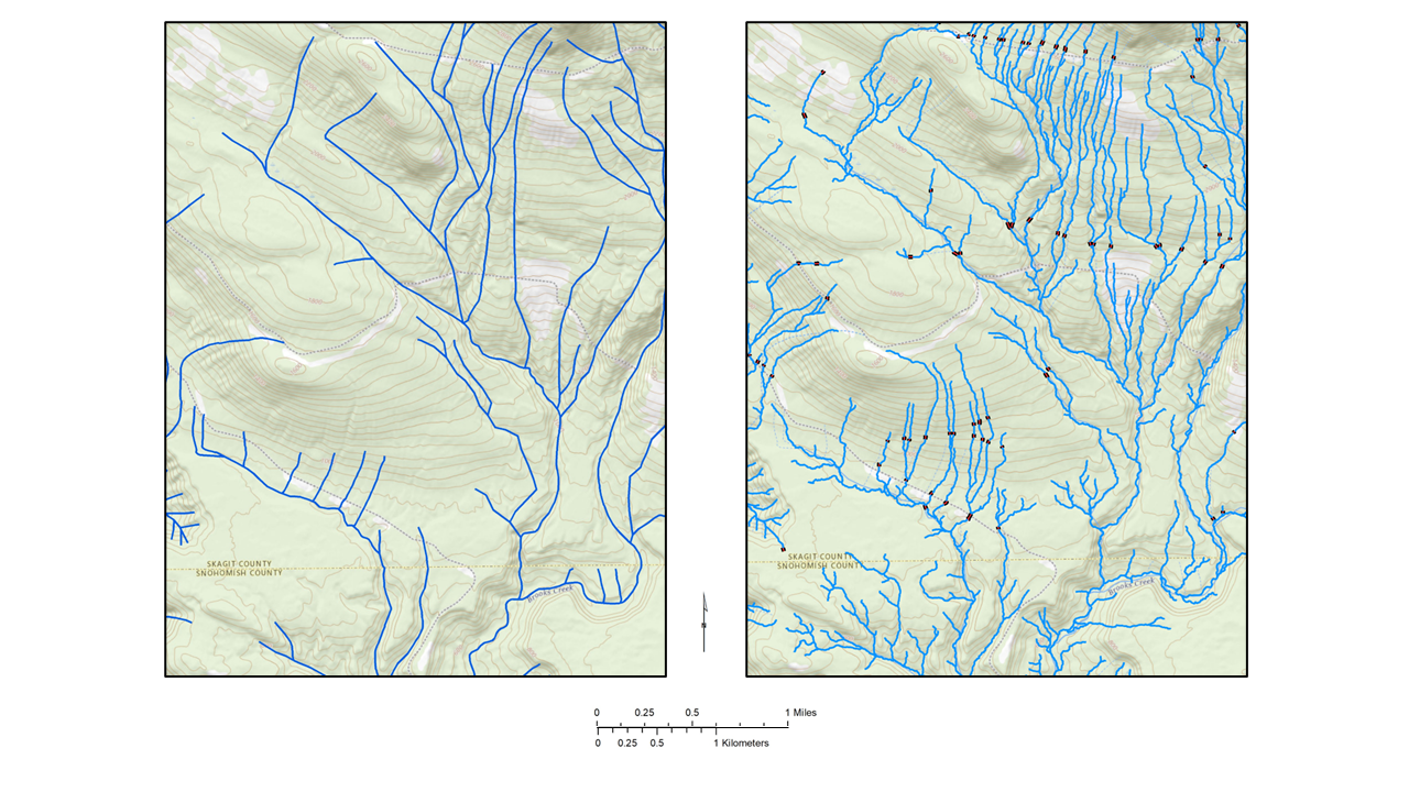
| Description | 3DHP (right) feature density and alignment compared to NHD. This image is approximately centered on 48.3091°N 121.9127°W. |
|---|---|
| Author | U.S. Geological Survey |
| Source | https://www.usgs.gov/media/images/3dhp-feature-density-and-alignment-compared-nhd |
| Date | 2023-07-12 |
Licensing
![]()
.svg)
This work is in the public domain in the United States because it is a work of the United States Federal Government under the terms of Title 17, Chapter 1, Section 105 of the US Code. See Copyright.
Note: This only applies to works of the Federal Government and not to the work of any individual U.S. states, territory, commonwealth, county, municipality, or any other subdivision. This template also does not apply to postage stamp designs published by the United States Postal Service since 1978. (See 206.02(b) of Compendium II: Copyright Office Practices).
Note: This only applies to works of the Federal Government and not to the work of any individual U.S. states, territory, commonwealth, county, municipality, or any other subdivision. This template also does not apply to postage stamp designs published by the United States Postal Service since 1978. (See 206.02(b) of Compendium II: Copyright Office Practices).
File history
Click on a date/time to view the file as it appeared at that time.
| Date/Time | Thumbnail | Dimensions | User | Comment | |
|---|---|---|---|---|---|
| current | 14:34, 9 November 2024 | | 1,280 × 720 (1.09 MB) | MattMap (talk | contribs) | {{Information | description= 3DHP feature density and alignment compared to NHD | source=https://www.usgs.gov/media/images/3dhp-feature-density-and-alignment-compared-nhd | date=2023-07-12 | author=U.S. Geological Survey | other_versions= }} |
You cannot overwrite this file.
File usage
The following page uses this file: