File:Einde bebouwde kom Bonaire.jpg
Jump to navigation
Jump to search

No higher resolution available.
Einde_bebouwde_kom_Bonaire.jpg (408 × 408 pixels, file size: 140 KB, MIME type: image/jpeg)
Summary
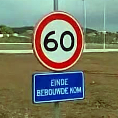
| Description | End of built-up area (Dutch: einde bebouwde kom) traffic sign on Bonaire. |
|---|---|
| Author | photographed by Plantaz-Groep (January 2024); edited by Jeroen van der Gun (April 2025) |
| Source | Mapillary |
Licensing
![]()
![]()
![]()
This work is licensed under the Creative Commons Attribution-ShareAlike 4.0 License.
Attribution: Plantaz-Groep (edited by Jeroen van der Gun)
Attribution: Plantaz-Groep (edited by Jeroen van der Gun)
![]()
This file comes from Mapillary, a service for sharing geotagged photos. All photos are under a CC BY-SA 4.0 license meaning the individual photographer must be credited for each image.
This template does not indicate the copyright status of the attached work. A normal copyright template is still required, typically it will be {{CC-BY-SA-4.0|HERE PUT NAME OF IMAGE AUTHOR}}.
This template does not indicate the copyright status of the attached work. A normal copyright template is still required, typically it will be {{CC-BY-SA-4.0|HERE PUT NAME OF IMAGE AUTHOR}}.
File history
Click on a date/time to view the file as it appeared at that time.
| Date/Time | Thumbnail | Dimensions | User | Comment | |
|---|---|---|---|---|---|
| current | 13:33, 6 April 2025 | | 408 × 408 (140 KB) | JeroenvanderGun (talk | contribs) | {{Information | description=End of built-up area sign on Bonaire. | source=[https://www.mapillary.com/app/?pKey=412315934559329&lat=12.179743116667&lng=-68.269754383333&z=17&focus=photo&x=0.8957859881218421&y=0.5405506078543778&zoom=1.34777183600713 Mapillary] | author=photographed by Plantaz-Groep (January 2024); edited by Jeroen van der Gun (April 2025) }} |
You cannot overwrite this file.
File usage
The following page uses this file: