File:GermanyCycleRoutes.jpg
Jump to navigation
Jump to search

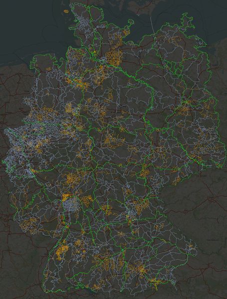
Size of this preview: 455 × 600 pixels. Other resolutions: 182 × 240 pixels | 364 × 480 pixels | 583 × 768 pixels | 777 × 1,024 pixels | 1,730 × 2,280 pixels.
Original file (1,730 × 2,280 pixels, file size: 1.03 MB, MIME type: image/jpeg)
Summary
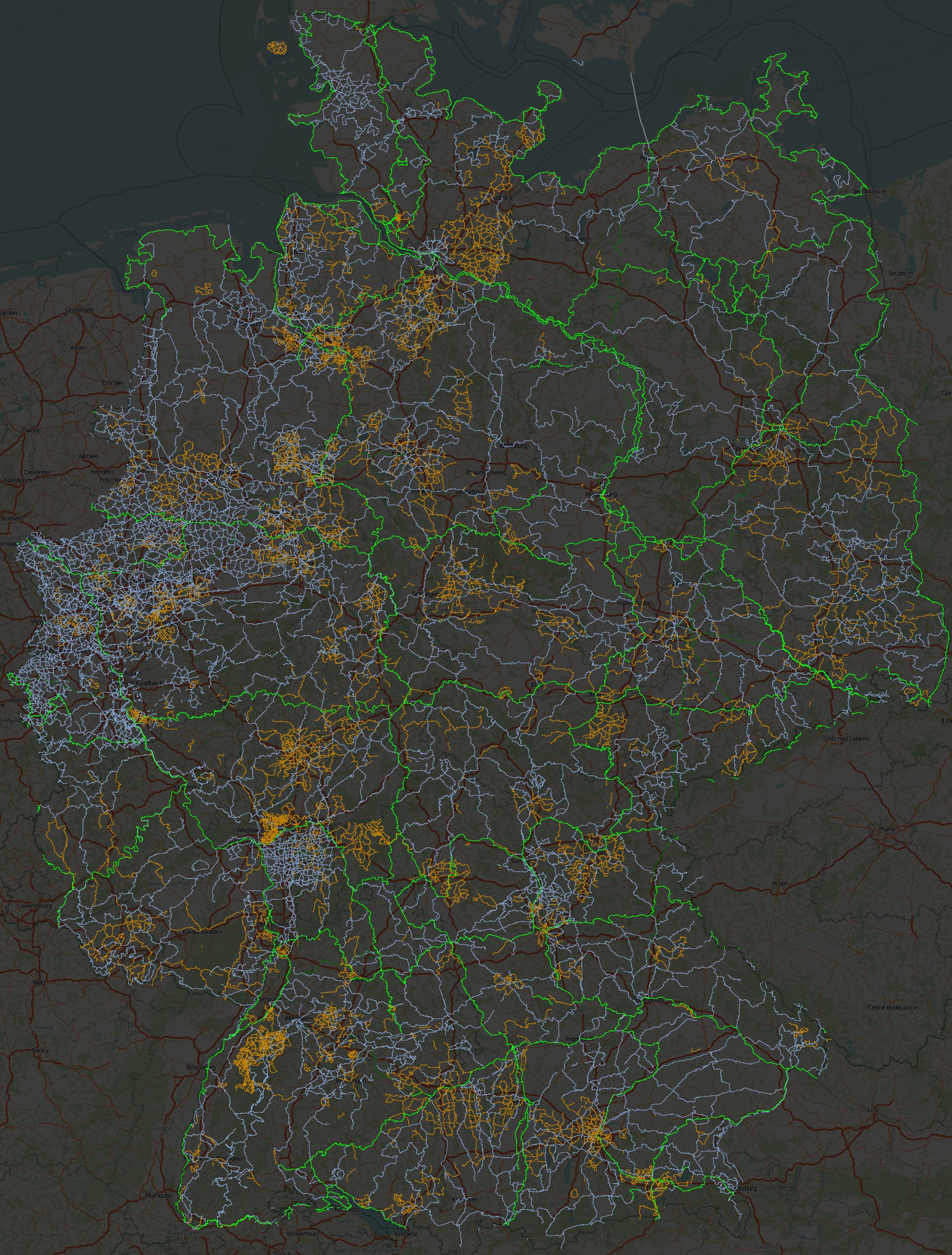
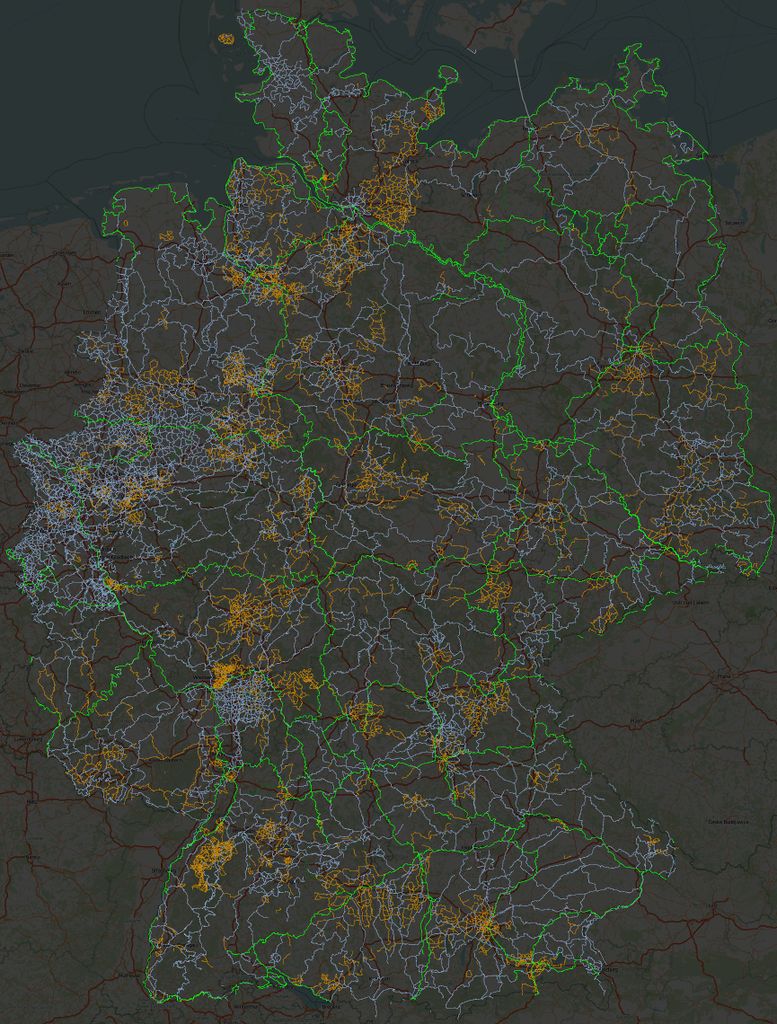
Visualisierung der Radrouten-Relationen für Deutschland - je nach network=* unterschiedlich koloriert.
Legende:
hellgrün :: icn, ncn (D-Routen)
blau :: rcn
braun :: lcn
dunkelgrün :: radweit
How to
At a bash prompt, with latest osmosis installed, do:
WORDS="icn-footway ncn-footway rcn-service lcn-bridleway radweit-track"
for i in $WORDS
do
  osmosis --read-pbf ../../germany.osm.pbf --tf accept-relations route=bicycle network=${i%-*} --used-way --un --tf reject-relations --wx - \
     | sed -e '0,/<way/ s/<tag .*//' \
     | sed -e "/highway/ s/.*/<tag k=\"highway\" v=\"${i#*-}\" \/>/" \
     | grep -vP '<tag.*k="(?!highway"|name")' > rel.route.$i.osm
done
osmosis $(for i in $WORDS ; do echo "--rx rel.route.$i.osm " ; done) --merge --merge --merge --merge --wx rel.route.merged.osm
Open rel.route.merged.osm in JOSM, select a decent background TMS, make a screenshot.
Licensing
![]()
![]()
![]()
This work is licensed under the Creative Commons Attribution-ShareAlike 2.0 License.
Attribution not specified as a parameter! THIS LICENSE ALWAYS REQUIRES ATTRIBUTION! Use {{CC-BY-SA-2.0|Attribution, typically name of author}} See Template:CC-BY-SA-2.0 for full description how this template should be used.
Note, there is
There is also
Attribution not specified as a parameter! THIS LICENSE ALWAYS REQUIRES ATTRIBUTION! Use {{CC-BY-SA-2.0|Attribution, typically name of author}} See Template:CC-BY-SA-2.0 for full description how this template should be used.
Note, there is
{{CC-BY-SA-2.0 OpenStreetMap}} for files based on old OSM map data, before the license change made on 2012-09-12.There is also
{{OSM Carto screenshot||old_license}} for files based on old OSM map data, before the license change made on 2012-09-12, created using OSM Carto map style.
File history
Click on a date/time to view the file as it appeared at that time.
| Date/Time | Thumbnail | Dimensions | User | Comment | |
|---|---|---|---|---|---|
| current | 15:24, 16 August 2011 | | 1,730 × 2,280 (1.03 MB) | Cmuelle8 (talk | contribs) | Visualisierung der Radrouten-Relationen für Deutschland - je nach network=* unterschiedlich koloriert. Legende: hellgrün :: icn, ncn (D-Routen) blau :: rcn braun :: lcn dunkelgrün :: radweit |
You cannot overwrite this file.
File usage
The following page uses this file: