File:Mistsignalering.jpg
Jump to navigation
Jump to search
Mistsignalering.jpg (336 × 360 pixels, file size: 194 KB, MIME type: image/jpeg)
Summary
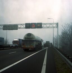
| Description | An electronic fog warning traffic sign on Rijksweg 16 near Prinsenbeek, Noord-Brabant, the Netherlands. |
|---|---|
| Author | Bart van Eyck (cropped and edited by Jeroen van der Gun) |
| Source | Rijkswaterstaat Beeldarchief (original photo) |
| Date | 1996-01-17 (original photo) |
| Other versions |  (original photo) (original photo)
|
Licensing
Photos from the Rijkswaterstaat Beeldarchief are free to download and can be used for educational purposes, but not for commercial purposes. The following conditions apply to correct use:
While this photo can thus be used on the OpenStreetMap wiki, be aware that commercial use is disallowed.
- Attribution is mandatory; this is: © Rijkswaterstaat | Bart van Eyck.
- Photos may not be edited in such a way that the integrity is lost and an image can be incorrectly interpreted.
While this photo can thus be used on the OpenStreetMap wiki, be aware that commercial use is disallowed.
File history
Click on a date/time to view the file as it appeared at that time.
| Date/Time | Thumbnail | Dimensions | User | Comment | |
|---|---|---|---|---|---|
| current | 00:35, 9 April 2025 |  | 336 × 360 (194 KB) | JeroenvanderGun (talk | contribs) | {{Information | description=An electronic fog warning traffic sign on Rijksweg 16 near Prinsenbeek, Noord-Brabant, the Netherlands. | source=[https://proxy.archieven.nl/0/5609B9D32C994444932554F99142264F Rijkswaterstaat Beeldarchief] (original photo) | date=1996-01-17 (original photo) | author=Bart van Eyck (cropped and edited by Jeroen van der Gun) | other_versions=File:135278.jpg }} |
You cannot overwrite this file.
File usage
The following page uses this file:
