File:Osmarender-EKCH-Airport.gif
Jump to navigation
Jump to search


Size of this preview: 651 × 600 pixels. Other resolutions: 261 × 240 pixels | 521 × 480 pixels | 834 × 768 pixels | 1,111 × 1,024 pixels | 2,457 × 2,264 pixels.
Original file (2,457 × 2,264 pixels, file size: 312 KB, MIME type: image/gif, 0.1 s)
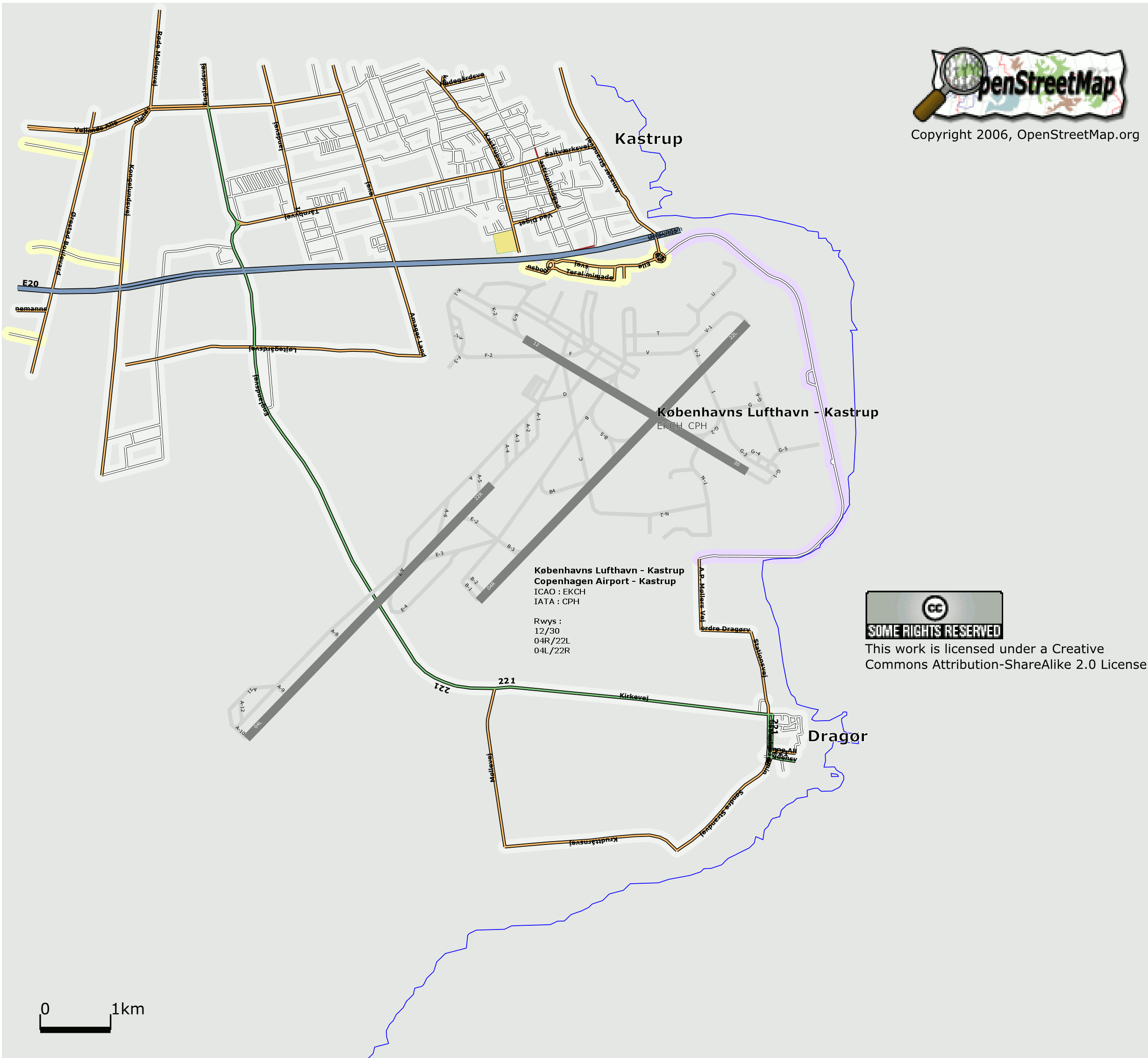
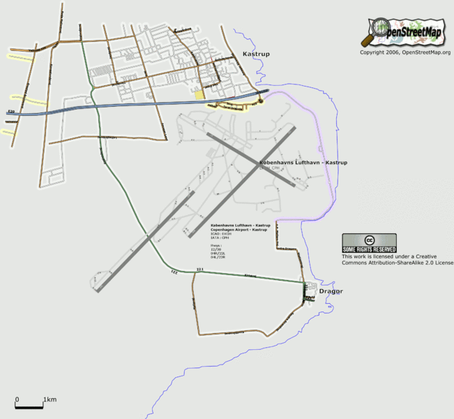
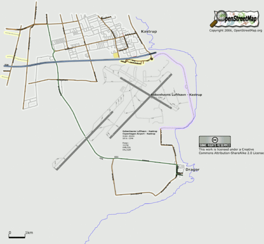
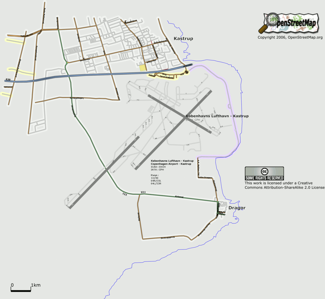
Map of Copenhagen
This map and others like it, were created by OpenStreetmap contributors, and are licensed as Creative Commons CC-BY-SA 2.0 (https://creativecommons.org/licenses/by-sa/2.0/) (see OpenStreetMap licence).
Use {{mapof|PlaceName}} to add this template to your images.
This map and others like it, were created by OpenStreetmap contributors, and are licensed as Creative Commons CC-BY-SA 2.0 (https://creativecommons.org/licenses/by-sa/2.0/) (see OpenStreetMap licence).
Use {{mapof|PlaceName}} to add this template to your images.
Map of Copenhagen airport shows labelled runways and taxiways, taken from official Danish air navigation data.
New version for Featured image usage, pr OJW's request on IRC
This is a Featured image, which means that it has been identified as one of the best examples of OpenStreetMap mapping, or that it provides a useful illustration of the OpenStreetMap project. If you know another image of similar quality, you can nominate it on Featured image proposals.
Front-page image on 16 Sep 2006
![]()
Contains map data © OpenStreetMap contributors, made available under the terms of the Creative Commons Attribution-ShareAlike 2.0 (CC-BY-SA-2.0).
File history
Click on a date/time to view the file as it appeared at that time.
| Date/Time | Thumbnail | Dimensions | User | Comment | |
|---|---|---|---|---|---|
| current | 21:43, 14 September 2006 | | 2,457 × 2,264 (312 KB) | Dutch (talk | contribs) | New version for Featured image usage, pr OJW's request on IRC |
You cannot overwrite this file.
File usage
The following 2 pages use this file: