Category:Rendered OSM data
Jump to navigation
Jump to search
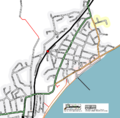
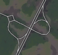
These are different images that have been rendered by various methods from OSM data. See "Subcategories" for more.
Subcategories
This category has the following 8 subcategories, out of 8 total.
Pages in category "Rendered OSM data"
The following 3 pages are in this category, out of 3 total.
Media in category "Rendered OSM data"
The following 200 files are in this category, out of 242 total.
(previous page) (next page)- 15feb2.jpg 375 × 484; 23 KB
- 1asector.png 1,030 × 633; 151 KB
- 1bsector.png 800 × 653; 588 KB
- 200611-stuttgart.png 1,020 × 571; 214 KB
- 20070207.final.png 1,296 × 1,461; 424 KB
- 2009 Vogelkundeweg Schautafel.jpg 2,048 × 1,536; 729 KB
- 20100317 london cycling guide 2 cut.jpg 311 × 233; 31 KB
- 20100317 london cycling guide 2.jpg 550 × 233; 55 KB
- 2013 GutauWanderkarteHinten.jpg 2,448 × 3,264; 3.38 MB
- 2013 GutauWanderkarteVorne.jpg 2,448 × 3,264; 3.47 MB
- 2013 GutauWandertafel.jpg 2,448 × 3,264; 3.08 MB
- 2013 GutauWandertafel2.jpg 1,659 × 1,244; 805 KB
- 20130223 DSC1072 Looking at Buildings.jpg 2,121 × 1,414; 1.37 MB
- 220106 2.png 1,119 × 796; 67 KB
- 7326451880 27be2ed69d h.jpg 1,600 × 1,200; 697 KB
- 8-Bit Cities London.png 470 × 264; 20 KB
- Amsterdam AND Sep2007.png 600 × 600; 472 KB
- Arreton.png 1,031 × 699; 22 KB
- Assen 20070529.PNG 500 × 500; 264 KB
- Austrian Buildings Completeness Map.png 801 × 604; 825 KB
- Ballon map v1.png 648 × 616; 361 KB
- Bedford new slippy map 2.png 636 × 498; 327 KB
- Bedford new slippy map.png 611 × 500; 160 KB
- Bedford new slippy.png 695 × 491; 762 KB
- Bedford tracklogs.png 1,216 × 810; 43 KB
- Bedford wide area.png 906 × 813; 33 KB
- Bedford.png 1,264 × 944; 498 KB
- Bengaluru Urban Area Map.png 1,156 × 810; 2.22 MB
- Bergen centre.jpg 1,200 × 1,200; 207 KB
- Berlin Hauptbahnhof Map 2 cut.jpg 2,447 × 1,932; 627 KB
- Berlin Hauptbahnhof Map 2.jpg 2,448 × 3,264; 894 KB
- Berlin Hauptbahnhof Map.jpg 3,264 × 2,448; 667 KB
- Bremen.png 640 × 480; 424 KB
- Bus stop in Bishkek Kyrgyzstan.jpg 3,174 × 2,381; 927 KB
- Cambridge-2007-01-18.jpg 800 × 650; 144 KB
- Cambridge-curvy.png 400 × 400; 103 KB
- Canterbury centre.jpg 1,500 × 1,500; 446 KB
- Cape Town and inner suburbs.png 734 × 476; 324 KB
- Cape Town City Bowl.png 807 × 795; 455 KB
- Cape Town.png 715 × 623; 417 KB
- CapeTown-2007-03-03.png 887 × 768; 276 KB
- CapeTown-20070930.png 668 × 618; 272 KB
- Carlton.png 326 × 264; 21 KB
- Cartogram-poi.png 1,530 × 958; 353 KB
- Central london bold.png 2,827 × 1,980; 1.41 MB
- CentralChester.png 1,023 × 1,145; 596 KB
- Chester2.png 800 × 908; 789 KB
- Chicago.png 749 × 781; 679 KB
- Cincinnati Bike Map first maps.jpg 506 × 379; 72 KB
- City oneway streets.jpg 584 × 569; 58 KB
- Closer Midlands Area - JOSM.png 1,174 × 829; 89 KB
- Copenhagen-8-10-2006.png 1,300 × 1,481; 118 KB
- Dorking.png 500 × 716; 104 KB
- Dressmap.it iPad cover at OSMit.jpeg 1,024 × 768; 81 KB
- DublinProgress.jpg 700 × 500; 96 KB
- Ebola Outbreak changesets vis.png 949 × 540; 261 KB
- Edinburgh-A71-A8-B701-2006-03-29.png 831 × 575; 98 KB
- Edinburgh-A8-A90-Drum-Brae-2006-03-29.png 667 × 542; 83 KB
- Enfield osmarender 300.jpg 300 × 300; 28 KB
- Everylinesf.jpg 1,024 × 768; 426 KB
- Fradley village.png 1,280 × 1,024; 232 KB
- France10-1year.jpg 2,560 × 2,624; 1.99 MB
- Freemap screenshot.png 771 × 509; 47 KB
- Freiburg Excerpt.png 392 × 301; 103 KB
- Gaza tourist.png 1,162 × 867; 977 KB
- Germany overview 1april.jpg 349 × 492; 48 KB
- GpsMaster Screenshot ActivityPicker.png 1,280 × 800; 386 KB
- GpsMaster Screenshot Basic.png 1,280 × 800; 454 KB
- GpsMaster Screenshot Chart01.png 1,280 × 800; 366 KB
- GpsMaster Screenshot Chart02.png 1,282 × 801; 303 KB
- GpsMaster Screenshot Cleaning.png 1,280 × 800; 334 KB
- GpsMaster Screenshot Distance.jpeg 1,280 × 720; 1.24 MB
- GpsMaster Screenshot Labels.png 1,282 × 803; 137 KB
- GpsMaster Screenshot Photos.png 1,783 × 836; 839 KB
- Graphhopper-android.png 800 × 480; 333 KB
- Great barford.png 892 × 767; 98 KB
- Greater Midlands Area - JOSM.png 925 × 788; 36 KB
- Gutau-Langlaufkarte-1000.png 1,000 × 608; 382 KB
- Gutau-Vogelkundeweg-00500.png 500 × 500; 232 KB
- Gutau-Wanderkarte-0500.png 500 × 800; 745 KB
- Gutau-Zentrum-0500.png 500 × 385; 201 KB
- HamburgNord-20060924.png 703 × 994; 59 KB
- Harrold bedfordshire.png 374 × 316; 22 KB
- Heathrow aeroways.jpg 1,229 × 770; 120 KB
- Heathrow.jpg 688 × 496; 97 KB
- Heathrow.png 1,075 × 783; 143 KB
- Hedge End Coloured.png 642 × 630; 31 KB
- I-55 and I-90.png 765 × 756; 160 KB
- IMG 20120428 164740.jpg 497 × 373; 67 KB
- IOW nodes small.png 300 × 257; 27 KB
- IoW thumbnail.png 200 × 132; 22 KB
- Ipswitch.png 700 × 700; 445 KB
- IsleOfMan.png 416 × 496; 88 KB
- IsleOfWight20060927.png 1,500 × 913; 87 KB
- Jakarta village office maps.jpg 960 × 720; 82 KB
- Josm spain geodesy network.png 1,252 × 980; 149 KB
- Jura.png 586 × 416; 59 KB
- Karlsruhe300.png 300 × 300; 121 KB
- Kinshasa z14.jpg 1,500 × 1,024; 323 KB
- Konsolidierung der PLZ-Relationen in Deutschland 2013 vorher nachher.png 1,502 × 651; 1.27 MB
- Kosice-bus stop.jpg 419 × 347; 153 KB
- KT13 Area.png 584 × 534; 24 KB
- LA2-Europe-20070411-Ukraine.png 602 × 516; 72 KB
- LesCrosets.png 741 × 712; 131 KB
- Lille toile.jpg 548 × 549; 57 KB
- Lincoln.png 900 × 884; 226 KB
- Linuxwochen Wien 2014-05-08 Tischtuch.jpg 1,927 × 682; 223 KB
- Ljubljana-2007-03-27 Osmarender.png 900 × 700; 147 KB
- Ljubljana-2007-06-15 Osmarender.png 800 × 650; 162 KB
- Ljubljana-2007-07-10 Osmarender.png 800 × 650; 195 KB
- Ljubljana-2007-08-29 Osmarender.png 800 × 650; 215 KB
- Ljubljana-2007-12-21 Osmarender.png 800 × 650; 389 KB
- Ljubljana-2009-08-13 Osmarender.png 800 × 650; 585 KB
- Ljubljana-2009-11-24 Osmarender.png 800 × 650; 596 KB
- Ljubljana-history.gif 800 × 650; 461 KB
- London medium.jpg 2,238 × 2,220; 729 KB
- London-20061121-bounded.png 1,280 × 1,186; 1.21 MB
- Lys i Kolding - 4 maj 2010 cutout.png 1,764 × 2,118; 765 KB
- Maidenhead.png 1,792 × 1,536; 936 KB
- Manchester.png 1,005 × 849; 47 KB
- MapColouringExperiment.png 471 × 462; 11 KB
- Mappa-mercia-ed1-detail.jpg 1,024 × 824; 229 KB
- Mapping party in Low Tatras 2013-10-13 traces.png 640 × 480; 583 KB
- Mapyrus screenshot.png 761 × 437; 69 KB
- Mapyrus screenshot2.png 708 × 396; 19 KB
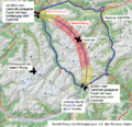
- Maxbe-stubaier-beschriftung en.png 820 × 780; 343 KB
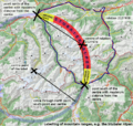
- Maxbe-stubaier-beschriftung.png 820 × 790; 333 KB
- Merkaartor-rotterdamwest-reduced.png 462 × 352; 107 KB
- MissingRoundabouts.png 349 × 168; 18 KB
- Munich MappingWeekend Oct-06 animation.gif 800 × 465; 182 KB
- Nestoria-cowes.png 400 × 422; 37 KB
- Neuhausen.png 682 × 768; 323 KB
- Newcastle centre.png 516 × 696; 124 KB
- Newcastle sketch.png 905 × 716; 39 KB
- Newcastle tracklogs.png 616 × 564; 14 KB
- NikeGridBlack.png 513 × 433; 147 KB
- NL-2006-01-14.png 331 × 366; 154 KB
- NLondon.png 840 × 683; 188 KB
- Northlondon slippymap.png 704 × 500; 173 KB
- Nottingham tram construction diversion notice.jpg 750 × 628; 166 KB
- Oakham labelled.png 1,782 × 1,980; 1,007 KB
- OpenMapSurfer HillshadeLayer.png 905 × 702; 1.14 MB
- Openstreetmap-streetcar-ad.png 472 × 300; 300 KB
- Openstreetmap-sutton-coldfield.png 1,280 × 1,024; 446 KB
- OSM beim HVV 2.jpg 1,024 × 768; 297 KB
- OSM beim HVV.jpg 1,024 × 768; 432 KB
- OSM on F1-1.jpg 1,920 × 1,080; 324 KB
- OSM on F1-2.jpg 1,920 × 1,080; 328 KB
- OSM on F1-3.jpg 1,920 × 1,080; 318 KB
- OSM on F1-4.jpg 1,920 × 1,080; 303 KB
- Osm-200607-rossia.png 900 × 2,200; 14 KB
- Osm-dec-2005-58.9-16.4-6.png 495 × 445; 304 KB
- Osm-feb-2006-58.3-13.1-7.png 652 × 490; 111 KB
- Osm-feb-2006-59.35-16.47-7.png 696 × 461; 126 KB
- Osm-jan-2006-59.4-17.2-8.png 694 × 412; 111 KB
- Osm-planet-2.jpg 1,024 × 768; 141 KB
- Osm-planet-200604-Scandinavia.jpg 298 × 380; 32 KB
- OSM-VE Av. Baralt 1.png 480 × 823; 301 KB
- OSM-VE Choroní 1.png 480 × 823; 146 KB
- OSM-VE Ciudad Bolívar 1.png 854 × 446; 381 KB
- OSM-VE Guárico 1.png 480 × 823; 96 KB
- OSM-VE Litoral 1.png 854 × 450; 202 KB
- OSM-VE Sabana de Parra.png 854 × 447; 159 KB
- OSM-VE Tramo Peaje.png 480 × 823; 61 KB
- Osm3d-germany.jpg 345 × 433; 51 KB
- Osm-wms-europe.JPG 798 × 726; 116 KB
- Osmarender-EKCH-Airport.gif 2,457 × 2,264; 312 KB
- OSMDireccion.png 392 × 195; 8 KB
- OSMPista001.png 264 × 225; 11 KB
- Oxford-svg-big-20060927.png 2,400 × 2,244; 1.44 MB
- PartyRenderSample Surrey black cityNames.png 1,120 × 626; 132 KB
- Pavia place mat.jpg 1,024 × 768; 124 KB
- PdfAtlasPreview3.png 691 × 722; 44 KB
- PdfAtlasPreview4.png 758 × 764; 52 KB
- Picture 24.png 821 × 579; 785 KB
- Plaza del ejecutivo-Mexico-City.jpg 760 × 715; 100 KB
- PortStMary IsleofMan.png 641 × 496; 63 KB
- Power-line-example.png 848 × 363; 2 KB
- Priozerka osm.jpeg 2,736 × 3,648; 2.8 MB
- QGIS tram lines black.png 1,200 × 723; 363 KB
- Reading uni whiteknights campus.png 1,500 × 1,226; 752 KB
- Reading.png 2,000 × 2,628; 663 KB
- Render osma trunk.png 400 × 400; 29 KB
- Render pedestrian2.png 300 × 300; 35 KB
- Rendering clean z12.png 500 × 261; 185 KB
- Routing graphhoppercom.png 933 × 530; 523 KB
- Sandown.png 965 × 952; 107 KB
- Sandy.png 711 × 758; 91 KB
- Schaffhausen Strassenabdeckung.png 1,289 × 979; 348 KB
- Schaffhausen-town.png 657 × 800; 368 KB
- Schweiz building distribution pre bing aerial images.png 1,358 × 979; 116 KB
- Shanklin.png 271 × 315; 39 KB
- Sharif-map.png 757 × 758; 184 KB
- Silsoe.png 957 × 639; 57 KB
- Sinj osm map 800px.JPG 800 × 1,135; 562 KB
- Sochi Olympics Krasnaya Polyana Mountain Cluster.png 902 × 784; 1.49 MB
- Softcities map leggings.jpg 680 × 1,024; 319 KB
- Sotmeu11 paper maps.jpg 1,280 × 853; 148 KB
- SouthernCalifornia.png 704 × 1,229; 67 KB
- Square-roundabout.png 186 × 178; 11 KB


