File:Ref-penndot interchange complication.png
Jump to navigation
Jump to search


Size of this preview: 800 × 579 pixels. Other resolutions: 320 × 232 pixels | 640 × 463 pixels | 1,000 × 724 pixels.
Original file (1,000 × 724 pixels, file size: 80 KB, MIME type: image/png)
Summary
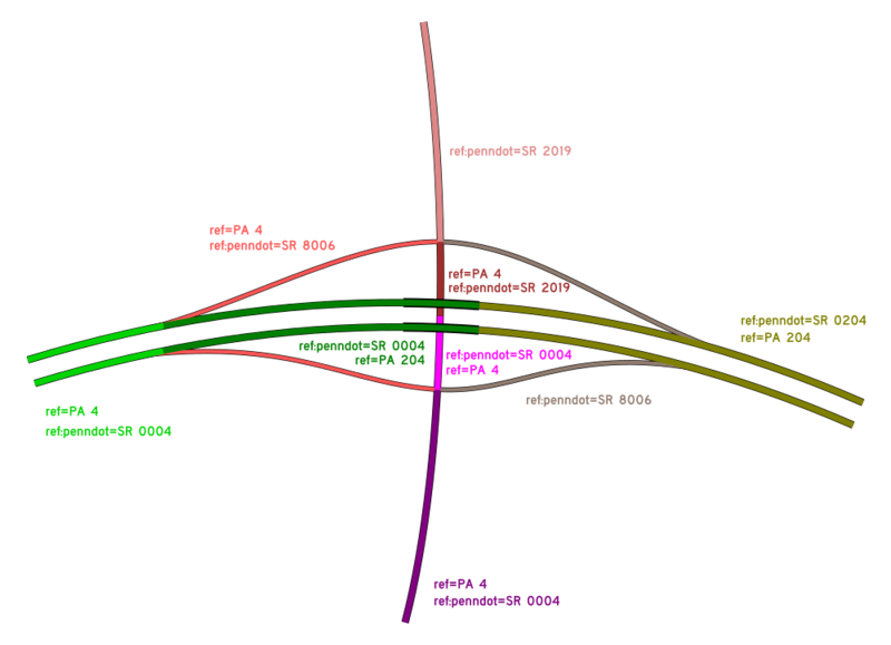
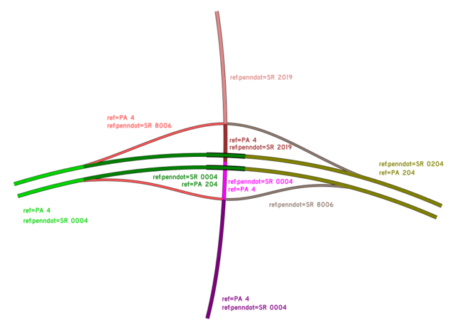
A example of how PennDOT's SR designations don't necessarily line up with signage.
See also https://wiki.openstreetmap.org/wiki/File:Ref-penndot_interchange_complication.svg
Licensing
![]()
![]()
![]()
This work is licensed under the Creative Commons Attribution-ShareAlike 4.0 License.
Missing attribution. You have to add the authors!
THIS LICENSE REQUIRES ATTRIBUTION!
Use {{CC-BY-SA-4.0|Authors}}
Missing attribution. You have to add the authors!
THIS LICENSE REQUIRES ATTRIBUTION!
Use {{CC-BY-SA-4.0|Authors}}
File history
Click on a date/time to view the file as it appeared at that time.
| Date/Time | Thumbnail | Dimensions | User | Comment | |
|---|---|---|---|---|---|
| current | 19:50, 27 December 2017 | | 1,000 × 724 (80 KB) | Roadsguy (talk | contribs) | A example of how PennDOT's SR designations don't necessarily line up with signage. |
You cannot overwrite this file.
File usage
The following 2 pages use this file: