Historical Crowd-Sources Spatial Data for Sustainable Development and Inclusive Mapping
The development of free and open technology can serve as a bridge or solution for accessing information that can be seen and owned by the public. Increased and improved internet access and communication infrastructure are further reasons that conservation and revitalization of ethnic, cultural, and historical places in innovative and creative ways are possible, by using a free and open map, OpenStreetMap (OSM). A map is a communication media that can effectively describe the distribution of information. With a map that is open and easily accessible to anyone, information on historical places in Indonesia can be maintained and developed. OSM also allows the involvement of the community to contribute by adding or updating important information related to cultural and historical places in the area where they live so that the community can also contribute to monitoring the state and condition of ethnic, cultural, and historical places. We also add the information about the access for people with disabilities in the historical places, the local disability communities can visit the museum, galleries, and libraries.
The spirit of free and open data has been initiated by Wikimedia Indonesia, one of which is through GLAM (Galleries, Libraries, Archives, and Museums) in Indonesia by inviting inclusive communities to collect data on historical places through the Wikipedia, Wikimedia Commons, Wikidata, and Wikisource platforms. Wikimedia Foundation projects, including each language’s Wikipedia, display maps using OSM data. If an entity in OSM has been tagged with a Wikidata ID, its outline can be highlighted on the map. At the moment, there is no POI support. Only shapes and lines can be shown this way.
Perkumpulan OpenStreetMap Indonesia (POI), in collaboration with Wikimedia Indonesia, proposes to create an interactive mapping system aimed at inventory and visualizing historical places in order to support the GLAM Indonesia project through WikiData, Wikimedia Commons, and OpenStreetMap. The mapping system is expected to be an innovative solution for marketing and promoting cultural and historical places, by providing open access to information, providing accessibility facilities for people with disabilities, and allowing the community to contribute by mapping cultural and historical places in Indonesia. Additionally, the mapping system ultimately allows the community to assist the government in developing and improving people's interest in studying history and cultural diversity in Indonesia, as well as improving the socio-economic level of local governments.
This project also places youth as the main actor of the project, because we believe that youth is not an “empty glass”. Youth always think, observe, and criticize what is happening in their environment. They also have the courage to express their opinion -but youth often don't know how to express their opinion properly in the “right place”. This project wants to show the public, mainly the government, about the great potential of youth as a development resource, with their critical, creative, and innovative thinking.
Objectives
- Improve Historical Infrastructures data through Youth Capacity Building using Open Data Technology Innovation
- Competition-based events in soliciting innovative ideas and conducting small research by the youth to utilize the historical site and how to enhance the role of youth to craft and implement innovative solutions to improve historical infrastructures in area
- Develop a crowd-sourced mapping information platform to disseminate the result of historical data that can be accessed online
Outcomes
- The local communities gain a new skill in mapping, editing in Wiki Data, and data collection using open source technologies
- The collected data are being used and utilized to support any of GLAM activities and programs
- The local communities will actively participate in OSM mapping and Wiki Data activities after the completion of the project
- Connecting Wikimedia Indonesia with OSM Community in Indonesia to collaborate and replicate/scale-up the pilot project in the future
Output
- Added new OSM mappers and Wiki Data users from the local communities
- Completely mapped and added the information of project areas in OpenStreetMap and Wiki Data along with disability facilities and important information for historical infrastructure
- Availability of OSM dan Wiki Data training materials that could be accessed and download for free for local communities
- Conducted at least 2 training and 2 edit-a-thon sessions of OpenStreetMap mapping and Wiki Data for the project participants to develop open technology knowledge capacity of the participants.
- Conducted at least 2 workshop socialization of OpenStreetMap mapping and Wiki Data for the project participants to develop open technology knowledge capacity of the participants.
- A crowd-sourced mapping platform that is accessible to the public, to visualize the historical infrastructures with disability facilities
Implementation
There 3 main events in this project which is Training and Edit-athon, Data Visualization Competition, and WebGIS Development. Below are some details about these 3:
Training and Edit-athon
- 10 Universities involved in this 3 session training (Universitas Sumatera Utara, Universitas Pendidikan Indonesia, Universitas Indonesia, Universitas Gadjah Mada, Universitas Negeri Makassar, Universitas Negeri Padang, Universitas Islam Bandung, Universitas Negeri Manado, Universitas Brawijaya, dan Institut Teknologi Sepuluh Nopember).
- There are 4 phases in this activities, first is the universities outreach, second is event promotion, third is online training and edit-athon, and the last is data validation. During promotional events, 345 students were participating in the events, while during the training, 182 student were participating.
- 3 mini competitions for each session were happening during the training. These competitions ask the participant to add more OSM and WikiData edit regarding GLAM object in Indonesia.
- 891 GLAM objects were added to OSM while 81.403 buildings also created by the participants. Meanwhile, 373 new GLAM added to wikidata and 561 total editing during the sessions.
- We also provided a short tutorial video for the public so they can contribute to OSM and WikiData during the mini competition. s.id/video-osmwikidata
- Here are some post documentation in instagram regarding public competition during the session https://www.instagram.com/p/Cmdl_86vI4c/?utm_source=ig_web_copy_link&igshid=MzRlODBiNWFlZA==
Data VIz Competition (GALACTICO)
- Competition for utilizing GLAM (Gallery, Library, Archive, and Museum) Data sourced from OpenStreetMap and Wikidata through the creation of data visualization artworks. Objectives:
- Raise awareness about GLAM institutions in Indonesia.
- Foster public interest in GLAM.
- Provide a platform for expressing ideas and concepts by utilizing the open and free platforms, OpenStreetMap and Wikidata. Categories of Ideas:
- Infographics
- Reels/Short Videos
- Registration was from 20 Feb - 3 Mar 2023, Promotional Webinar was 24 Feb 2023, Main Competition (where participant uploads their infographic and reels) was from 6 - 31 Mar 2023, Winner Assessment was from 3 April - 10 May 2023, and The Winner Announcement was in the end of May 2023.
- 2 promotional events were conducted (In Person and Online event).
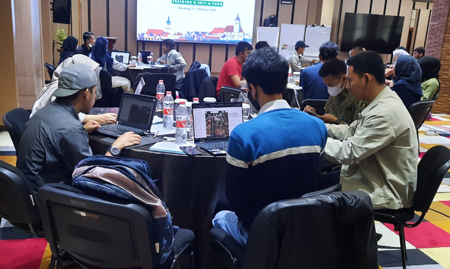
- The offline socialization held together with the GLAM Training & Edit-A-Thon in Bandung, targeting the youth community and the public interested in GLAM. This socialization event was take place one week before the registration opens. This training was attended by 31 participants. 237 GLAM object added to WikiData, 3589 buildings added to OSM, and 14 new GLAM added to OSM.

In Person Training in Bandung - The online socialization conducted after the registration period opens. During the socialization, prospective participants was receive detailed information about the competition.
- To find more about the reels and infographic result from GALACTICO 2023, go and search #GALACTICO2023 hashtag on instagram.

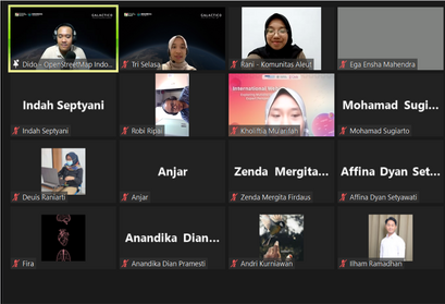
Winner Announcement Webinar with Aleut Community 
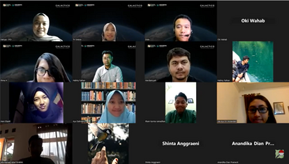
Socialization Webinar with Niskala Institute
GLAM WebGIS Development
Visit https://glam.openstreetmap.or.id/ to know more about the WebGIS. The WebGIS is also in the need of improvement for the future.
More Info
Find slideshare about this collaboration project with Wikimedia Indonesia here.
Presentation for Wikimania 2023 here.