Ireland/Mapping Townlands
The following outlines a step-by-step process for the mapping of townland, civil parish & barony boundaries in Ireland.
A talk about this project was given at SOTM 2016, giving a useful overview.
A brief history
A townland is a small geographical division of land. The townland system is of Gaelic origin, pre-dating the Norman invasion, and most have names of Irish Gaelic origin. However, some townland names and boundaries come from Norman manors, plantation divisions, or later creations of the Ordnance Survey.
There are approx. 61,000 townlands in Ireland according to Wikipedia. Through a donation of out of copyright sheets from Trinity College Dublin, the Irish OpenStreetMap community now has a source from which to map all townlands on the island of Ireland. The total quantity currently added to OSM is detailed on the townlands.ie website
Progress Monitoring
You can review the current state/progress of the project by visiting any of the 3 sites below
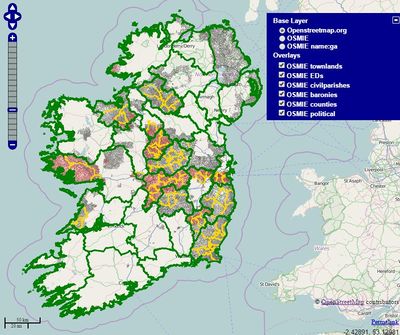
| OSM Ireland Boundary Layer | Townlands.ie | OSM Ireland Historical Map Server |
|---|---|---|
 |
| |
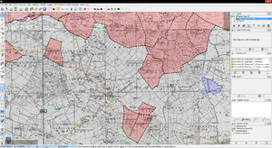
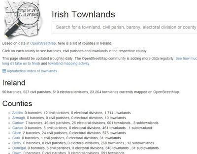
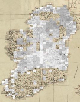
| OSM Ireland map server showing boundaries currently mapped | Townlands.ie was created by rorym and includes a lot of analysis of current and historical progress | OSM Ireland out-of-copyright map server visually showing the current coverage of the rectified GSGS 3906 sheets |
Why are townland boundaries important to have?
In Ireland, a townland is (generally) the smallest administrative division of land and they form the building blocks for higher-level administrative units such as:
- Civil Parishes
- Electoral Divisions (in the Republic of Ireland) or Wards (in Northern Ireland)
- Baronies
- Counties (will allow for accurate fine tuning of pre-existing data in OSM)
- Provinces (will allow for accurate fine tuning of pre-existing data in OSM)
- Local, National & European Election Constituencies
The benefits of having all townland boundaries mapped in OpenStreetMap are:
- It will allow for geocoding of rural addresses
- It will enable anyone to fully utilise and visualise Census data
- Highly useful for genealogical searches for people looking into the history of family trees of immigrants down the centuries
- Gives the option of using OSM data for a much higher level of statistical analysis as presently the smallest boundaries available with which to divide up Ireland are City & County boundaries.
- All of the above plus the favourable terms of the ODbL license applies ensuring this data is free to use for any and all that want to make use of it, in other words, no exorbitant fee's would apply for this data.
If you know of other reasons, feel free to add them to the list.
How long will it take to finish all townlands in Ireland?
This is a multi-year project which has been ongoing at varying rates among the OpenStreetMap Ireland community over the last number of years. Recently Townlands.ie added an ETA function showing how long it would take to complete all the townlands in Ireland. As of 13th Oct 2014, at the current rate of mapping, the project would not be completed until the year 2025.
The hopes are that the information on this page will spur additional people to take part in mapping these important boundaries.
As of 13th Oct 2014, there are approximately 50,500 townlands remaining to be added to OSM. Based on this, the 3 tables below show the time required to complete map this quantity based on X number of mappers adding X number of Townlands on a daily basis.
| Qty of mappers | 1 | 2 | 3 | 4 | 5 | 10 | 15 | 20 |
|---|---|---|---|---|---|---|---|---|
| Daily qty by x mappers | 5 | 10 | 15 | 20 | 25 | 50 | 75 | 100 |
| Days To Finish | 10,113 | 5,057 | 3,371 | 2,528 | 2,023 | 1,011 | 674 | 506 |
| Months To Finish | 337.1 | 168.6 | 112.4 | 84.3 | 67.4 | 33.7 | 22.5 | 16.9 |
| Years To Finish | 28.1 | 14.0 | 9.4 | 7.0 | 5.6 | 2.8 | 1.9 | 1.4 |
As you can see, the more people actively involved, the better.
The table below contains the same information, however the qty of townlands mapped each has been increased from 5 to 6 to illustrate the impact a small increase in effort can have when spread among many participants.
| Qty of mappers | 1 | 2 | 3 | 4 | 5 | 10 | 15 | 20 |
|---|---|---|---|---|---|---|---|---|
| Daily qty by x mappers | 6 | 12 | 18 | 24 | 30 | 60 | 90 | 120 |
| Days To Finish | 8,428 | 4,214 | 2,809 | 2,107 | 1,686 | 843 | 562 | 421 |
| Months To Finish | 280.9 | 140.5 | 93.6 | 70.2 | 56.2 | 28.1 | 18.7 | 14.0 |
| Years To Finish | 23.4 | 11.7 | 7.8 | 5.9 | 4.7 | 2.3 | 1.6 | 1.2 |
How long will it take an average mapper to complete a single map sheet?
To give a rough idea, for a single sheet that requires rectification and mapping, the approximate time frame to complete it, spending an hour a day at the task, is roughly a month. That breaks down as follows:
- 2 weeks to review all existing OpenStreetMap data under the sheet and realign and map any missing roads etc.
- 2-3 days to rectify the sheet
- 2 weeks to map the townlands
Whom to contact if you need assistance
Feel free to use any of the following methods to contact any of the Irish mappers, however it is recommended you use the mailing list for all townland mapping related questions so that everyone on the list is aware of the question and more importantly, the answer. As time progresses, these Q&A's will be assembled into a F.A.Q on this page to benefit other mappers
| Mailing List |
|---|
| Sign up for the mailing list talk-ie@openstreetmap here |
| IRC |
| Use this link to connect via your web browser
or the following link if using an IRC client irc://irc.oftc.net #osm-ie |
| Facebook Group: "OpenStreetMap Ireland" |
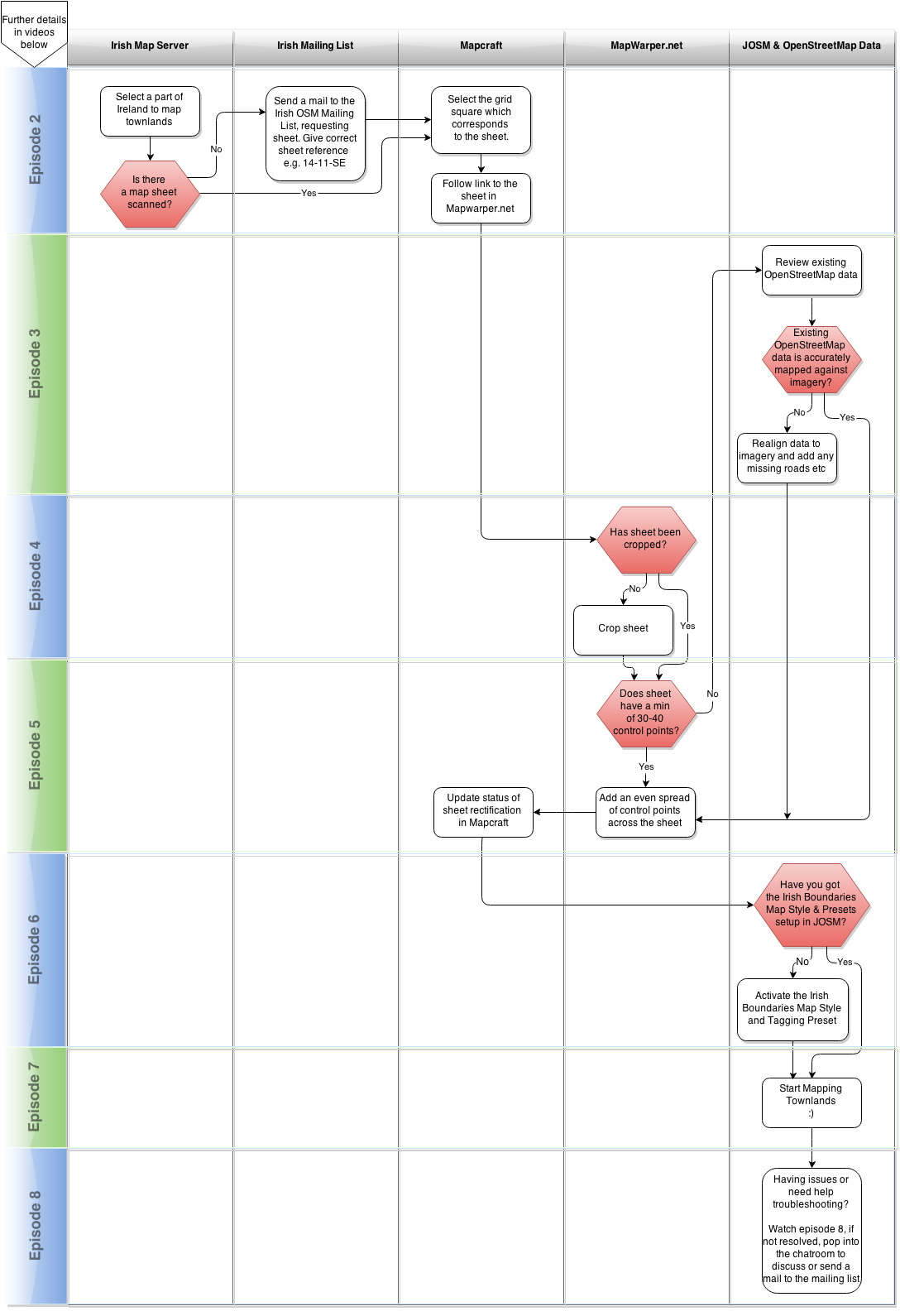
The process laid out
Below is a high level overview of the process of mapping townlands including the rectification of the TCD map sheets. For more detailed information an 8 part video series is available futher down this page which goes into much more detail.
Mapping townlands video series
An 8 part video series was created by DaCor which goes through all aspects of townland mapping. Below is a brief summary of each episode, along with links to anything mentioned in each episode.
To watch the full series in sequence, click here
Episode 1 - Overview
| Video Link | Episode 1 - Length 4 Mins | |
|---|---|---|
| Summary | This episode gives a brief overview of the whole series and includes a quick run through of the various tools and resources that will be featured in later episodes | |
| Links | Covered in later videos |
Episode 2 - Selecting an area to map & requesting new map sheets if needed
| Video Link | Episode 2 - Length 5 Mins | |
|---|---|---|
| Summary | In this episode I show how to use the OpenStreetMap Ireland map server to identify if townlands have already been mapped in your chosen area and if not, how to request a new map sheet to be added. | |
| Links |
|
Episode 3 - Review existing OpenStreetMap data for accuracy
| Video Link | Episode 3 - Length 15 Mins | |
|---|---|---|
| Summary | The map sheets that are used as a basis for mapping townlands need to be positioned correctly to allow for accurate tracing of the boundaries.
This positioning is called rectification which will be covered in episode 5 however the map sheets are rectified against existing OpenStreetMap data, so it is important that this data is correct before using it to rectify against. In this episode I will show how to review existing data and adjust it if required to improve its accuracy. I will also go through a handy heatmap tool from ITOworld.com that you can use to keep track of your progress | |
| Links | ||
| Keyboard Shortcuts |
|
Episode 4 - Cropping a map sheet so it displays correctly
| Video Link | Episode 4 - Length 11 Mins | |
|---|---|---|
| Summary | This episode provides instruction on cropping map sheets in using Mapwarper.net so that only the main body of the map sheet remains and the border is removed | |
| Links |
Episode 5 - Rectifying a map sheet
| Video Link | Episode 5 - Length 18 Mins | |
|---|---|---|
| Summary | This episode goes through the steps of rectifying a map sheet so that it appears in the correct location and is as accurately placed as possible using Mapwarper.net. Also included is instruction on using Mapcraft. | |
| Links |
Episode 6 - Preparing JOSM with presets and map styles
| Video Link | Episode 6 - Length 6 Mins | |
|---|---|---|
| Summary | In this episode, I show how to setup JOSM with Map Paint Styles and Tagging presets to assist with mapping townlands. I also show how to modify the toolbar to allow easier access to the various tagging presets. | |
| Links |
Episode 7 - Creating townland boundaries
| Video Link | Episode 7 - Length 33 Mins | |
|---|---|---|
| Summary | This video shows you how to create townland boundaries using JOSM. Included is instruction on how to read the map sheets to identify the correct boundary line and some simple tips to make this task easier. | |
| Links | ||
| Keyboard Shortcuts |
|
Episode 7.1 - What is a sub-townland and how to map it
| Video Link | Episode 7.1 - Length 5 mins | |
|---|---|---|
| Summary | This video explains what a sub-townland is and also goes though in detail how and when it should be mapped and when it is not necessary to map these. Included is instruction on using the sub-townland preset to make this task easier. | |
| Links |
Episode 7.2 - How to map townlands split into multiple parts
Coming soon
Episode 7.3 - Future topic title here
Episode 8 - Tips, tricks, and troubleshooting
| Video Link | Episode 8 - Length 27 mins | |
|---|---|---|
| Summary | This videos covers some additional tips, tricks and troubleshooting for issues that may come up but have not been covered in the previous videos of this series. Each bullet point below contains a links to the portion of the video specific to each bullet point:
| |
| Links |
Episode 8.1 - How to map and tag Historical and other features found on the TCD map sheets
| Video Link | Episode 8.1 - Length 21 Mins | |
|---|---|---|
| Summary | This videos shows how to correctly map castles, forts etc. In addition, there is also instruction on how to map schools, churches etc, all of which can be identified on the TCD map sheets and details on how to modify the map styles to allow for easier viewing of the information below in the satellite layer or on the map sheets.
Each bullet point below contains a links to the portion of the video specific to each bullet point:
| |
| Links |
|
Getting JOSM ready
There are a few things you need to add to JOSM to enable you to map townlands effectively. These only need to be done once so if you have already done these, skip this step. Detailed instruction, if needed, is available in Episode 6 of the Townland Mapping series, linked above
Why JOSM instead of other editors?
- Editing relations is easier with JOSM
- The townland-mapping workflow has been refined with JOSM in mind
- Most Irish townland mappers just prefer JOSM, and will find it easier to help you with that editor if you come across issues
Map paint style for Irish boundaries
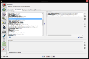
The Irish Boundaries Map Paint Style in JOSM makes it easy to see your progress in JOSM and where gaps exist if you are adding townlands over a large area. To add the map paint style, created by IrlJidel, complete the following:
- Go to Edit > Preferences > Map Settings (3rd option down) > Click Map Paint Styles tab > Scroll through the left list until you find "Irish Boundaries" > Select it > Click the blue arrow to add it to your "Active Styles" list on the right
Presets
The "Irish Boundaries" presets, also created by IrlJidel, will enable you to tag townlands quickly and help prevent you making errors and also ensure all townlands are tagged in the same manner across the country. To add these presets to JOSM you need to complete the following:
- Go to Edit > Preferences > Map Settings (3rd option down) > Click Tagging Presets tab > Scroll through the left list until you find "Irish Boundaries" > Select it > Click the blue arrow to add it to your "Active Presets" list on the right
Join in
The list below is out of date. Better data is available on townlands.ie Whos Mapping and Mapping Activity pages
Below is a list of all 32 counties on the island of Ireland, along with the names of mappers active in each county with regards to townland mapping. Feel free to join in and put your name beside a county.
Progress is tracked through rorym's townland site
| County | Townland Mappers | Status |
|---|---|---|
| Antrim | Stephen_Co_Antrim | Complete |
| Armagh | Stephen_Co_Antrim | Complete |
| Carlow | brianh,IrlJidel,pjna | Complete |
| Cavan | KDDA - Around the border with Fermanagh | Underway |
| Clare | cgarvey, rorym | Underway |
| Cork | ... | Underway |
| Derry | Stephen_Co_Antrim | Complete |
| Donegal | Stephen_Co_Antrim, Stereo, SK53 - Inishowen peninsula, KDDA, idnoc - South Donegal | Complete |
| Down | Stephen_Co_Antrim | Complete |
| Dublin | There's a few :) | Complete |
| Fermanagh | KDDA | Complete |
| Galway | Boggedy, DaCor | Underway |
| Kerry | eireidium | Underway |
| Kildare | jmkie | Complete |
| Kilkenny | ... | Complete |
| Laois | Teester | Complete |
| Leitrim | NoelB | Complete |
| Limerick | ... | Underway |
| Longford | PaddyMatthews | Complete |
| Louth | ... | Complete |
| Mayo | ... | Underway |
| Meath | brianboru | Complete |
| Monaghan | Stephen_Co_Antrim, KDDA - Around the border with Fermanagh | Underway |
| Offaly | Teester | Complete |
| Roscommon | DaCor Galway/Roscommon border areas only | Complete |
| Sligo | NoelB | Complete |
| Tipperary | Dafo43 | Complete |
| Tyrone | KDDA, Stephen_Co_Antrim | Complete |
| Waterford | jpronans | Underway |
| Westmeath | brianboru | Complete |
| Wexford | pjna,IrlJidel | Complete |
| Wicklow | matze | Complete |
Frequently asked questions
The following are a list of questions that have come up regarding the townland mapping process which have not been answered through the videos or other resources. Most of these are quick questions, with quick answers. Where more detailed information is warranted, videos will be created, carrying on from episode 8 e.g. 8.1, 8.2 etc.
| Topic | Question | Answer |
|---|---|---|
| Townland Boundary | Where the volume of water in lakes has changed, how do I map the boundary given the map sheet shows an outline of the lake which no longer matcher the physical feature? | Trace your townland boundary right up to the waters edge, whether the lake has increased or decreased in size. Include the lake boundary itself as part of your townland boundary. |
| MapCraft | Do you want the reserve/freeing process in Mapcraft apply to when you are editing the townlands in OSM or just when perparing the map/rectification in mapwarper? | You only need to reserve a slice in MapCraft when you are changing its status.
You are free to continue to reserve the slice for as long as you wish, however it has no impact on the rectification or townland mapping process. MapCraft is purely a tool to allow for easy tracking of progress and to maintain a record of links to all the various map sheets. |
| Townland Boundary | How do I treat existing boundaries when I come across them, for example county boundaries. What should I do with these? | County boundaries are essentially a collection of townlands and as such, the boundary of a county is the same boundary used by townlands.
When you are adding townlands near a county border, feel free to realign the county border when adding your townlands as the pre-existing boundaries in OpenStreetMap for Ireland were traced off much lower quality out-of-copyright maps which means they are often slightly off. You should also include the county boundary as part of your townland boundary the same way you would a road or river. |
| Townland Naming | What do I do when I come across townlands with "or" in the title? | Where you find "or" in the title of a townland e.g. "Cloonlish or Robinhood", you should chose one as the name and the second as the alt_name.
For an example of this tagging see how the townland shown as "Cloonlish or Robinhood" has been tagged here. You can see what this townland looks like on the GSGS 3906 map sheets here |
| Townland Naming | What do I do when I come across townlands with "and" in the title? | Where you find "and" in the title of a townland there is no need to use the alt_name tag.
Instead treat the title as a single name e.g. Gannew and Curreen (on OSM). |
| Broken boundary | I think the townland or county boundary is broken as it is not displaying correctly but I can't tell how to find where the issue is | You can use relation analyzer tools to pinpoint where the are breaks in the boundary. There are 2 good tools you can use for this
The Osmose QA tool (here) finds and locates administrative boundary issues on a map (and links them to relation analysers). It also includes selectable layers showing broken areas for the most common administrative boundary levels. |
| Townland Naming | I found a townland with it's name followed by brackets which display the Electoral Division, for example Ballynagran (E.D. Glenealy). How should I name the townland? | Name the townland without the Electoral Division, e.g. Ballynagran. This will help users when searching for townlands in Nominatim. |
Naming Townlands and Other Boundaries
Townland names are seen in a variety of spellings and word structures. This sometimes makes it difficult to name them, correct spelling mistakes, use them in search queries or link them to other data. We hope that the guidelines below will help to correct typos, help those working on automation, improve search and link data. The examples below are from Co. Mayo but should apply for the rest of the country.
Assumptions:
- We assume that the GSGS3906 1:25k War Office map sheets, are the original source of townland names and the spellings are valid names.
- There can be multiple valid names for one townland. Valid name(s) can be from: the map source, a structure variation (e.g. X East, East X, Upper X Island West More, etc.), a local/commonly-used name (e.g. Bellavarry is commonly written as Ballyvary, both are valid and so should not be overwritten),
- With the correct spelling of townland names, the Logainm script should be able to automatically add logainm tags. A lack of logainm tags is an indication that there is a mismatch with the name or name:en tags. After the typos are fixed, any remaining townlands without tags can be added manually. Islands are not included, yet.
Guidelines for Correcting Typos in Boundary Names:
- Make double sure that the typo is a mistake and not a valid alternative name as I outline below.
- Try to keep the names where possible by adding alt_name, loc_name or old_name tags.
- Try to keep consistent naming schemes. For example, If there is an "X More Island", then also try to keep "X Beg Island" and not "Xbeg Island", Its not always possible though, I would not create a new name just to be consistent.
- Its sometimes ok to keep invalid names, if they are common spelling errors and there is proof that it is in use. For example, "Srahcorick" gets a few search hits. "Srahacorick" is the correct spelling but I recommend not adding the alt_name in this example. An example where I would add an alt_name is "Bohea", official correct spelling is "Boheh". Local names often come from spelling mistakes that become popular.
- The name= tag is the one that is usually displayed/dominant. I suggest that the order of "importance" for this is local name > other names. If someone knows a local or commonly used name of a place, they should use loc_name=, but often they just replace the name= tag. (This is all debatable, which name tags to use? alt_name is for townlands that have 2 official names. I also use alt_name for valid spelling variations. name:en may also be used etc.)
How to identify Typos:
- Compare the list of townlands to the openOSI and other sources. Logainm (derived from OSI), local authorities, etc.
- Visually identify them in your area here,
- Missing Logainm tags indicate a name mismatch. Townlands without Logainm reg tags can be viewed when you zoom in here.
How to check that the "typo" is a mistake:
- Check if it is an alternative spelling or alternative name. (see next section)
- Check the map source.
- It may be obvious why the typo occurred. Is the mis-typed letter hard to read?, blocked?, or a common mistake? (See common mistakes). This is only an indication but it helps.
- If the name on the map source does not match any in the relation (even as alt_name), this indicates that it was misspelled when first copied or possibly overwritten.
- To check if it was overwritten, check the relation history on OSM, if the name did not change since version #1, it is likely that it was misspelled when first copied.
- Alternatively, do a web search for the name (be sure it is the correct townland), if there are lots (> 50 maybe) of webpage posts with that spelling, no matter how wrong you think it is, it is likely a valid name spelling. Be aware that some websites use OSM data so there will always be a few hits, even for typos.
Alternative Names, Local Names, Historical Names and Other Correct Names:
- Many townlands have two official names on the map source, "Ballindoo or Doocastle". Both are valid, We should try to find out which one is commonly-used/dominant and use that one in the name= tag and the other in the alt_name= tag.
- A name structure variation is valid, "East X" = "X East". We don't have to add every variation but if you come across them, you can add them. The idea is that if someone searches for a townland, we want them to find it no matter what variation they use. The example above is trivial for search but something like Inishmore Vs. Inish More. Also consider, Upper/Lower, Island, More/Beg Oughter/Eighter etc.
- Missing spaces can be valid names. e.g. Inishdeashmore = Inishdeash-more = Inishdeash More
- Island's have on island name= tag (place = islet) and the townland of an island has a name= tag too (place = locality). These should match but sometimes differ. e.g. Cullenmore island (Islet/island) and Collan More (Townland).
- X Deme(ns)e and X Deme(sn)e. I suggest sticking to Deme(sn)e as this is what is on the map source.
- Identical townland names are common, many appear beside each other (without north/south upper/lower etc.). check the source to see if they should have a secondary name in brackets after them. For example, "Dookinelly (Calvy)" and "Dookinelly (Thulis)". Sometimes names in brackets after a townland indicate which civil parish it belongs to, but not always.
- Some townlands are named "Part of X" or "X (part of)". This means it is a separate part of a nearby townland or in other words an exclave. Usually, you will find an "X" townland nearby. We suggest to include the exclave as part of the main X townlands relation. If it is not possible to include it in a nearby townland, write the name as "X (part of)".
- Apostrophes in names. The old maps do not contain apostrophes in names. "Georges Island", "Abbots Island". Some name tags are now "George's Island" etc. I suggest to keep "Georges Island" as an alt_name in this case.
Common typo errors that occured when compying townland names from maps
| similar shaped letters | e.g. m n, w v, R K, i l, C, G etc. |
| missing ending letter(s) | |
| double letters | e.g. connelly, kill Vs Kil, oo |
| spaces | e.g. Xmore Vs X More, X Island, X Beg etc. |
| vowels | e.g. aun, ua, oa etc. |
| 'glue' letters | e.g. Ballycastle, Ballynacastle, Ballyacastle, Ballyincastle |
Useful links
A collection of all links already listed on this page collected in one location.
- Wikipedia
- Taginfo
- Full townland mapping video series
- OpenStreetMap Ireland Map Server
- OpenStreeMap Ireland mailing list
- IRC Chatroom - Use this link to connect via your web browser or the following link if using an IRC client irc://irc.oftc.net #osm-ie
- JOSM - Java openStreetMap Editor
- ITOworld.com 90 days of edits heatmap
- MapWarper
- Mapcraft
- Townlands.ie
- gsgs legend
- UCD scales and symbols
- Irish Townland Map Server
- Relation analyzer
- another Relation analyzer
Townland specific resource sites
- The IreAtlas
- HistPop.org - Useful site which lists townlands in alphabetical order, showing the county, civil parish, barony and electoral district they fall into
External reference sites
The follow are sites that are useful for tagging additional features which you may find while mapping townlands e.g. schools, with information relevant to these features.
