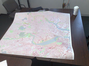
JA:紙でのOSM
英語版の記事の内容が分かる方は、翻訳の完成にご協力ください。このウィキの翻訳方法についての説明をお読みください。
現時点では、誰もこの記事の翻訳に取り組んでいないようですので、あなたが取り組めます。
OpenStreetMap は高精細の紙の地図を作成するたくさんの可能性を提供しています。 Mapquest や Google Maps などのような商用地図サービスとは異なり、 OSM の画像を利用するにあたって制約は少ししかありません。
基本的なエクスポート
openstreetmap.org のフロントページにある主要なエクスポート機能で、普通の場面に合うような限定された解像度の地図を自由にエクスポートできます。 PDF エクスポート(「共有」アイコンを利用)は高解像度のプリンタでの印刷に適しています。ビットマップ形式での出力もできますが、解像度が高くなるにつれて文字が小さくなり、文字が読みにくくなります。
OSM の地図を印刷する単純なウェブインタフェース
注: 以下の2つのサービス一覧は対応範囲で分かれており、機能や全体の質の順になるよう試みています。
全世界対応、英語インタフェース
- Field Papers (ウェブ) - 複数ページの地図帳印刷オプションが素晴らしい。簡易にエリアやページを選択するインタフェースです。白黒印刷用のものを含む、様々な印刷用レンダリングスタイルがあります。ビットマップは PDF でエクスポートします。等高線はありません。
- MapOSMatic (ウェブ) - PNG、詳細なベクタ PDF、 SVG の地図をグリッドと道路索引付きで作成します。等高線はありません。
- milvusmap.eu offers a webservice to choose an area of an OSM based map in order to produce and download a rendered map in real PDF with an own style by milvusmap.
- mapz.com offers high resolution output of OSM based maps with custom overlays. Free to use for non-commercial purposes, and the ability to buy commercially licensed maps. Registration required.
- printMyMap.world - you choose your preferred map section and the map scale. The map is printed on tear- and weatherproof quality paper and delivered to your place within a few days.
- Inkatlas – Create multi-page atlases or large format maps at standard scales, optimized for print (black and white or colour). Several paper sizes and map styles, including a topographic one with elevation contours. Users can add their own GPX tracks.
- Overpass turbo (web) has a nice feature in Export menu: save displayed map as PNG bitmap graphic file, with proper attribution included.
- BBBike.org extract service offers download of SVG and PNG files for an area of your choice in different stylings, updated weekly.
- Walking-Papers (ウェブ) - フィールドペーパーの先駆けとしての有名なサービスです
- Boundaries Map offers worldwide download of all administrative boundaries in different file formats, SVG is one of them. Database will be updated at midnight, German time. Created by User:wambacher.
- mapworks is a web service that has features to display either single objects or a whole category (so far: buildings ways etc) with a user defined fill and outline colour, output as PNG or SVG file.
地域的なサービス
- cycle.travel (web) - lets you download a really nice vector PDF after planning a cycle route on the site (Western Europe only, log-in needed for PDF export)
- Get Veloroad - generates vector and raster images for selected area and size (in mm), allows adding GPX trace. Russia and Baltic states only. Code on github.
- mapwebbing.eu produces a high quality PNG bitmap file with selection of a certain area and DPI parameter. Currently in German only.
- printmaps-osm.de ベータ版、ベクタデータ埋め込み PDF、凡例、印刷サイズは最大5000×5000mm、地図データはドイツ、オーストリア、スイス、様々な地図スタイル。 ベータ版、現在はドイツのみ
印刷可能な地図を生成することに特化したその他のツール
- MapPDF for vector PDF renderings
- Mapapel (Mapapel.com) Printable city maps based on OSM data.
- TownGuide (townguide.webhop.net) 道路索引とユーザが選択できる POI の索引が付いたPDFマップジェネレータです。
- Osmbook はOSMデータから複数ページの地図ブックを印刷できるプログラムで、グリッドつきの概要、全ての印刷されたラベルの索引、オプションによるサブグリッド付きのページが付いています。
- MapBook (MapBook)
- OSM-Atlas では印刷に適した道路地図をPDFで作成できます。
- Generic Mapping Tools (gmt.soest.hawaii.edu) is a collection of tools to produce high quality scientific maps; GMT input files can be derived from OSM e. g. via PostgreSQL/PostGis and the GDAL ogr2ogr conversion utility
- Smrender is a generic rule-based renderer for printable charts mainly developed to produce sea charts.
- SplashMaps offers customers a high-quality, water resistant, customisable fabric map of anywhere in the world based on OSM data.
- Kartograph is a frame work to produce vector tiles in SVG format.
- OSMgrabber collects a given number of screenshots after moving the map by simulated mouse clicks and pastes them together to a printable PNG file.
- Nik4 is a mapnik-to-image exporting script. You can set special parameters to get quality graphics for printing or publishing.
- Mobile Atlas Creator (mobac.sourceforge.net) can be used to create png images for paper maps
- mapCreator.py a light-weight python script for downloading a set of tiles and stitching them to a single jpeg image
- Hikingmap a python script to render 1 or more GPX tracks on a minimum amount of pages
- gb-leisure-carto CartoCSS style and Python script for creating maps in Great Britain which use the OSGB projection and grid. Script could be adapted for other CartoCSS/Mapnik styles
- OpenPaperMaps is a tool based on the TownGuide. No web service available currently, but can be run locally.
大きな画像地図として
There are many ways of getting a map image which you can then print out.
既存のタイルセットから生成
- Static map images - Services to generate a map image with specified centre point and dimensions
- StaticMap - Interface to pick from several styles
- MapQuest Open Static Maps ([1]) - Static map images in the mapquest style
- bigmap ([2] または bigmap 2) - タイル画像を並べて大きな地図を形成します。ビューを調整するインタフェース。貼り合わされた画像を生成するためのPerlスクリプトをダウンロードします。結果は高解像度のプリンタで印刷できるように、巨大なビットマップ画像になりますが、文字の大きさには問題があります。
- Category:Tile stitching - Lists these and other tools which can download tiles and stitch them together to form a large (hi-res) image.
画像のレンダリング

選択肢の全体的な一覧や、独自のレンダリングソフトウェアをセットアップするための詳細は、レンダリングを参照してください。
- Mapnik はメイン OSM ホームページ上のデフォルトタイルレイヤーを作成するのに使われているレンダラーです。SVGを出力することができます。
- Maperitive はインタラクティブなマッピング用のデスクトップアプリケーションで、多くのツールと機能を持ち、ビットマップ及びSVGファイルへのエクスポートも含みます。Windows, Linux 及びMac上で動作します。Maperitive は の後継です。最新版では Walking Papers のような地図を生成できるようになりました。このチュートリアル(英語)も参照してください。
- Mapweaver is another perl application with customized output.
- Merkaartor is desktop OSM editor that can output SVG and bitmaps using presets and editable styles.
- osmrender.pl はカスタマイズが容易でシンプルな地図を描画できる小さな Perl プログラムです。
- Osmarender 高品質なラスタイメージを生成することができる SVG の地図イメージをレンダリングします。
- CartoType's sample program generally displays realtime vector maps from a local offline OSM datafile on a desktop PC according to an own rendering style, you can create easily a PNG bitmap file from current screenview.
Note that many of these renderers can be configured for creating your own tiles, and you might then follow the tile-stitching approaches listed above
Increased resolution, the ability to take a map style configuration and uniformly increase the scale of all of the features, may be important for good quality printouts. See 高解像度タイル.
利用例
白黒印刷に適したスタイル
ほとんどのスタイルが地物の識別を色に依存しているため、白黒プリンタで印刷された地図はふつう、役に立たない灰色のしみになってしまいます。スタイルによっては色を使わないように設計されています。
- http://maps.stamen.com/toner/
- refill スタイルのファミリー ( http://tangrams.github.io/refill-style/ http://tangrams.github.io/refill-style-no-labels/ http://http://tangrams.github.io/refill-style-more-labels/ )
- http://inkatlas.com/about/ で使われているスタイル(ブラウザーからの世界地図へのアクセスはできません)
- styles used by http://inkatlas.com (black & white styles currently can't be previewed in the browser, but are used in the finished printable documents)
その他のリンク/チュートリアル
- Create your own maps using OpenStreetMap - use-it.be 上にあるJOSM、Osmarender、Inkscapeを使ったステップ・バイ・ステップのチュートリアル。
- Osmarender restguide - osmarender を使ってレストランガイドを作成するスクリプト。
- Compass Rose をあなたの地図に追加
- 普通のプリンタに印刷できる大きな地図を作るには Maps for developing countries を参照
- A tutorial of printing a big map using Maperitive, Easy Poster Printer and Microsoft ICE


