DE:Tag:airmark=beacon
(Redirected from Key:DE:beacon:channel)
Jump to navigation
Jump to search
| Beschreibung |
|---|
| Basis tag für Flugnavigationsfunkdienst |
| Gruppe: Luftfahrtinfrastruktur |
| Für diese Elemente |
| Sinnvolle Kombinationen |
| Status: de facto |
| Werkzeuge für dieses Attribut |
|
Flugnavigationsfunkdienst
- NDB ungerichtetes Funkfeuer (Non-Directional Beacon)
- VOR Drehfunkfeuer (VHF Omnidirectional Radio Range)
- ILS Instrumentenlandesystem (Instrument landing system)
- TACAN Tactical Air Navigation
- DME Distance Measuring Equipment
Merkmale, die im Zusammenhang verwendet werden
Beispiele
| Foto | Tags | Abkürzung | Beschreibung |
|---|---|---|---|
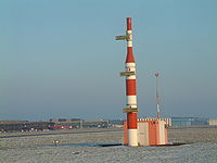
 Gleitweg-Sender |
airmark=beacon beacon:type=ILS glideslope=yes |
ILS - GS | |
 Landekurssender |
airmark=beacon beacon:type=ILS localizer=yes |
ILS - LOC | |
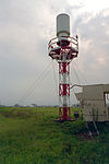
 VHF Omni Directional Radio Range |
airmark=beacon beacon:type=VOR beacon:code= beacon:frequency= |
VOR | |
 D-VOR Antenne (Kreis mit 50 Antennen) |
airmark=beacon beacon:type=DVOR beacon:code= beacon:frequency= |
DVOR | |
 D-VOR-DME |
airmark=beacon beacon:type=DVOR/DME beacon:code= beacon:frequency= |
DVOR/DME | |
Non-directional (radio) beacon |
airmark=beacon beacon:type=NDB beacon:code= beacon:frequency= |
NDB | |
Tactical Air Navigation System |
airmark=beacon beacon:type=TACAN beacon:code= beacon:channel= |
TACAN | |
VOR und TACAN. |
airmark=beacon beacon:type=VORTAC beacon:code= beacon:channel= |
VORTAC |


