MB-Ruler
Jump to navigation
Jump to search
| MB-Ruler | ||||||||||||||||||||
|---|---|---|---|---|---|---|---|---|---|---|---|---|---|---|---|---|---|---|---|---|
| Author: | Markus Bader | |||||||||||||||||||
| License: | (free of charge) | |||||||||||||||||||
| Platform: | Windows | |||||||||||||||||||
| Version: | 4.0 | |||||||||||||||||||
| Languages: | German, English, and ...
| |||||||||||||||||||
| Website: | http://www.markus-bader.de/MB-Ruler | |||||||||||||||||||
|
Onscreen triangular ruler and protractor |
||||||||||||||||||||
| ||||||||||||||||||||
Overview
MB-Ruler is a Windows application, that was originally designed to measure distances and angles on the screen.
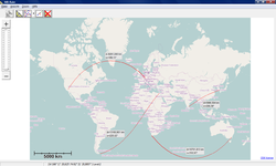
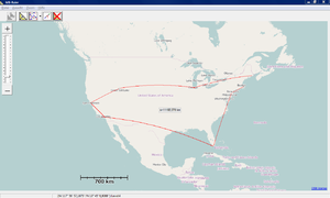
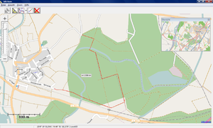
Since MB-Ruler 4.0 measuring distances in OSM data is supported, too.
MB-Ruler has no own renderer but uses the prerendered tiles of the OSM servers.
Features:
- measure distance between two points
- measure length of a polyline
- draw the measured distance (section of a great circle)
- for users testing GPS based applications: MB-Ruler can generate NMEA data and write it to a COM port. This data can be used by an other application to test it's GPS functionality (details in the MB-Ruler help file)
Downloading
MB-Ruler 4.0 can be downloaded from the its download site
further Screenshots
License
MB-Ruler is freeware for non-commercial use. An enhanced shareware version MB-Ruler Pro is available, too.
Links
- http://www.markus-bader.de/MB-Ruler - MB-Ruler homepage
- http://www.markus-bader.de/MB-RulerPro - MB-Ruler Pro homepage


