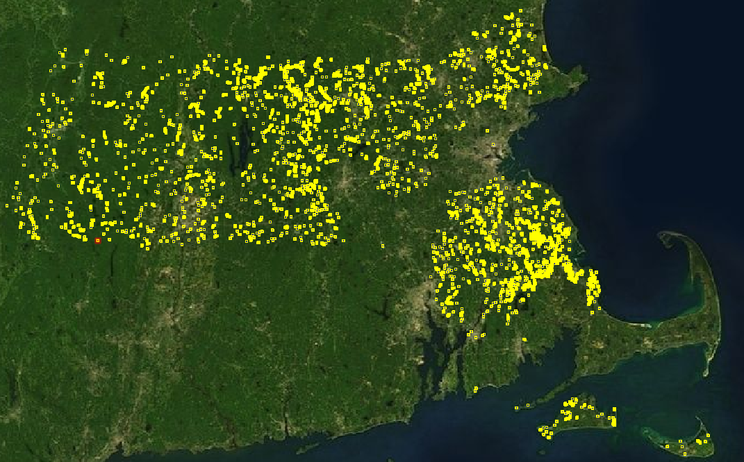
MassGIS DEP Wetlands Import 2013
This is the import page for the "MassGIS DEP Wetlands (1:12,000)" 2013 import. The data set contains rivers, wetlands, lakes, and ponds. However, only the lakes and ponds are going to be imported. The total import will be around 2,800 ponds and lakes. This data was partially imported in 2010.
Import Plan Outline
1. Generate OSM file with missing ponds and lakes using scripts. Other features such as wetlands are not being imported.
2. Manually fix mistakes in missing pond OSM file.
3. Use upload scripts to convert OSM file to OSC, split into < 10,000 element chunks, and upload.
Goals
Import the rest of lakes and ponds in Massachusetts.
Schedule
The import was started July 2013, and was completed in September 2013.
Import Data
The geometry MassGIS Data - DEP Wetlands (1:12,000). (Updated link as of 2024: https://www.mass.gov/info-details/massgis-data-massdep-wetlands-original-112000 )
The data table that maps PALIS_ID to pond/lake name is MassGIS Data - MassDEP 2010 Integrated List of Waters (305(b)/303(d)).
Background
Data source site: MassGIS
Data license: Public Domain
Link to permission (if required): All MassGIS data is in the public domain.
OSM attribution (if required): Overview
ODbL Compliance verified: Yes
OSM Data Files
Import Type
This is an one time import. The OSM file will be prepared with scripts, the resulting OSM file will be QA'ed and corrected, and then split and uploaded.
Data Reduction & Simplification
The data is simplified to 1 meter, in the conflate.py script.
Tagging Plans
natural=water on all ways.
name=<name> - If the palis_id is > 0, then the name is looked up in the MassGIS Data - MassDEP 2010 Integrated List of Waters (305(b)/303(d)) layer.
water=[pond,lake,reservoir] - If the poly_code=1, the body is a reservoir, then the water=reservoir tag is emitted. Otherwise, no water= tag is used. The source code is in conflate.py.
Changeset Tags
source="MassGIS Data - DEP Wetlands (1:12,000) January 2009;MassDEP 2010 Integrated List of Waters (305(b)/303(d))"
comment="MassGIS DEP Wetlands Import 2013"
bot=yes
Team Approach
Users jremillard, and Ahlzen will be working on the import. The talk-us email list will be used to ask for QA help, and to keep everybody informed. We will also directly email/message via our private contacts known active OSM mappers in MA in case they are not on the talk-us email list.
Conflation
Any open water geometry will be excluded from the import if it overlaps with an existing lake or river in OSM. The source code for the conflation is conflate.py. The source data does not differentiate between rivers and lakes. Since this is a lake/pond import, we will trace out the any missing rivers in OSM by hand so the conflation logic will skip them.
QA
- Verify that the generated OSM file is not importing over any existing water in OSM. Any rivers
- Use JOSM validator on generated OSM file.
- Spot check geometry against Bing.
- Spot check names, with USGS maps and gnis nodes.
- Spot check water= tag.
