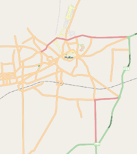
Multan
| V・T・E |
| latitude: 30.2, longitude: 71.45 |
| Browse map of Multan 30°12′00.00″ N, 71°27′00.00″ E |
| Edit map |

|
|
External links:
|
| Use this template for your locality |
Multan is a city in Pakistan at latitude 30°12′00.00″ North, longitude 71°27′00.00″ East.
Description
Multan is one of the oldest city in this part of the world. It is historically important as it is on the land route to India. Many conquerors from Persia, Afghanistan and Europe have come from this route to India. It is also known to have been visited by Alexander the Great.
Multan is known as the city of saints and holy Sufi sages of the Islamic world. There are many shrines located at different places around the city. People from all parts of the country and around the world visit and meditate closer to their spiritual teachers and try to absorb their universal message of love, tolerance and peace.
Multan is also famous for four things:
- Dust storms,
- Heat,
- Beggars and,
- Graveyards.
It is also famous for Mangoes and dates. The world's sweetest mangoes are grown in this part of the country.
Events
Upcoming: Multan/Mapping_Parties
OSM Coverage
Multan is still in very early stages. However we are planning to take it up a notch and start weekly mapping parties.
News Articles
Some recent articles and presentations:
Equipment
Thanks to a Open Society Institute scholarship as well as a grant from the Bahauddin Zakariya University, Multan, we now have the following GPS units available for mapping:
Garmin Geko 201Stolen :-(- Garmin eTrex Legend HCx
Garmin eTrex Vista HCxStolen ;-(- SparkFun Electronics GeoChron
- iphone 3G
Volunteers who have GPS enabled Mobile phones can also participate.
Features to collect (map what users need)
- roads and paths
- railway line
- bus stops
- rivers / canals
- wells / water sources
- pit latrines/toilets
- medical facilities (ngo or private or govt)
- schools (govt or private)
- places of worship
- markets / businesses
- training workshops
- community based organizations
- children centers
- administrative units
- NGO
TODO
Initially we propose to map the following main roads and tag them properly:
Bosan RoadLMQ Road- Kutchery Flyover
- Lahore Road
Nawabpur Road- Multan Expy
- MDA Road
- Nishtar Road
- Multan bypass
- Vehari Road
- Akbar Road
- Old Bahawalpur Road
- Nawan Shehr Road
- Qasim Road
N70N5Khanewal RdBaba Safra Rd
