NL:Tag:highway=footway
| Omschrijving |
|---|
| Gemarkeerde voetpaden en wandelpaden, voornamelijk of geheel gebruikt door voetgangers. |
| Representatie in OSM Carto |

|
| Groep: wegen |
| Gebruikt op deze elementen |
| Impliceert |
| Nuttige combinaties |
| Status: de facto |
| Gereedschappen voor deze tag |
Gebruik highway=footway voor het vastleggen van paden die grotendeels of voornamelijk gebruikt worden door voetgangers of wandelaars.
Voor voetgangersgebieden binnen de bebouwde kom wordt de tag highway=pedestrian gebruikt. Paden die door meerdere soorten ongemotoriseerd verkeer worden gebruikt, worden getagd met highway=path. Voor fietspaden wordt de tag highway=cycleway gebruikt. Daar waar voetpaden ook door fietsers gebruikt mogen worden, kan de tag bicycle=yes toegevoegd worden, zodat navigatiesystemen fietsen daarop toelaten.
Voor ![]() trottoirs direct naast of parallel aan de weg wordt de tag sidewalk=left/right/both/separate toegevoegd aan de weg zelf. Alternatief, als het parallelle voetpad apart is ingetekend als highway=footway, voeg dan footway=sidewalk eraaan toe.
trottoirs direct naast of parallel aan de weg wordt de tag sidewalk=left/right/both/separate toegevoegd aan de weg zelf. Alternatief, als het parallelle voetpad apart is ingetekend als highway=footway, voeg dan footway=sidewalk eraaan toe.
Niet aan een bepaald type verkeer toegewezen tracks and paden kunnen worden getagd met highway=path + access=*-tags en nader gedetailleerd met sac_scale=* and trail_visibility=*.
Let op: In British English is "footway" de wettelijke term voor een parallel pad dat verbonden is met een weg. In OSM is "footway" de term voor een pad dat niet per se aan een weg verbonden is, en wordt the term "sidewalk" gebruikt voor een bijbehorend voetpad naast de weg.
Hoe te mappen

|
Om een voetpad te mappen teken je een lijn, en voeg je de tag highway=footway toe. Tag waar nodig ook name=*. Je kunt ook andere access=* tags toevoegen. Zie Default Access-Restrictions |
Voorbeelden
| Picture/Description | Tags | Mapnik | Osmarender |
|---|---|---|---|

|
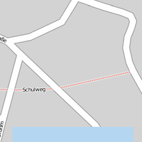
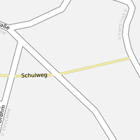
highway=footway name=Schulweg |

|

|
Zie ook
- Path controversy legt overeenkomsten en verschillen met highway=path uit.
- sidewalk=*
- footway=sidewalk
- footway=crossing
- UK public rights of way
Verwante termen: ‹ footway ›